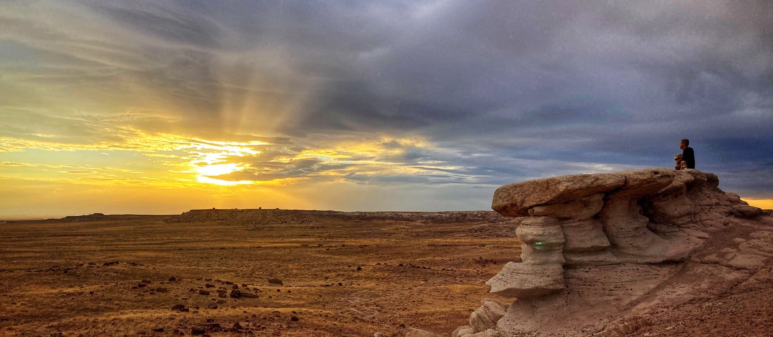
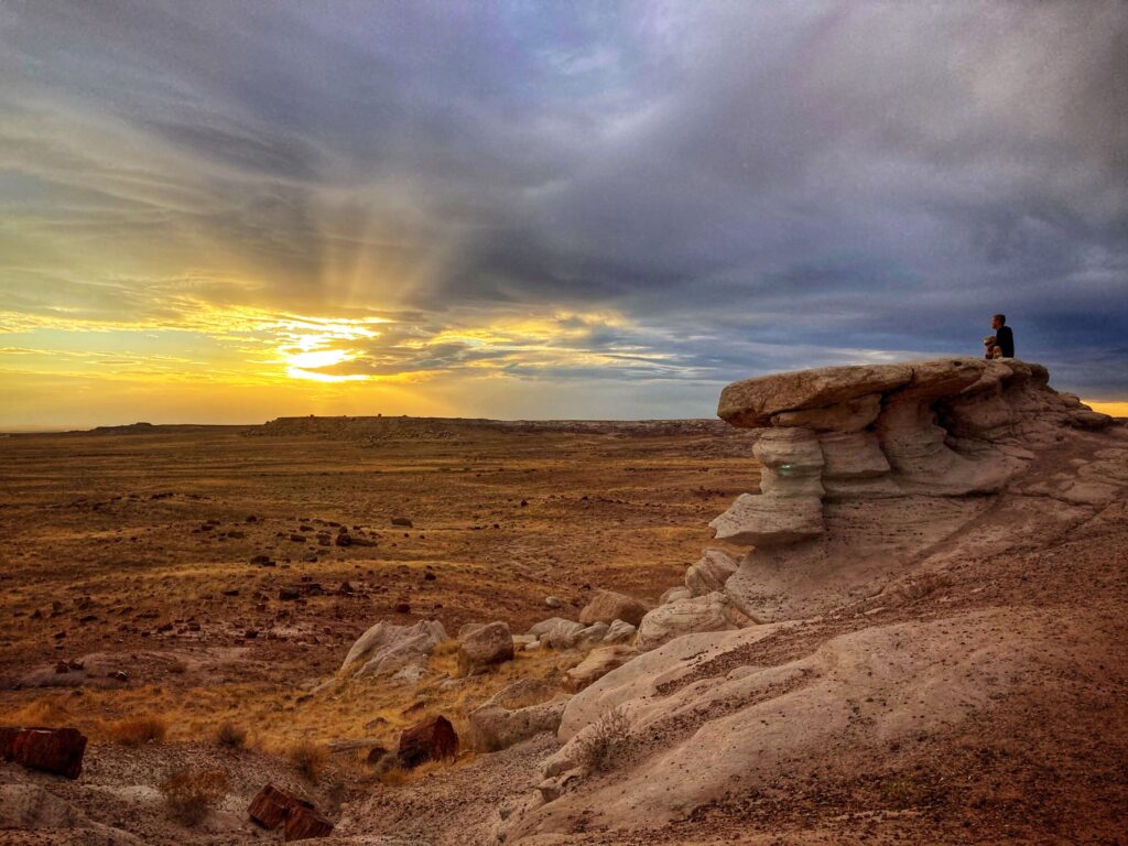
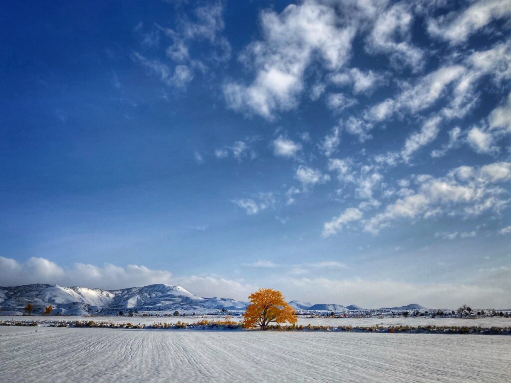
Petrified Forest National Park was our first of three Arizona National Parks, but our last one planned before hanging up the keys to spend the winter season in Phoenix. Located in the northeast corner of Arizona, we stopped here as we made our way down from Mesa Verde. Interstate 40 splits the park into a northern section and southern section. The northern section, looks out into the Painted Desert, while the southern section contains the petrified trees that date back 225 million years!
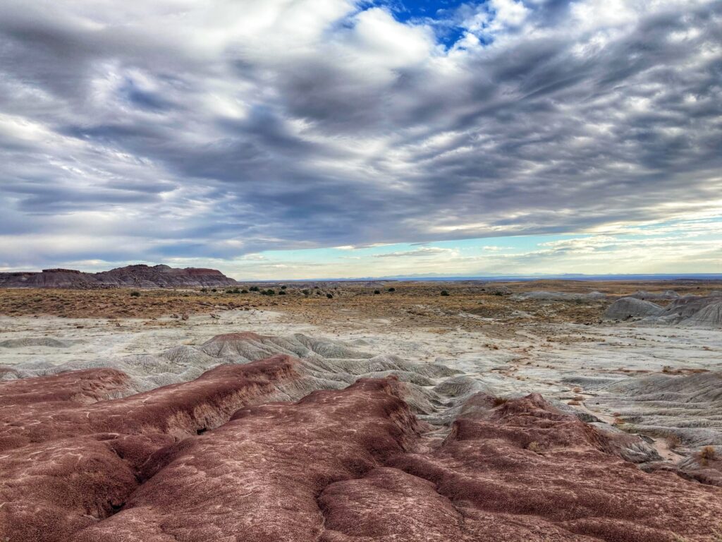
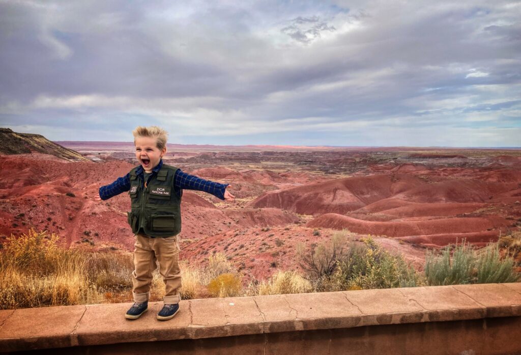
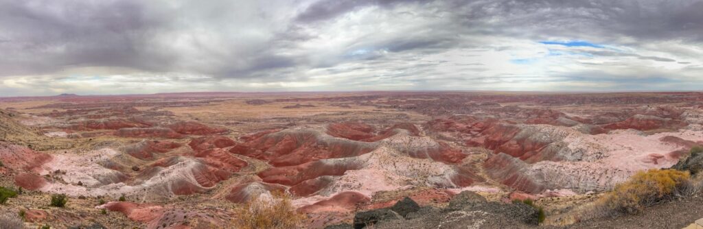
Painted Desert
The painted desert region in the north section of the park has little to do with the petrified forest, but it is incredibly scenic. We observed the endless shades of red rock from a short trail near the Painted Desert Inn, and again from Pintado Point, both of which are right along Painted Forest road. It is possible to hike down into the desert region, and while we didn’t tackle that hike on this trip, we saw some folks on the trek down and it looked like it would be a lot of fun.
Giant Logs
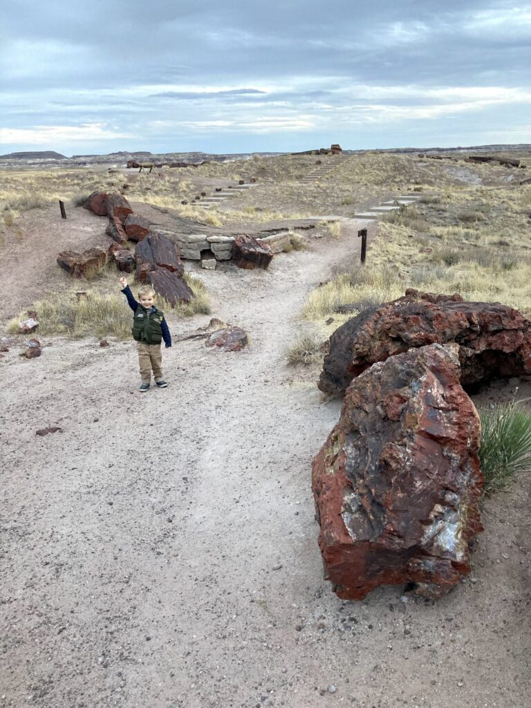
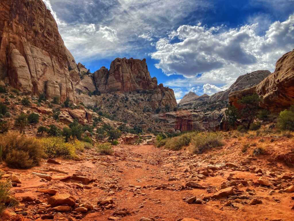
After driving the length of Painted Desert road from the north entrance, through a surprisingly varied landscape, and with a quick stop the Newspaper Rock Petroglyphs, we reached the Rainbow Forest Museum at the southern end of the park. This is also the launching point for the short but awesome Giant Logs Trail. There are petrified logs strewn along this trail that date back to the Triassic period. For some rough context, that is before the rise of most dinosaurs, and it’s when the land on earth was mainly arranged in a single supercontinent called Pangaea. In other words, super old. It was mind-blowing to walk this trail and think about what has happened around these fossilized tree trunks in the time since they were alive.
We didn’t really know what to expect at Petrified Forest, and we were pleasantly surprised with the varied and scenic landscape, as well as the mind-boggling timescale of the super-old fossils. If you live in or travel to the southwest, you may have driven through this park along I-40 without even realizing it. Next time though, take the afternoon, or day, to stop and explore it!
Petrified Forest Gallery
225 Million years ago. That’s when the trees that would eventually become the Petrified Forest lived. As humans, it’s hard to wrap our brains around that kind of time scale. It was wild to walk amongst these fossilized tree trunks and think about all that has happened since they fell.
Dates we visited: Oct 29th – Oct 30th 2020 Where we stayed:Sundance RV Park
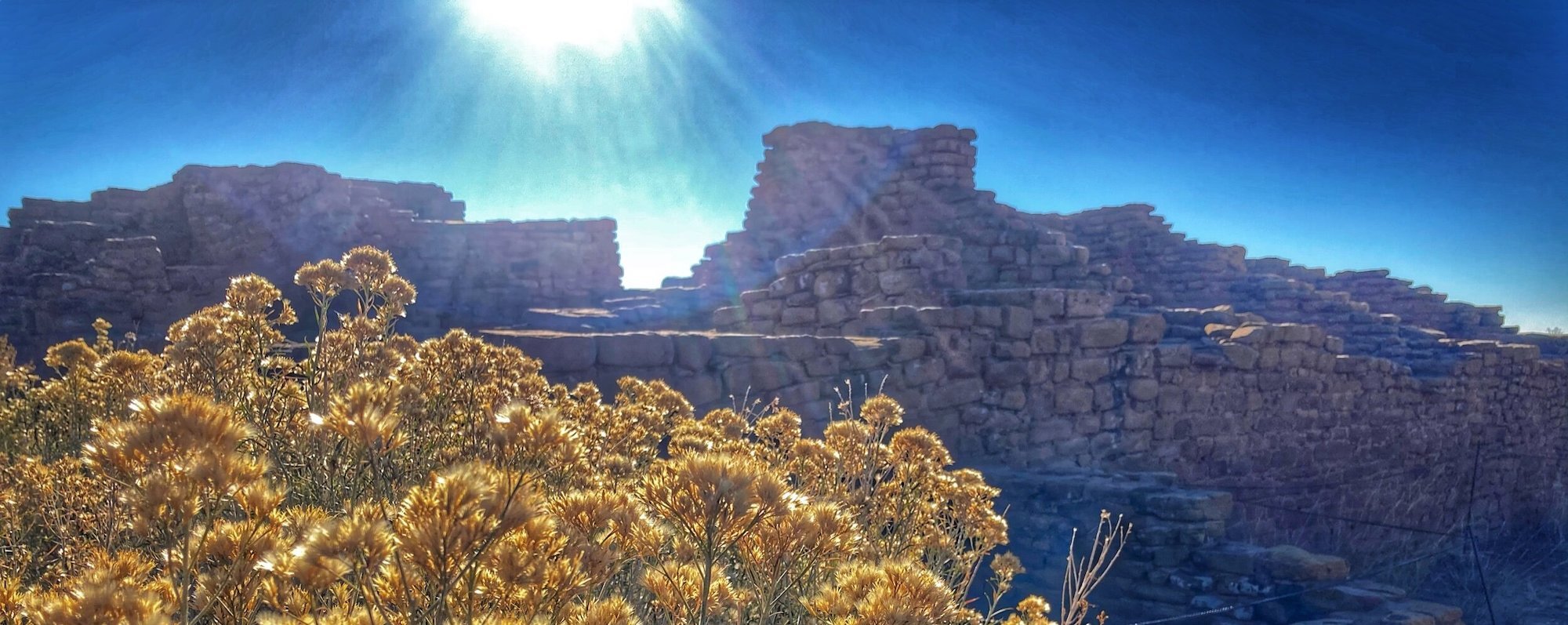
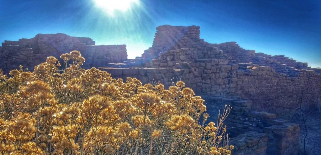
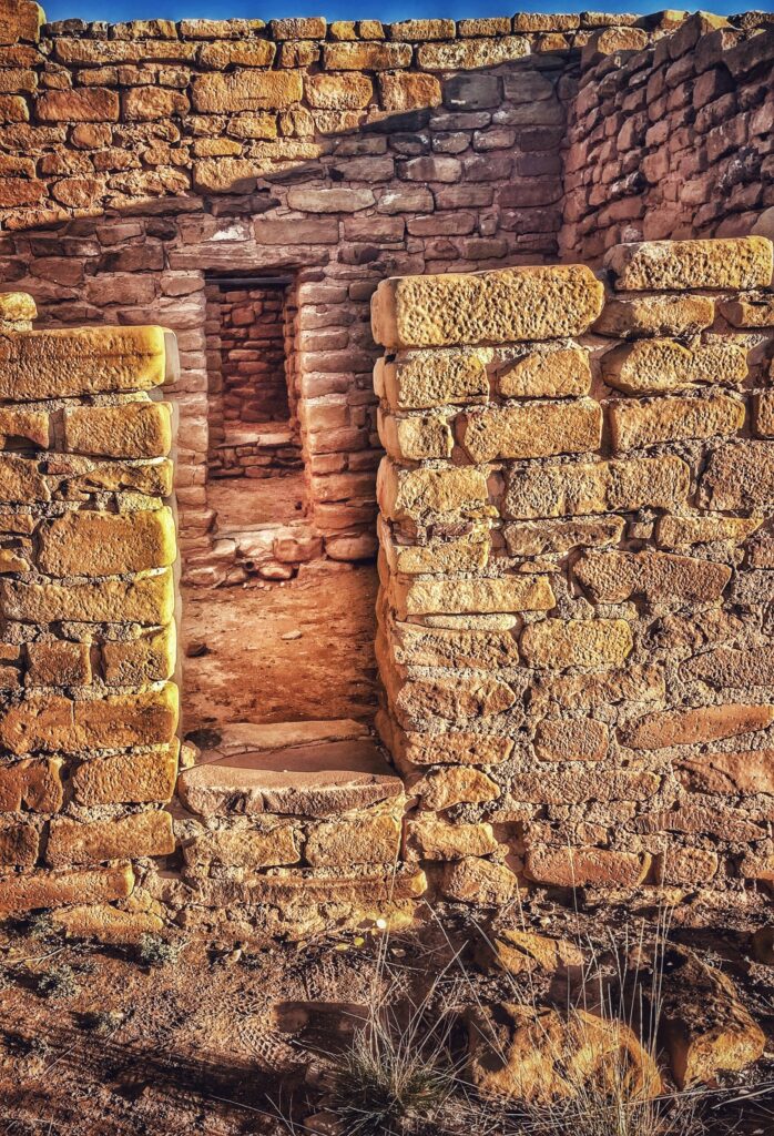
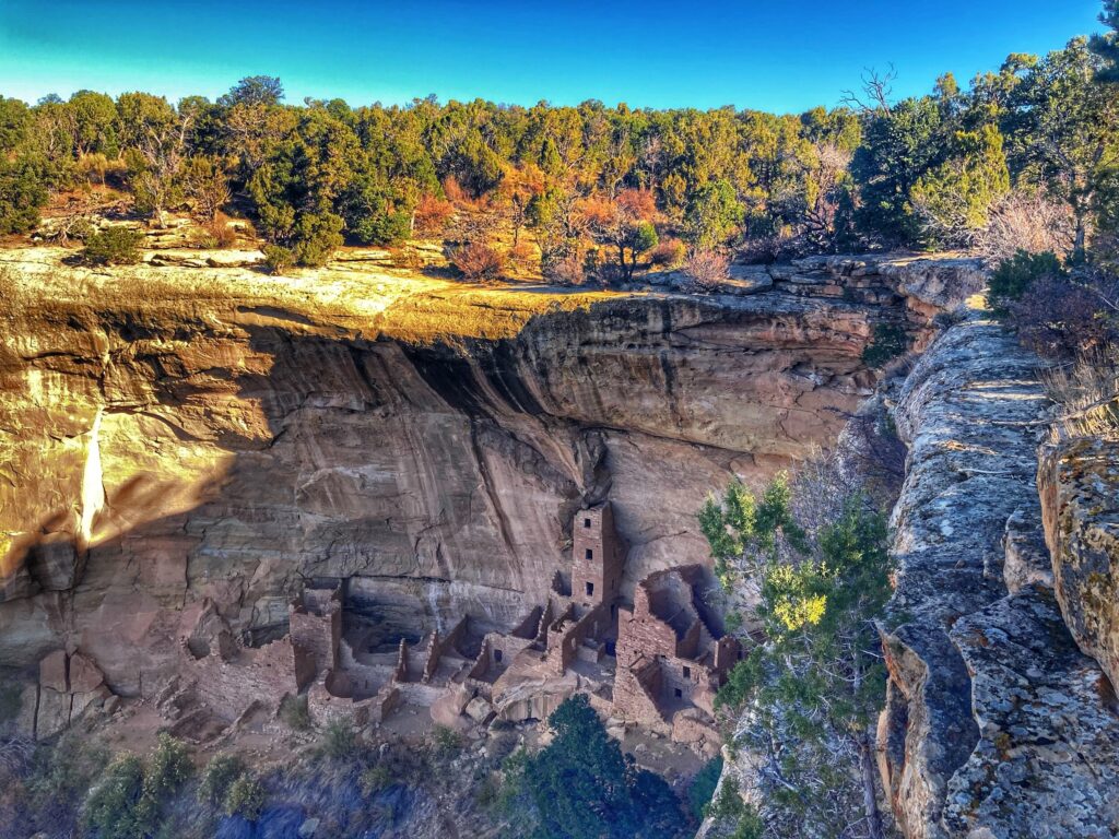
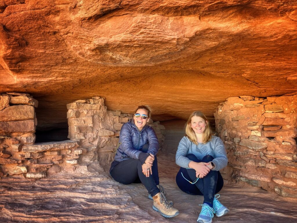
After braving a blizzard at Black Canyon of the Gunnison National Park, we headed down to the southwest corner of colorado to visit Mesa Verde National Park. Mesa Verde was the first park that we visited that was established primarily for archeological reasons. The area was set aside to preserve and study the Ancestral Pueblo heritage and relics in 1906. The Puebloans called this place home from roughly the year 600 till the year 1300. According to the Park Service, the area preserves over 5,000 archaeological sites and more than 600 cliff dwellings.
Pit Houses to Cliff Dwellings
One of the most fascinating things about this park is the ability to see how the Puebloan people progressed and changed over time. Early in their time here they built and resided in “Pit Houses” that were complex structures built into the ground. These were sometimes solitary and sometimes grouped together. Larger “Kivas” were also nearby and served as gathering places and for social functions.
Then, over time, they moved out to the cliff dwellings. Archaeologists are still studying this migration, what prompted it, and what eventually prompted the Puebloan people to abandon the incredible cliff structures and move out of the area. Try as I might, I couldn’t wrap my head around thinking about the first person that was like “Hey, why don’t we build a house on those cliffs over there? What do you all think?”
Sunrise
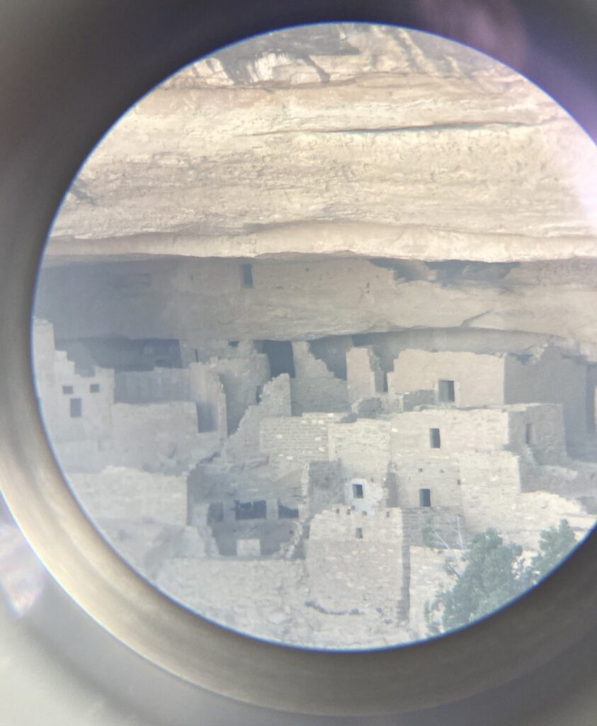
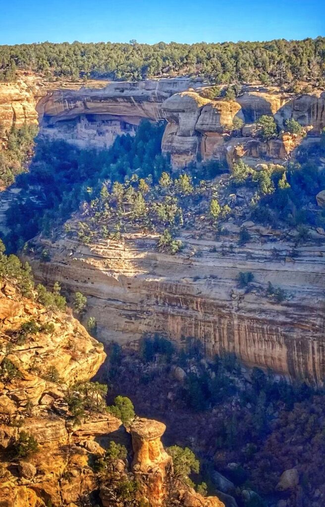
We opted for a before sunrise entry to Mesa Verde, and were rewarded with some spectacular views and had the park essentially to ourselves. We made several stops along Mesa Top Ruins road to explore and hike. Some of our favorites were: Park Point Overlook, Far View House, Square Tower House.
There are numerous other pull-offs where you can get a view of some of the most complex cliff dwellings and we stopped at many of them. Normally, it is possible to get a guided tour of these, but that was limited or unavailable due to Covid, so we had to settle for observing them from afar.
We only spent one day at this park, but this is one of those places that you could easily spend a month exploring all the various archaeological sites, hiking trails, and scenic areas. All three of us left the park with a greater respect for the native inhabitants of the area, and a wonderment for the engineering prowess they possessed for their time.
Gallery
The first National Park that we visited that was primarily archaeological in nature, Mesa Verde left us inspired and awestruck at the engineering capabilities of the ancestral Puebloan people.
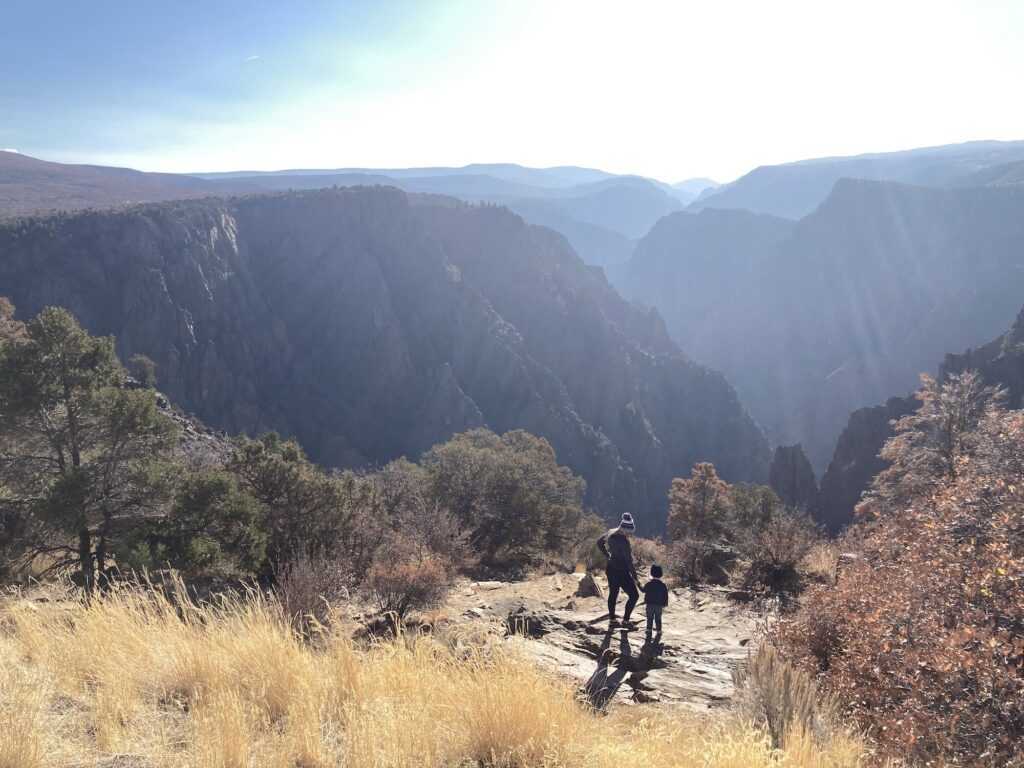
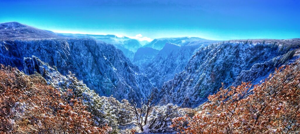
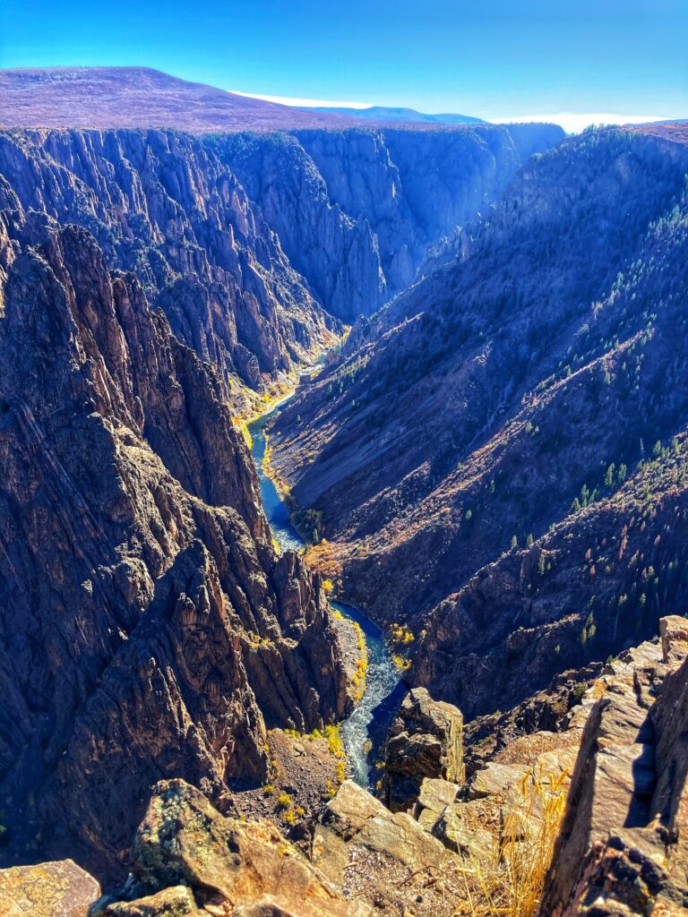
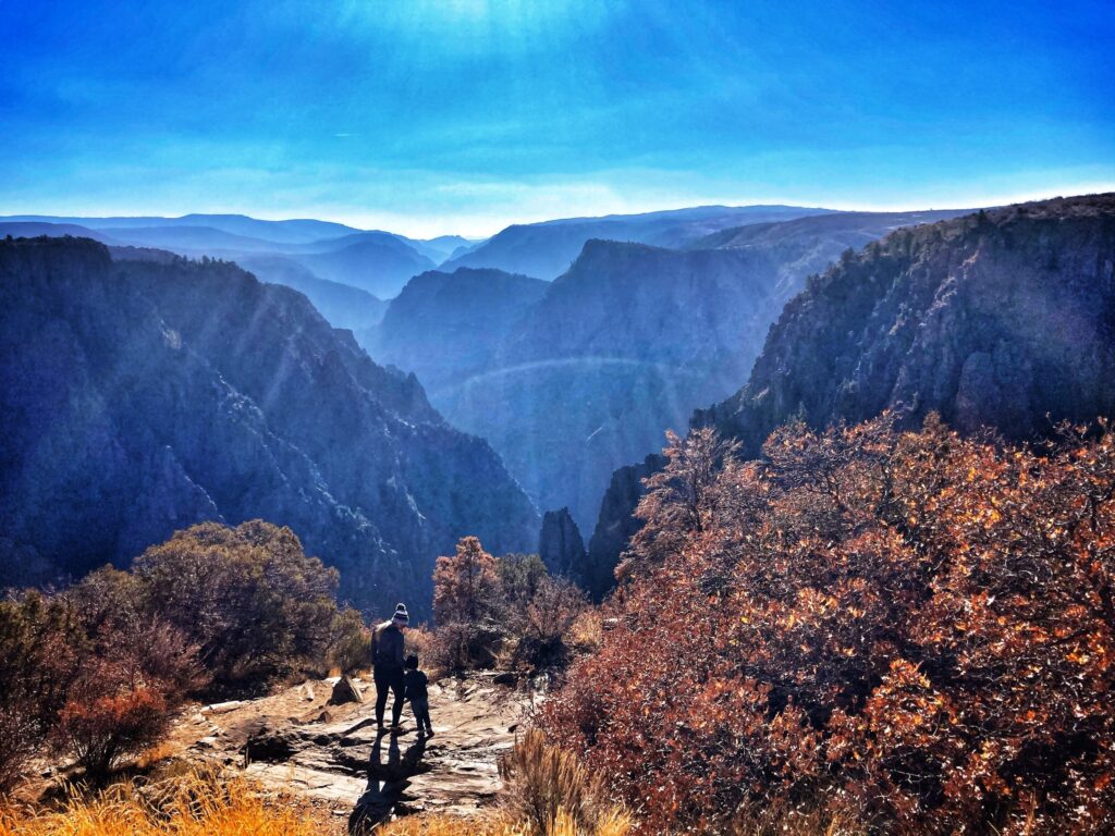
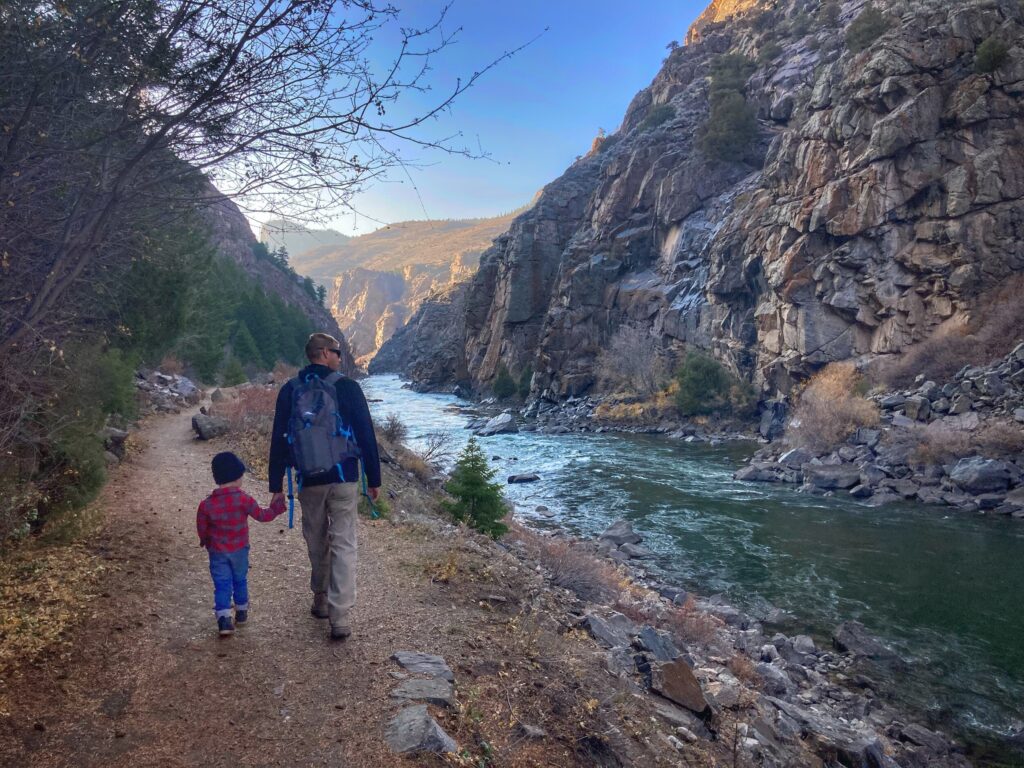
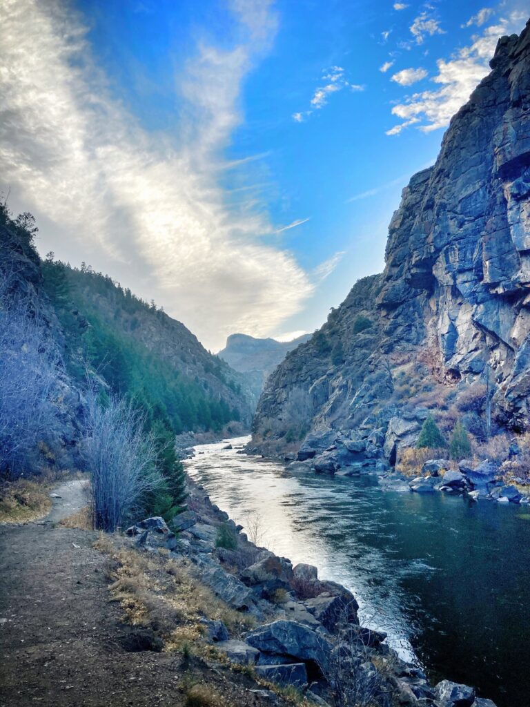
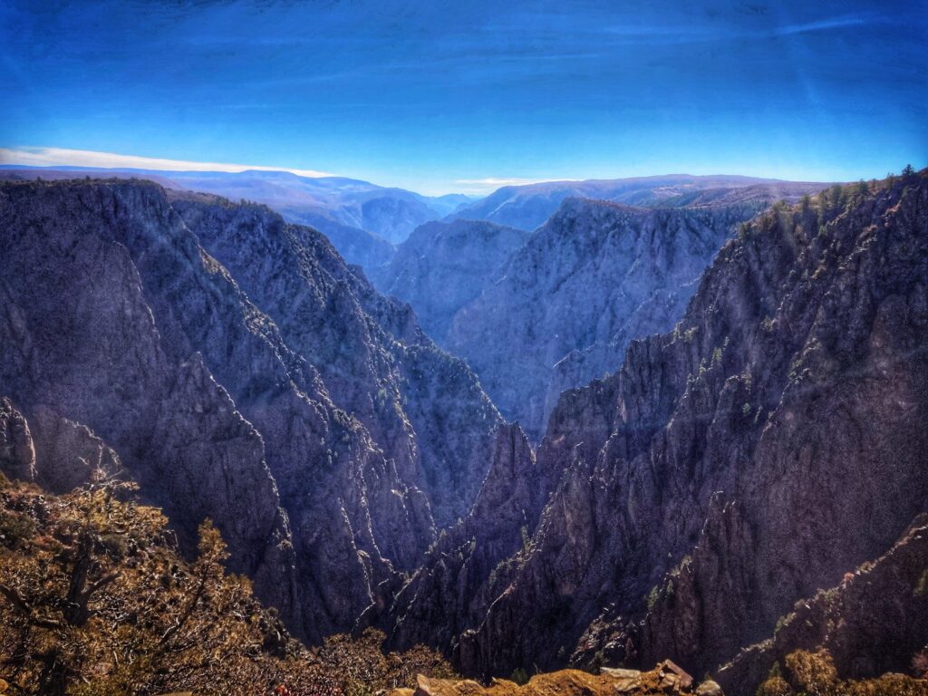
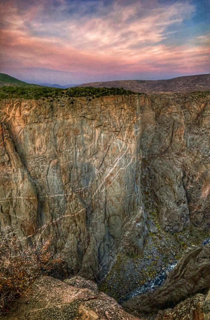
Black Canyon of the Gunnison National Park is a lesser known park on the western side of Colorado. It was our next stop after completing the Utah Mighty 5 with a visit to Canyonlands. We didn’t really know what to expect going into this park, and it ended up ranking near the top of our favorites list! There were very few other visitors in the park, so we were able to take our time and explore the many overlooks available along Rim Drive. Two million years in the making, the Gunnison river carved out this canyon to be exceptionally deep, narrow and ominously scenic.
Snow
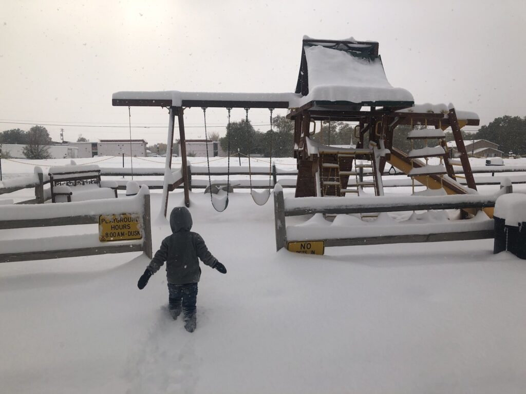
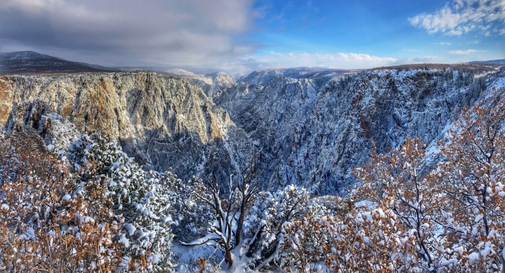
While staying in Montrose, Colorado we were hit by a massive snowstorm that tested our RV cold weather preparedness. Our pipes briefly froze up and I had to clear the snow off the slide roof with a broom. But, we survived and learned a lot about cold weather camping in the process. Additionally, the storm gave us the opportunity to see the Black Canyon through the lens of multiple seasons. It was quite striking with the fresh Colorado snow.
Highlights
The Rim Drive road is the main thoroughfare through the park. Starting at the South entrance station and ending at “High Point” it stops at the visitor center and offers many scenic overlooks. The various stops highlight different vantage points of the precipitous canyon. Some of our favorites were Tomichi Point, Chasm View and Painted Wall View.
There is also a road on the north rim, but there is no bridge to it inside the park and it’s a 3-4 hour drive out and around to reach it…maybe next time.
We spent several days at this park, but if you are just passing through, it’s possible to drive the south rim road and see the main attractions in an afternoon. Just make sure the road is open!
Pine Creek Trail
While we were in the area, we also took a drive east to hike a portion of the Pine Creek trail in the Curecanti National Recreation Area. This was a fun trail that runs right along the Gunnison river. There used to be a passenger rail line that ran alongside the river and there are a number of informational placards and remnants of the rail system along the trail.
Even though I grew up in Colorado, and Kristy lived there for years, neither of us had spent much time west of the mountains. The blizzard was definitely a challenge, but it was fun to frolic around in the snow, and we really enjoyed our time in the area. Since the Rim Drive is closed in the winter months, we consider ourselves lucky to have been able to see Black Canyon covered in snow.
Gallery
One of the lesser known, and least visited National Parks, Black Canyon of the Gunnison turned out to be one of our favorites. A massive winter storm dumped over a foot of Colorado snow on us, testing our RV cold weather preparedness. We survived, and were rewarded with the experience of seeing the park blanketed in snow.
Dates we visited: October 12th – October 18th 2020 Where we stayed:Green River KOA
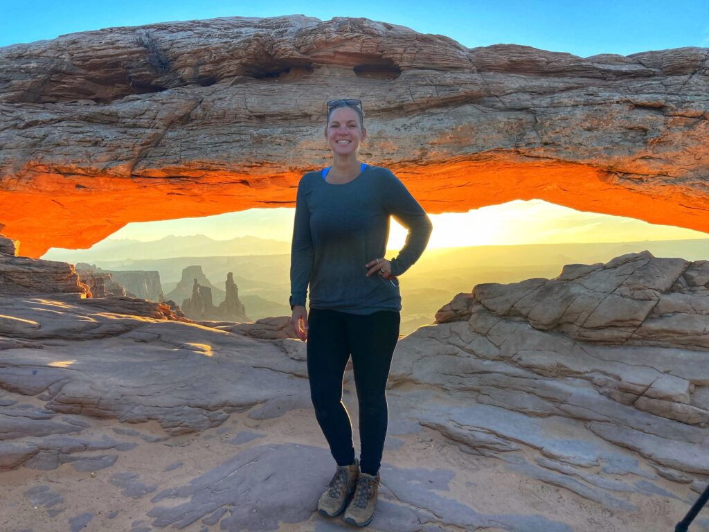
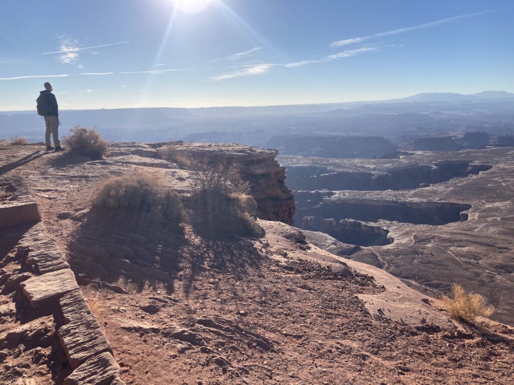
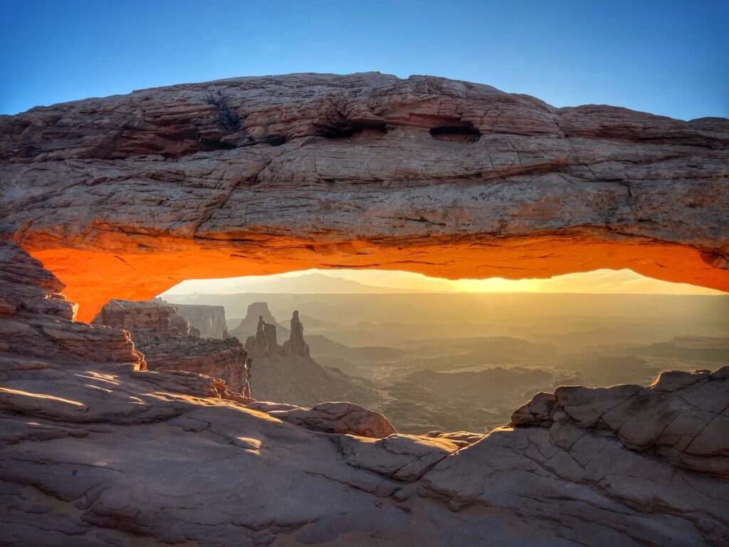
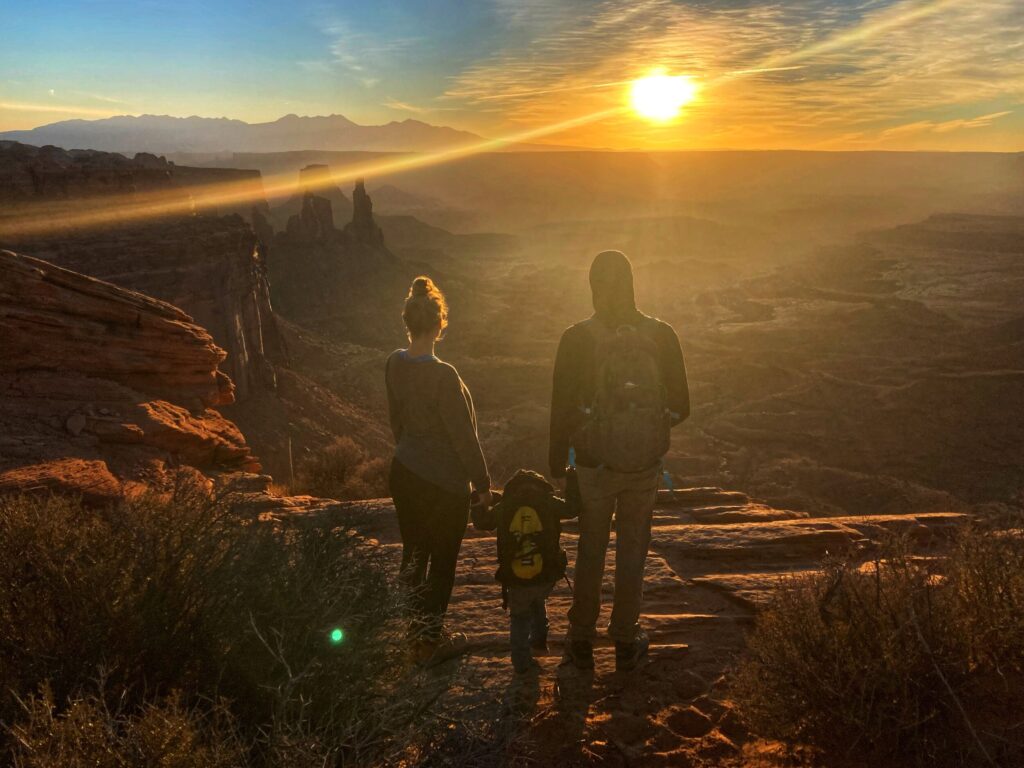
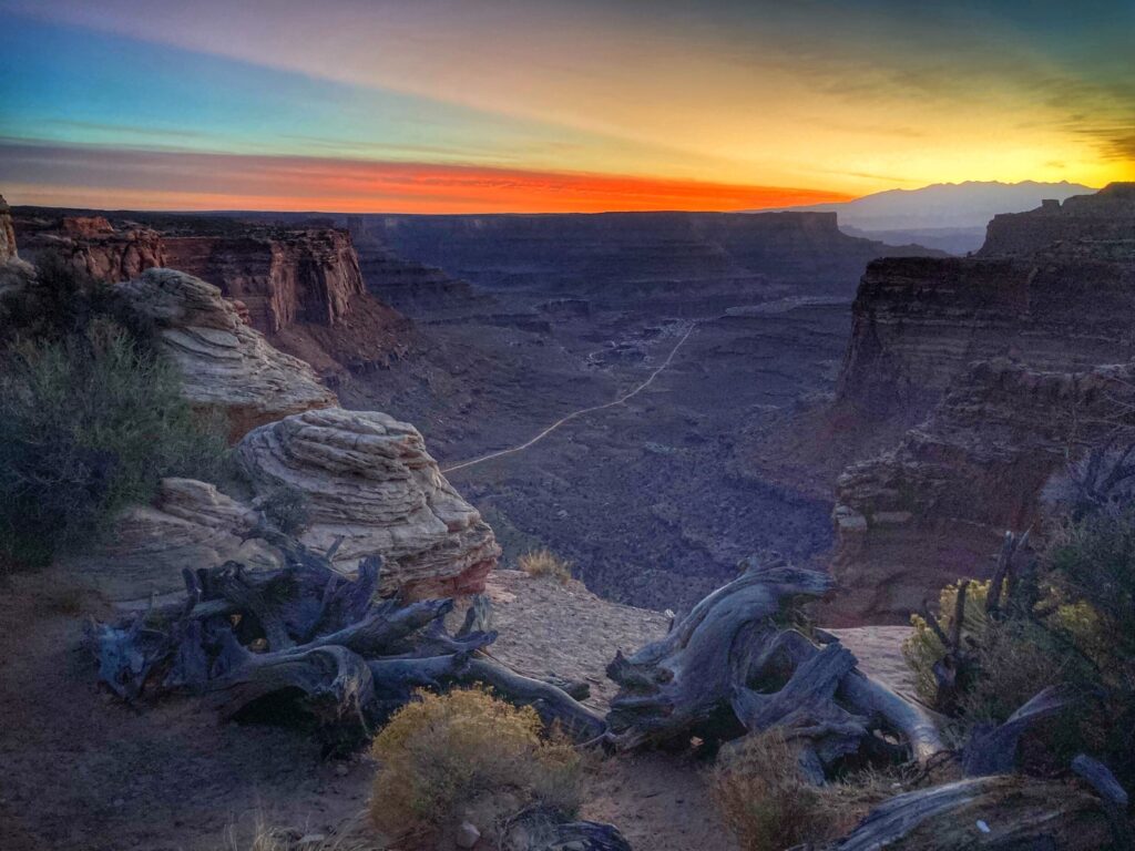
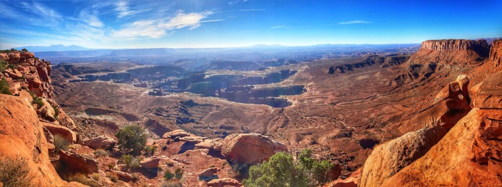
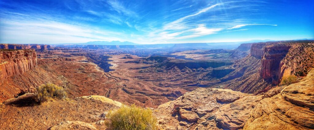
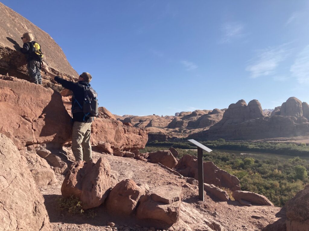
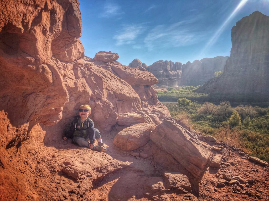
Our fifth and final stop in the Utah Mighty 5 was Canyonlands National Park. Like Arches, this park is near Moab, however it is far less well-known, and much less visited. As it turned out, this was also our favorite of the five Utah National Parks. As its name implies, there are many canyons to be explored here. While it may not be as grand in depth and length as the Grand Canyon, we found this area to be very interesting. As you can see in some of Kristy’s photos, there are canyons within canyon’s which are joined by other canyons. It’s basically canyons all the way down.
Mesa Arch
Surprisingly, one of our favorite features of Canyonlands was the Mesa Arch. This arch was a striking example of this unique rock formation, and it was a bit more accessible than some of it’s brethren over in Arches National Park. We took a short hike to this Arch at sunrise, and even though there were a few other folks in the area, everyone was friendly and took turns capturing photos from the prime locations.
Grand View
The main road at Canyonlands enters the park on the north side, and offers a scenic drive up Grand View Point Road to it’s ending at Grand View Point.
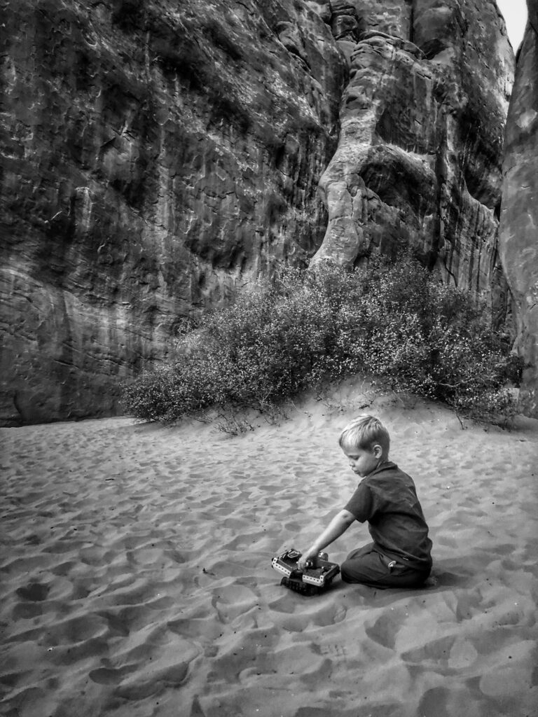
The 1.8 mile out and back trail at Grand View Point is spectacular. The trail winds along the rim of the canyon, offering different vantage points of the multiple canyons. It was a little nerve-racking with Owen since there are no guardrails on the trail, but he did a great job sticking close to us and holding hands at the narrow sections.
If you haven’t heard of Canyonlands National Park, consider yourself informed. There are a number of hiking trails around the park, along with what appeared to be a pretty intense 4-wheel trail down into the canyons. Next time you are in the Moab area of Utah, make sure to take a day or two to explore this park.
Gallery
Canyonlands National Park is like the movie Inception, but with canyons. There are canyons inside of canyons and the deeper you go, the more canyons there are. The hikes were breathtaking due to both their beauty and the terror of having a three year old with us that loves to make sudden moves. Nonetheless, we loved this lesser known park that is just southwest of Moab.
Dates we visited: October 12th – October 18th 2020 Where we stayed:Green River KOA
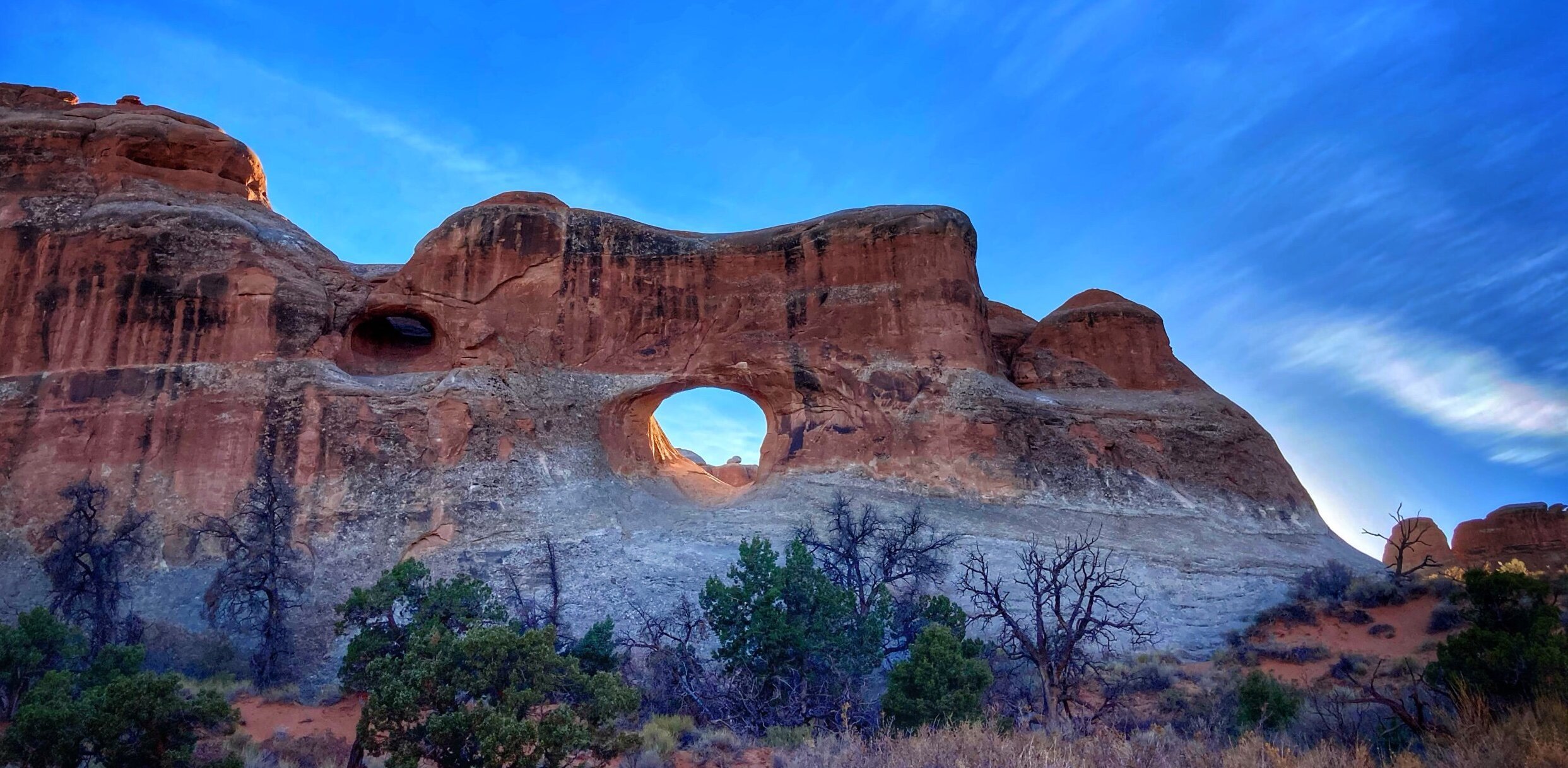
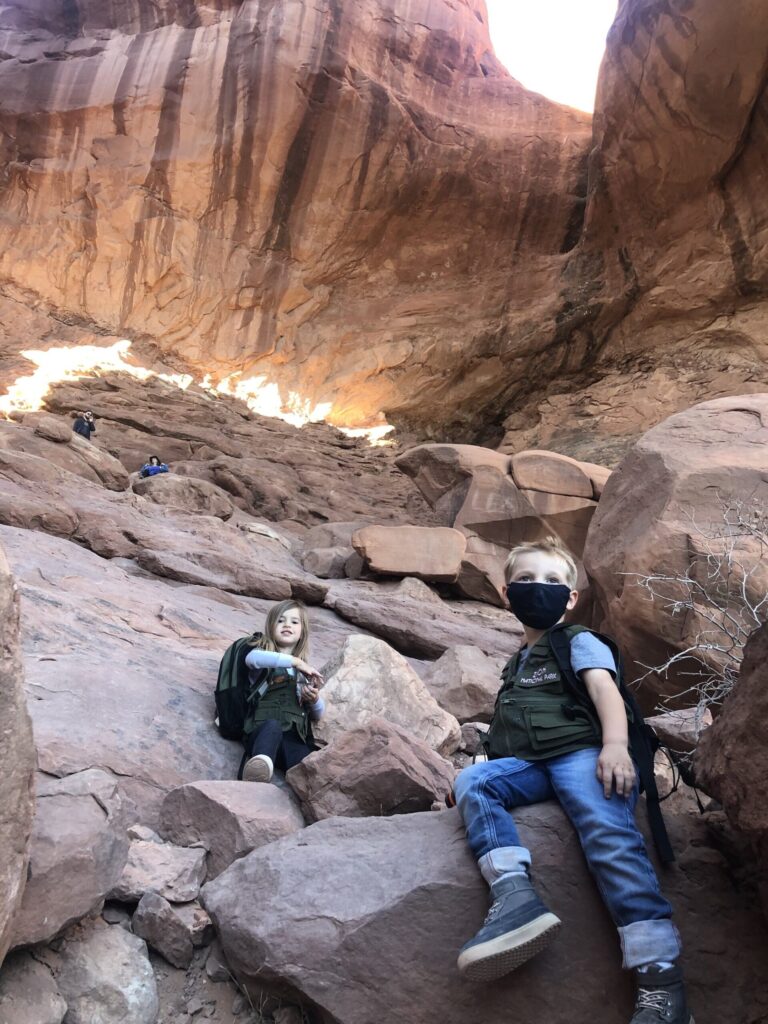
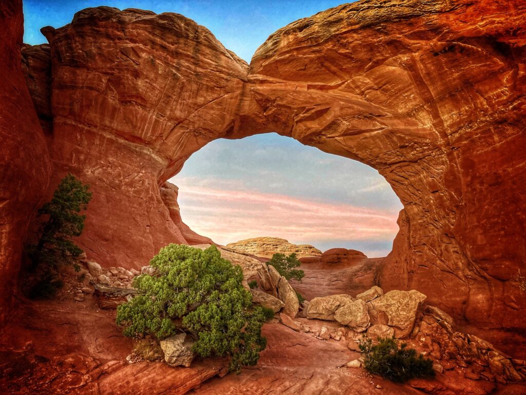
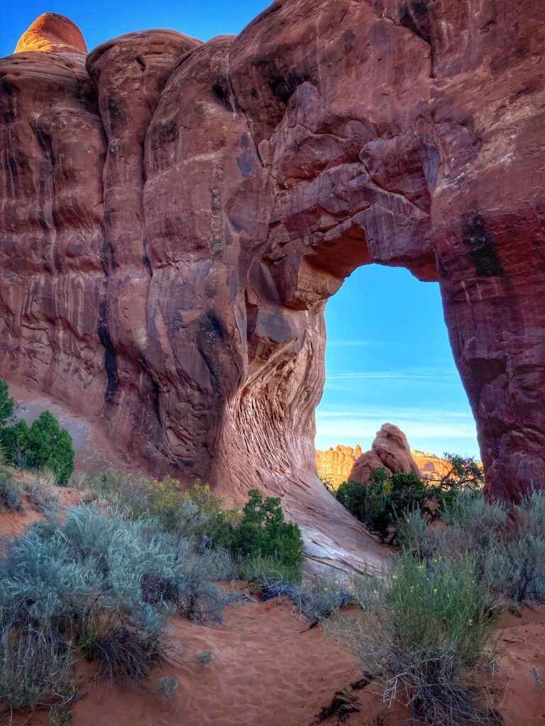
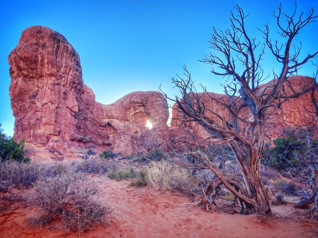
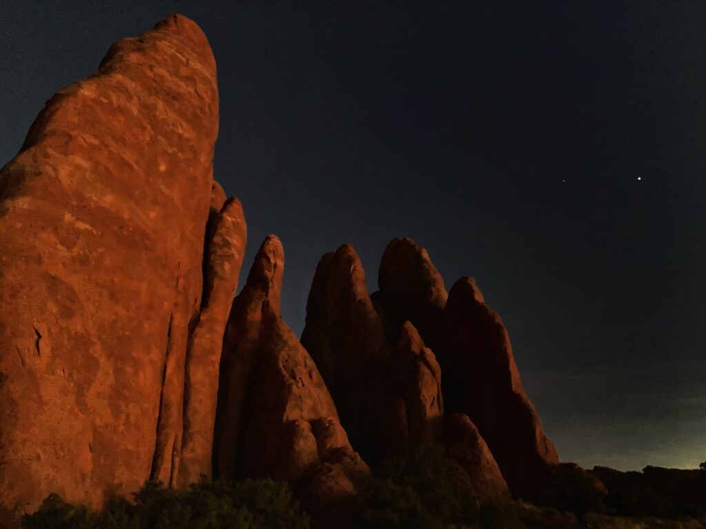
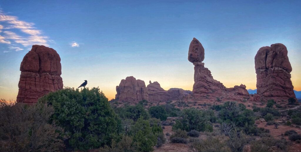
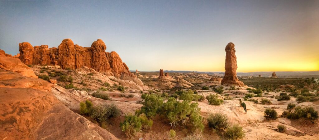
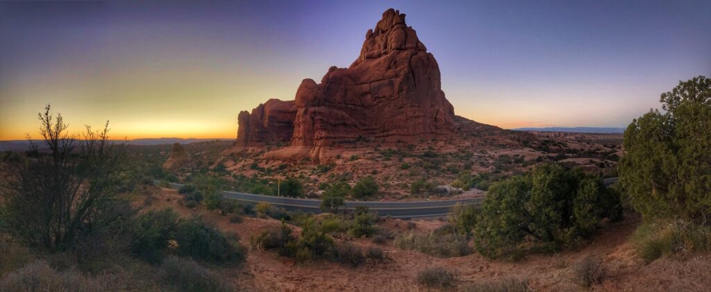
The fourth of Utah’s “Mighty 5” , we visited Arches National Park after Capitol Reef. Arches is a popular destination and one of the more well-known National Parks. It’s also the closest park to Moab, which is famed for its mountain biking and outdoors activities. We stayed in the city of Green River, which is a few miles to the northeast, but is much less busy, and offers more affordable accommodations if you are willing to drive a bit further to get to the attractions in the area.
Highlights
We made a few trips into Arches so that we could check out the various features along the main road that runs the length of the park.
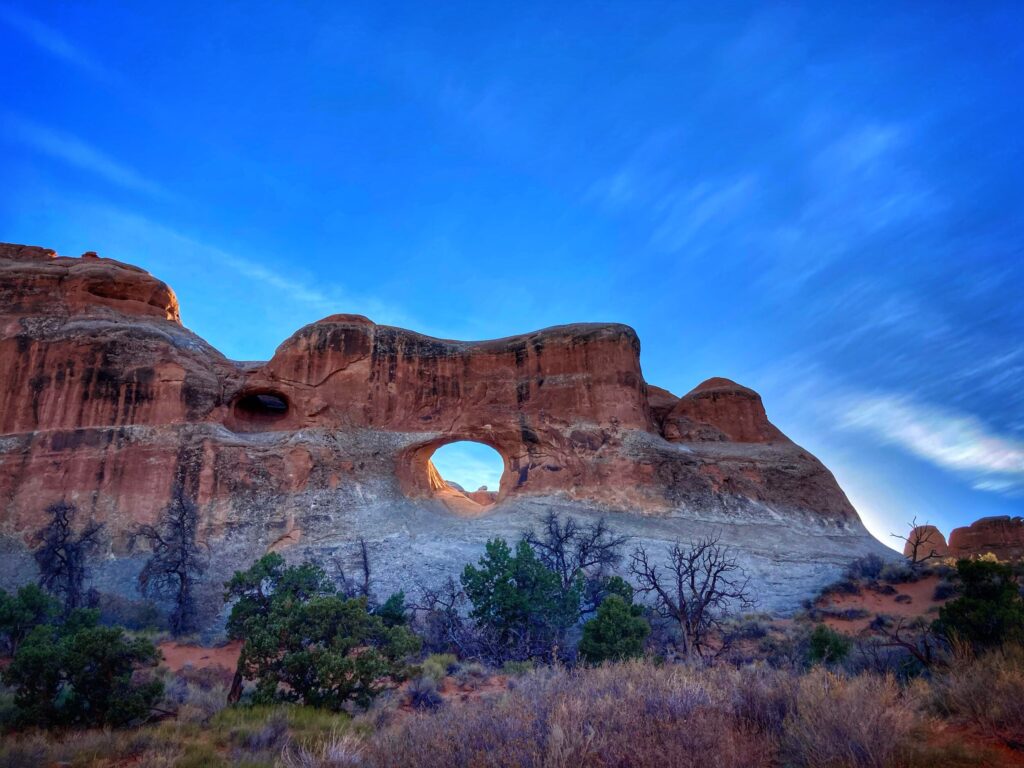
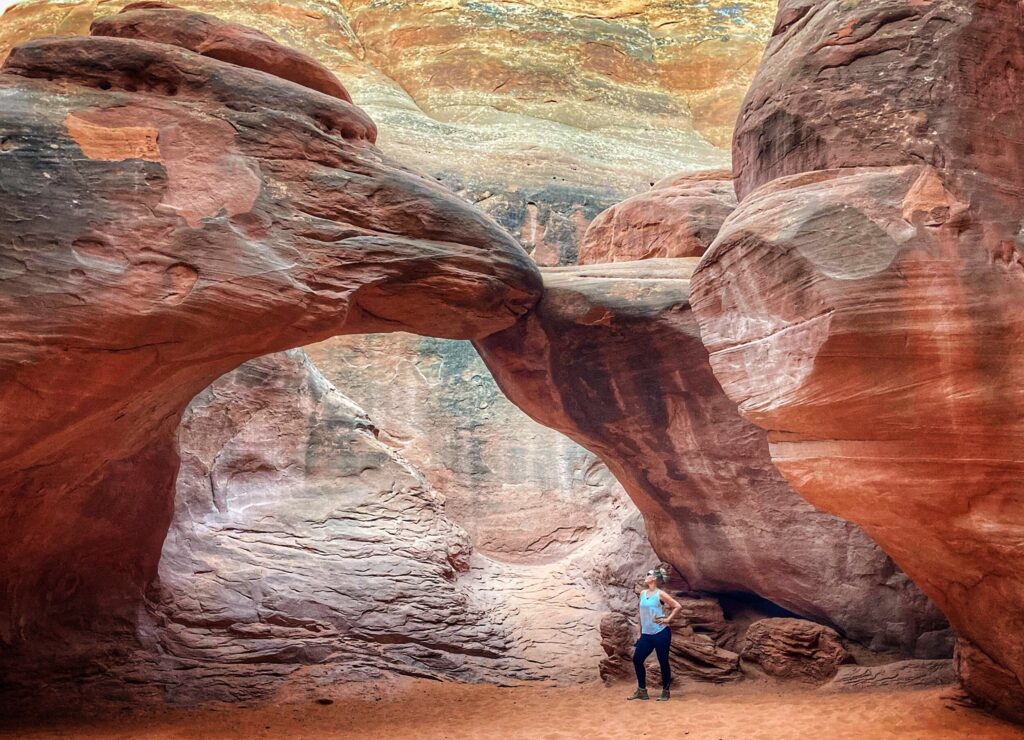
As you might expect, we stopped to check out several of the arches around the park. Two of our favorite locations were Delicate Arch and Double Arches. Delicate Arch is one of the most photographed arches in the world, and when you think of an arch rock formation, most likely this is the one that your brain conjures up.
Double Arches is also a popular location, this one is a bit more kid friendly to approach. The two massive arches are situated in a way that allows you to hike up underneath them, and Owen really enjoyed checking them out from below.
Obviously Arches is known for its, well, arches, but there is more to it than that. We also enjoyed the short hike around Balanced Rock. The massive and precariously sitting boulder will eventually topple off of it’s perch due to erosion. Most likely, that won’t happen for hundreds of years, but we’re still glad we got to see it before then!
Potash Dinosaur Tracks
The Potash dinosaur tracks and petroglyphs are not inside Arches national park, but proved to be an exciting destination for us nonetheless. A few miles south of Moab, there is a short but challenging trail that leads to fossilized dinosaur tracks. It’s possible to hike right up to the rock face and actually touch the tracks if you choose. This little trek was especially enjoyable for us because the destination is a little off the beaten path, and we were the only ones on the trail. If you are in the area, and into fossils and petroglyphs, it’s worth taking a few hours to pop over to this location.
Arches is a popular destination for a reason, the arch rock formations found here defy logic when you see them up close. Due to its proximity to Moab, the park is often busy, and we experienced more lines and crowds than we are used to. Our take is that you should definitely check out Arches at least once in your life, but if you are looking for a more peaceful experience, perhaps check out some of the other less visited Utah parks.
Gallery
Arches National Park contains an unbelievable assortment of natural stone arches, but that’s not all we found there. We visited this park a few times over several days and found several hikes and features that the whole family enjoyed.
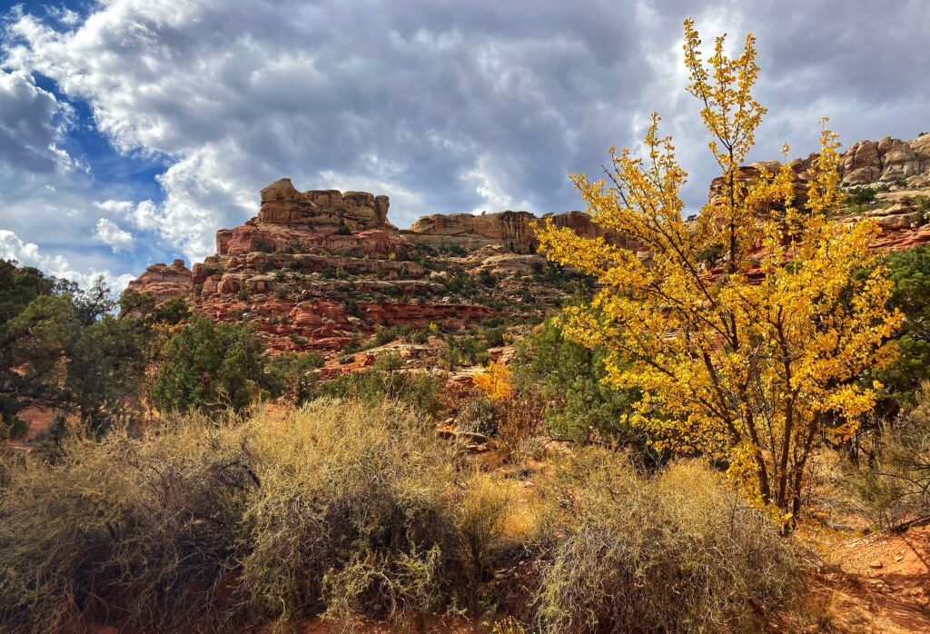
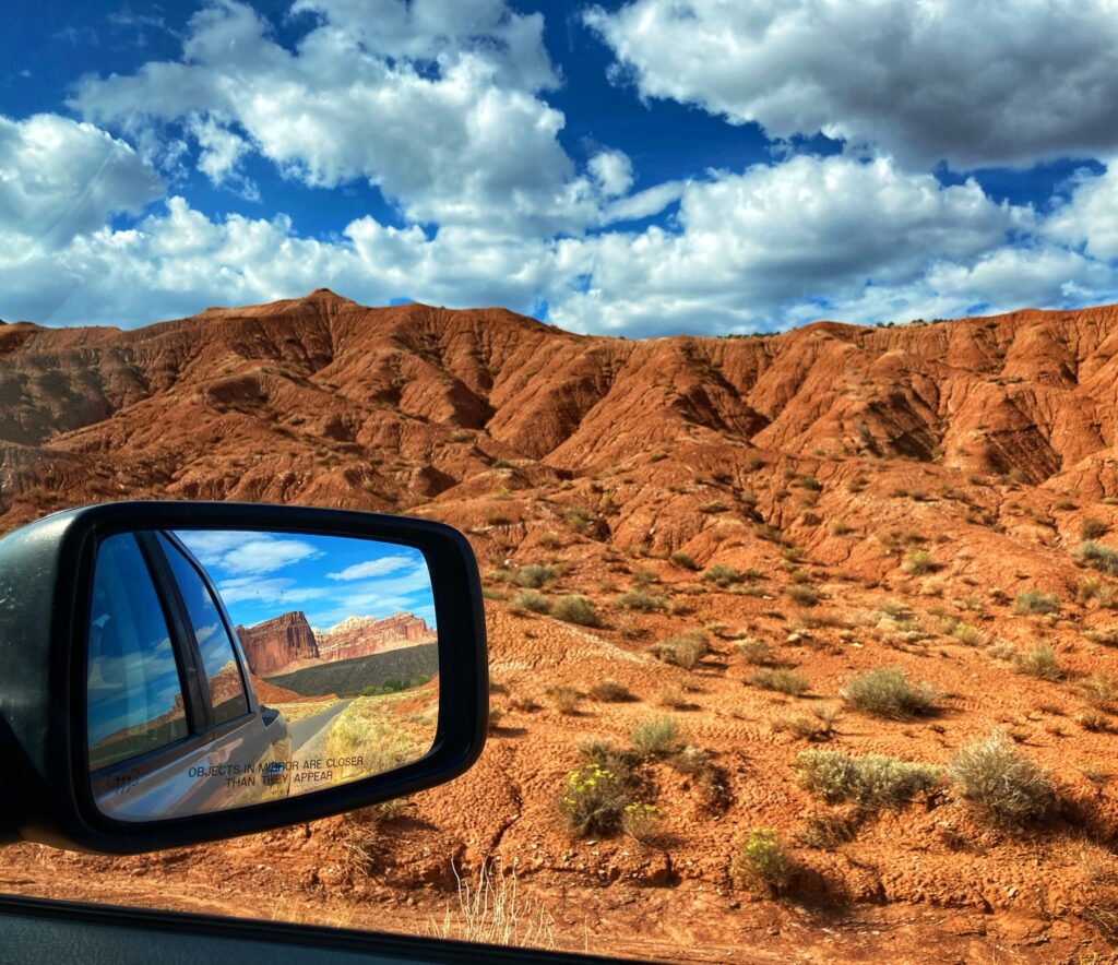
After visiting Bryce Canyon, the next destination on our agenda for Utah’s “Mighty 5” National Parks was Capitol Reef. It’s a relatively large National Park at 378 square miles and is the most remote of the five Utah parks. Rather than tow the RV through some of the remote and mountainous terrain between Bryce and Capitol Reef, we opted to take a longer, but more well established, route by going up north to I-70 and then east. As it turned out, the drive along I-70 east of Salina, UT was absolutely stunning. There were dramatic rock formations that, if you’ll permit me to geek out a bit, looked like Star Wars Imperial cruiser spaceships crashed on earth (albeit made of red rocks).
Capitol Reef was given its name by combining two of it’s geologic features. First, the “Capitol Dome” was named due to its resemblance to the U.S. Capitol building in Washington DC. Secondly, the combined geologic features of the “waterpocket fold” and the Colorado plateau uplift formed a giant, very long cliff called an escarpment. Early explorers felt the escarpment resembled a reef, like one might find in the ocean. And so you put those together and you have Capitol Reef!
Petroglyphs
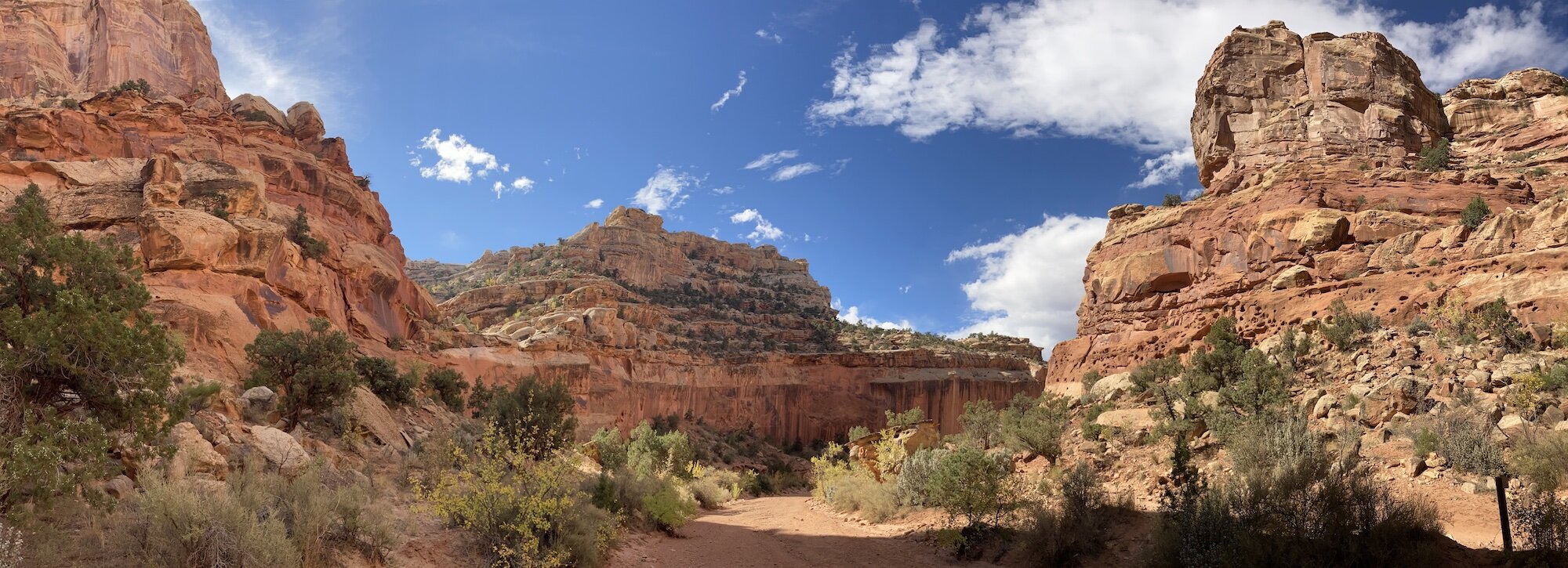
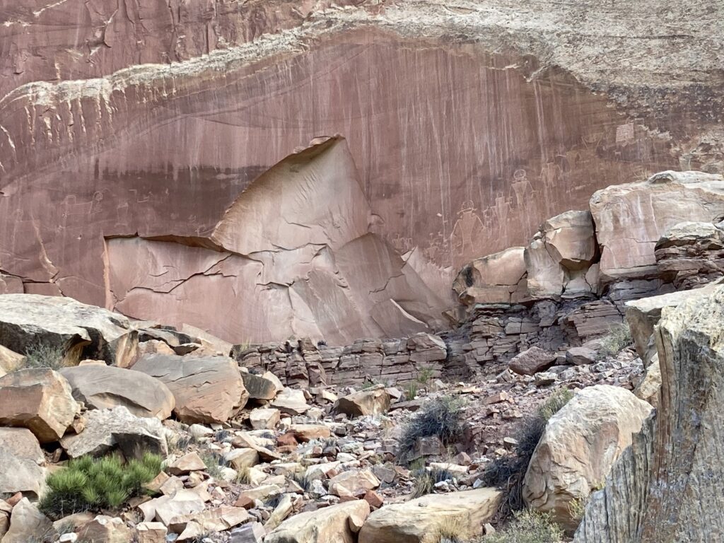
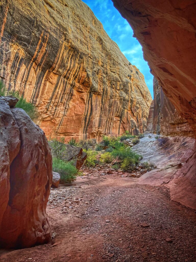
The drive into the park is super scenic, winding its way through the red rock canyons. After passing the namesake Capitol Dome formation, and shortly before reaching the visitor center, is a pull off to view some ancient petroglyphs. We stopped here to check them out and learn a bit about the history of the area. Seeing these thousand year old drawings carved into the sandstone is a reminder of those who came before us, and it refreshed our commitment to be good stewards of the land.
Grand Wash
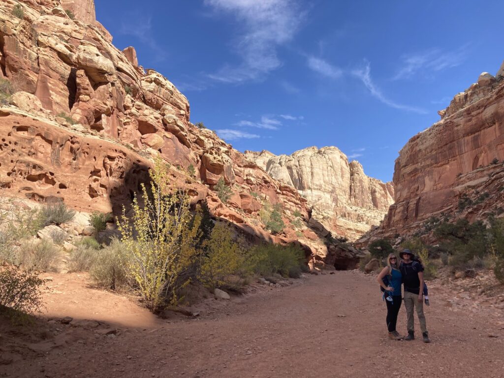
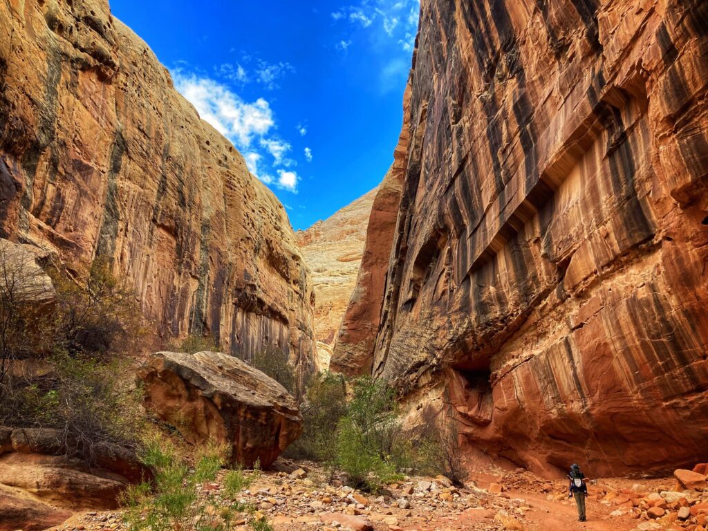
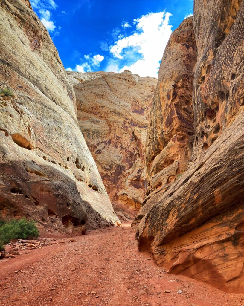
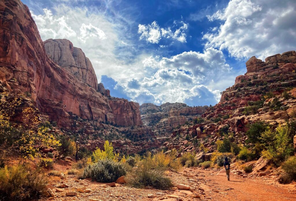
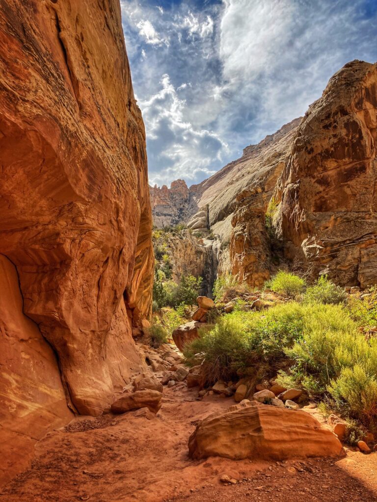
After a quick stop and short hike to check out the Goosenecks Overlook, we made our way up the scenic drive to the Grand Wash Trail. We did this trail backwards from how Alltrails.com recommends. We turned off of Scenic Drive road on to the dirt Grand Wash road, and then parked at the Cassidy Arch Trailhead.
This is a great, albeit somewhat long, trail for younger kids. The trail is mostly flat, and while there is some elevation change, it is relatively gradual. as the name implies the trail follows a “wash” which is where flood waters flow when it rains, making it imperative that you check the weather before embarking on this hike.
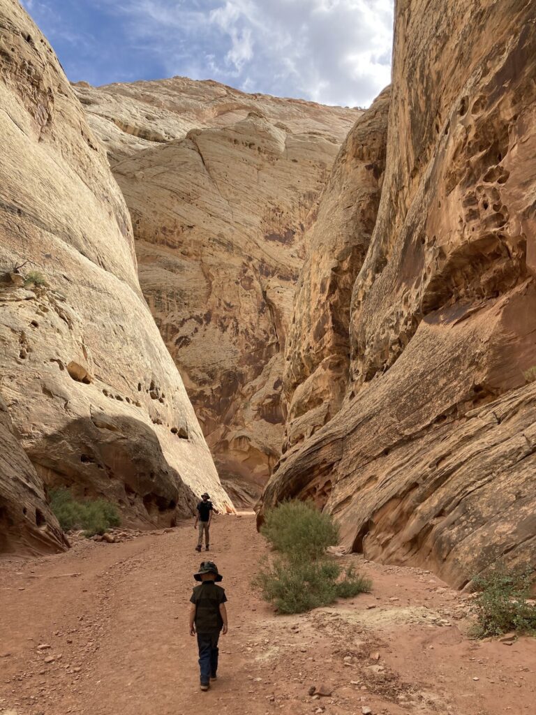
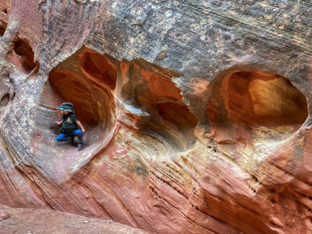
The highlight of the hike is “The Narrows” which is a particularly narrow section of often referred to as a slot canyon. Owen had fun running his hands along the walls and describing the different textures of rocks we found along the way.
On our trip out we came across a pair of fellow hikers, one of which had rolled her ankle and was in quite a lot of pain. While they repeatedly turned down our offers of assistance, we were still quite concerned for them, as it was a hot day, and they were still 3/4 of a mile to the trail head. We decided to let the rangers know about her situation on our way out, and while there is little they can do unless someone specifically requests assistance, hopefully they were able to at least confirm she made it out safely. It was a good reminder for us to where the right gear, bring plenty of water, and keep some basic first aid supplies with us at all times.
An additional attraction at Capitol Reef is the Gifford Homestead, and the nearby orchards. This was a bit unexpected based on the terrain here, but supposedly the fruit, jams and jellies here are quite good. We didn’t have the opportunity to experience these treats on this go around, so that goes on the list for next time.
Even though we only made one trip into Capitol Reef, we took great pleasure in the diverse landscape and the awe inspiring canyons and escarpments. We tried to put ourselves in the shoes of early explorers on horseback who would have happened upon this giant, miles long cliff while looking for passages further to the west. I imagine the first time that happened it would have been a bad day, with them saying to each other, “well, I guess we just have to go around”.
Capitol Reef Gallery
Capitol Reef was the third of Utah’s “Mighty Five” on our agenda. We were struck by the coloration of the rock walls and unusual geology this park had to offer. We even managed to squeeze in a great hike through a slot canyon!
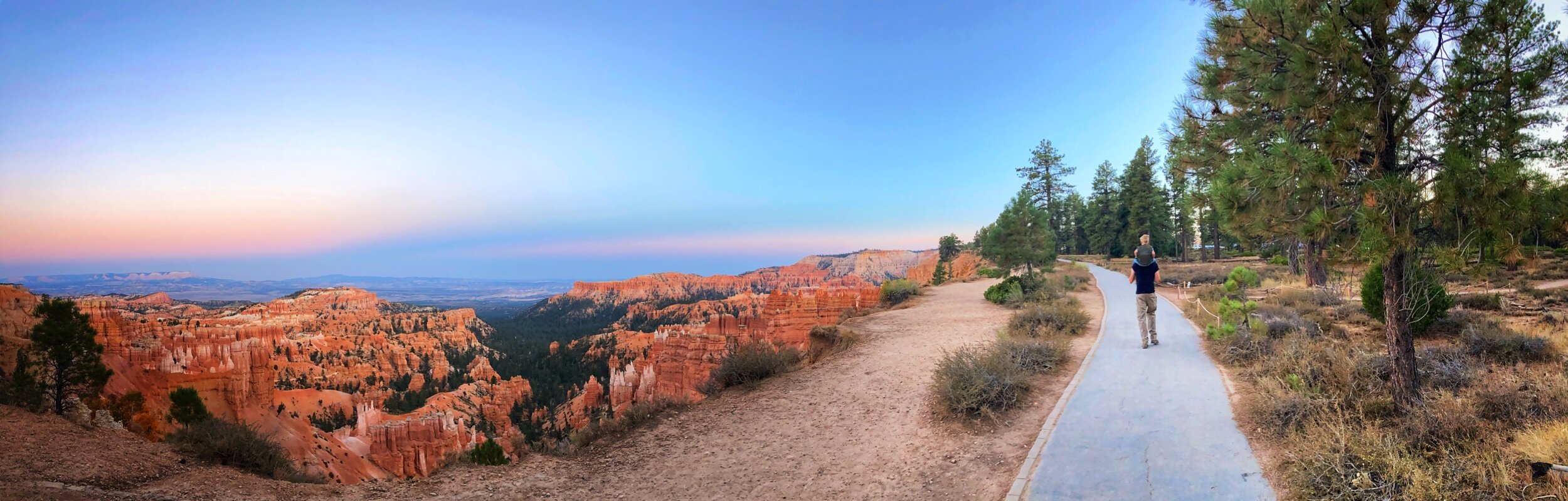
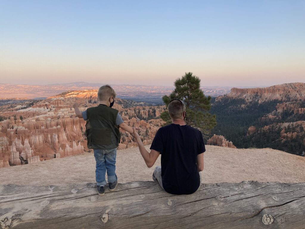
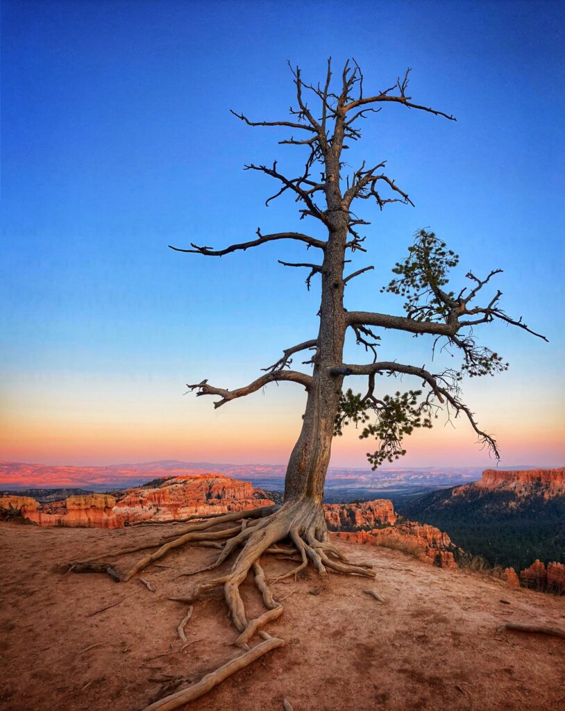
The feeling of walking through a forest and then suddenly emerging at the edge of a cliff overlooking a multicolored and dynamic canyon is hard to put into words. Bryce Canyon National Park, our second of five Utah parks, offered us family friendly trails and stunning vistas. We were lucky to be able to experience this park both in the evening as well as the early morning, each giving the park it’s own unique personality.
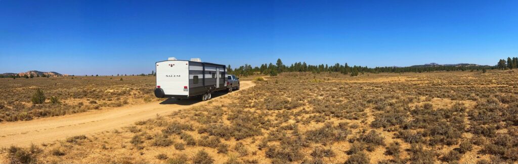
Dixie National Forest Boondocking
After our failed boondocking attempt near Zion we were a little nervous to try again, however this time it went much better. I was able to locate what appeared to be a suitable area of U.S. Forest Service Land using the Dyrt and Google Maps, but I wasn’t able to actually scout it out in person. Luckily, when we arrived, we found an available and relatively easily accessible campground within about twenty minutes.
If you are looking for a good, free, boondocking experience while visiting Bryce Canyon, definitely check out the FR117 dispersed camping area off of highway 12.
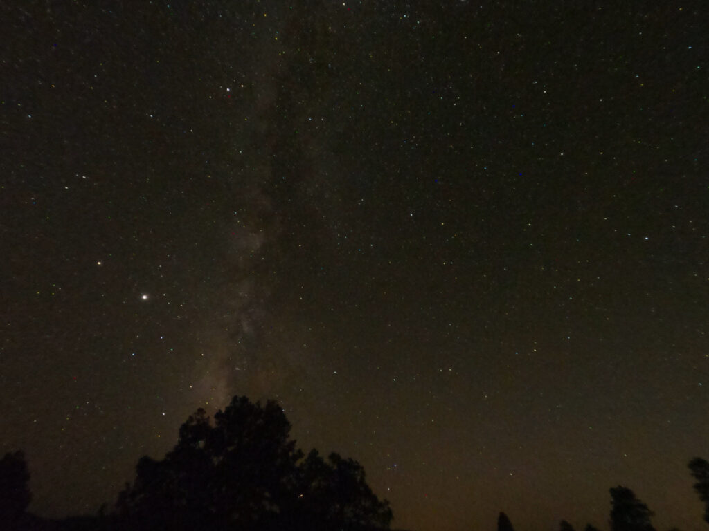
We had great stargazing conditions here, and enjoyed sitting out together to experience the evening. The one downside to this spot was that it was dusty. Perhaps it was the spot we picked, or maybe it’s just a fact of camping in this area, but we had planned to stay here for two nights, and ended up moving on after one due to the dust.
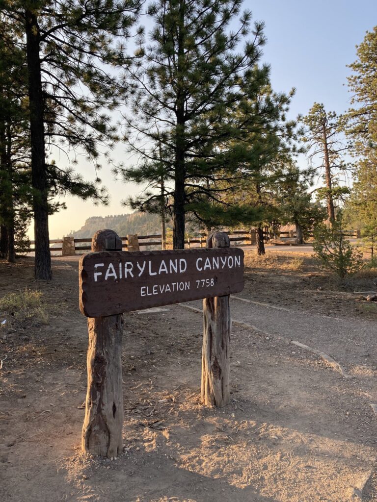
Fairyland
Our first stop in Bryce Canyon was Fairyland Point. This overlook is at a turn off right after the park sign, but before the formal entry gate. While there is a trailhead here, the trails are rather challenging with relatively steep drop-off exposure, so we just took in the sights from the overlook.
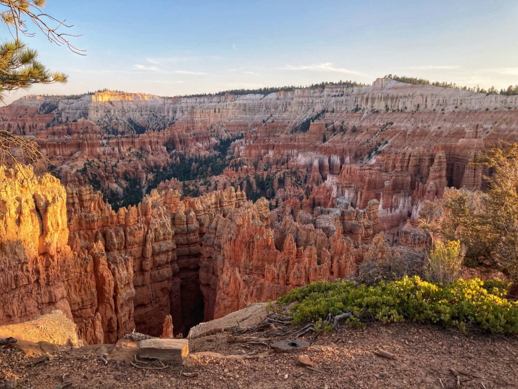
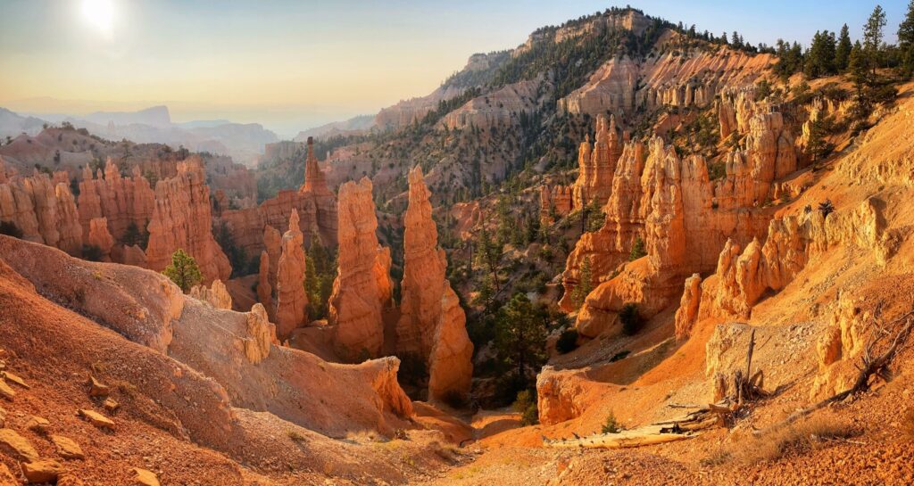
Some of the defining features of Bryce Canyon are the rock formations called hoodoos. While this is obviously a fun word to say, these unique spire-like rocks are even more fun to see. Imagine tall, roughly cylindrical shaped, red rocks scattered across the landscape. Some of them larger on their tops than their bottoms.
Sunrise to Sunset
Just inside the park is an area called Bryce Canyon City. The visitor center is nearby, along with campgrounds and a multitude of trails. There are two popular observation points called Sunrise Point and Sunset Point that are about a half mile away from each other. There is a popular and easily accessible trail that runs between the two point along the rim of the “canyon” (turns out it’s not technically a canyon, because it wasn’t carved by a river). In theory the views are best from each point at the time of day for which they are named. However, we found that each offered stunning views of the expansive hoodoo filled canyon at any time of day.
TIP: Try visiting Sunrise Point at sunset. Most of the crowds understandably flock to Sunset Point at sunset, but Sunrise Point offers a wonderful perspective with fewer people.
TIP: Try visiting Sunrise Point at sunset. Most of the crowds understandably flock to Sunset Point at sunset, but Sunrise Point offers a wonderful perspective with fewer people.
Scenic Drive
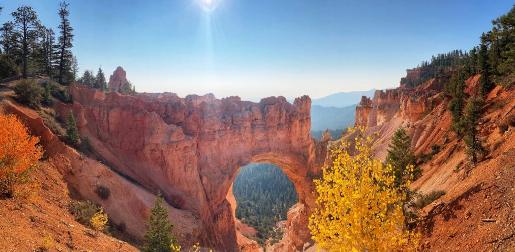
The scenic drive in the park is Highway 63. The road runs from the park entrance all along the rim with a number of overlooks, trailheads and interesting features along the way. We made a brief stop to check out the Bryce Natural Bridge, which is a stunning rock arch formation, before continuing on up to the end of the road at Rainbow Point.
After gawking at the vast expanse of unique geology at Rainbow Point, we completed the short Bristlecone Loop Trail. This trail was great for Owen, as well as Kristy and I. It meandered through the woods, with options to shorten or lengthen the hike, and had spurs to overlooks in all directions.
Bryce Canyon stunned us with the surprisingly quick transition from forest to eroded cliffs. We found it hard to wrap our heads around the natural forces capable of creating such a dramatic landscape. Next time we visit here we would love to tackle one of the more challenging hikes down into the canyon area. The view from above was spectacular, but I would imagine the view from ground level to be a totally different and unique experience.
Bryce Canyon Gallery
From hoodoos and fins to natural bridges, Bryce Canyon National Park was a dramatic landscape. We walked along the rim of a canyon that’s not technically a canyon and tried to wrap our minds around the natural forces that could have created such wild terrain.
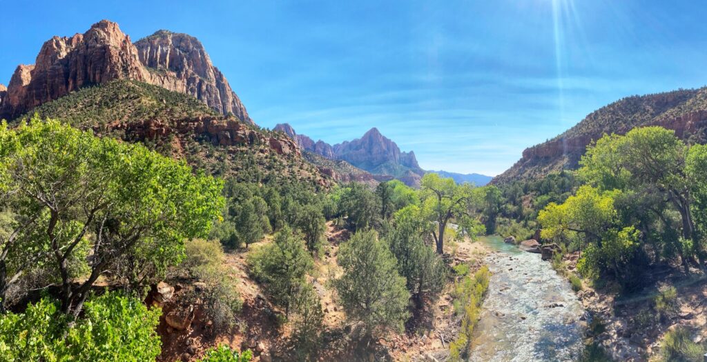
Zion National Park was the first of Utah’s “Mighty 5” National parks that we visited. It’s also one of the most popular National Parks in the country. Carved by the Virgin river through multi-colored sandstone rock, Zion is definitely an experience. We were met with a few surprises here, but that didn’t stop us from enjoying this National Park!
Failed Boondocking
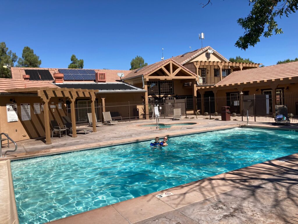
Our initial plan for Zion was to boondock on some BLM land near the park. However, when I went out to scout some spots in the Hurricane Cliffs region west of Zion, I found the roads to be essentially impassable with our rig, and the spots we would have been able to get to were full. So we quickly changed our plans and managed to snag a spot at the Zion River Resort, which turned out to be super nice. Like, they had a super clean hot tub and pool kinda nice.
The pool was an especially nice perk because it was hot! The high elevation and cool weather at Great Basin National Park had convinced us that it was Fall time, but a few thousand feet lower, and in the direct southern Utah sun it still felt like summer.
Surprise!
For our first trek into Zion I had researched a few hiking trails, and planned to drive us up the Zion Canyon Scenic Drive to do the Zion Narrows Riverside Walk. Well, we stopped into the visitor center to get a map and a Junior Ranger activity book and found two things:
Zion was BUSY! The bookstore at the visitor center was open, and quite full, and there were a ton of people in line at the ranger tent. The second surprise may have partially responsible for the business at the visitor center…
Turns out that during the summer months, Zion Canyon Scenic drive is closed to public traffic. The only way up the canyon is via a shuttle, and the shuttle tickets sell out very quickly. The shuttles were operating, but even if tickets had been available, we probably would not have taken one. I’m sure they were operating with practical safety precautions, but riding on a shuttle bus with a bunch of strangers just didn’t sound like a great idea for us right now. So we scratched the Zion Canyon drive off our list for this visit.
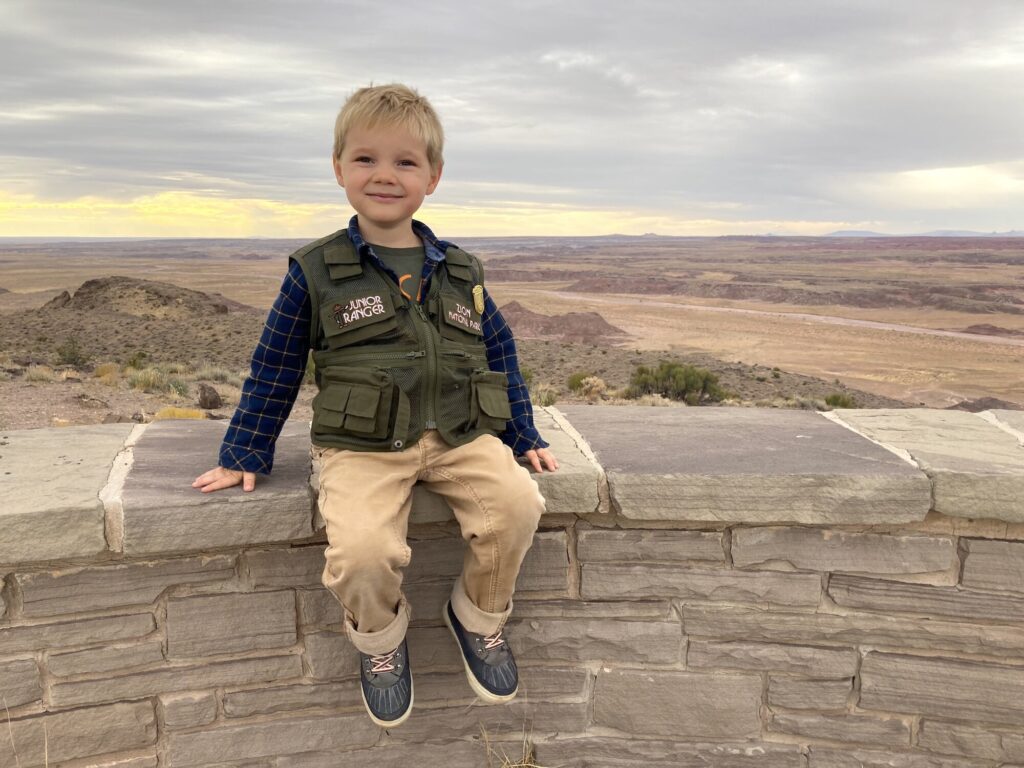
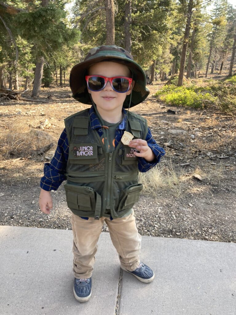
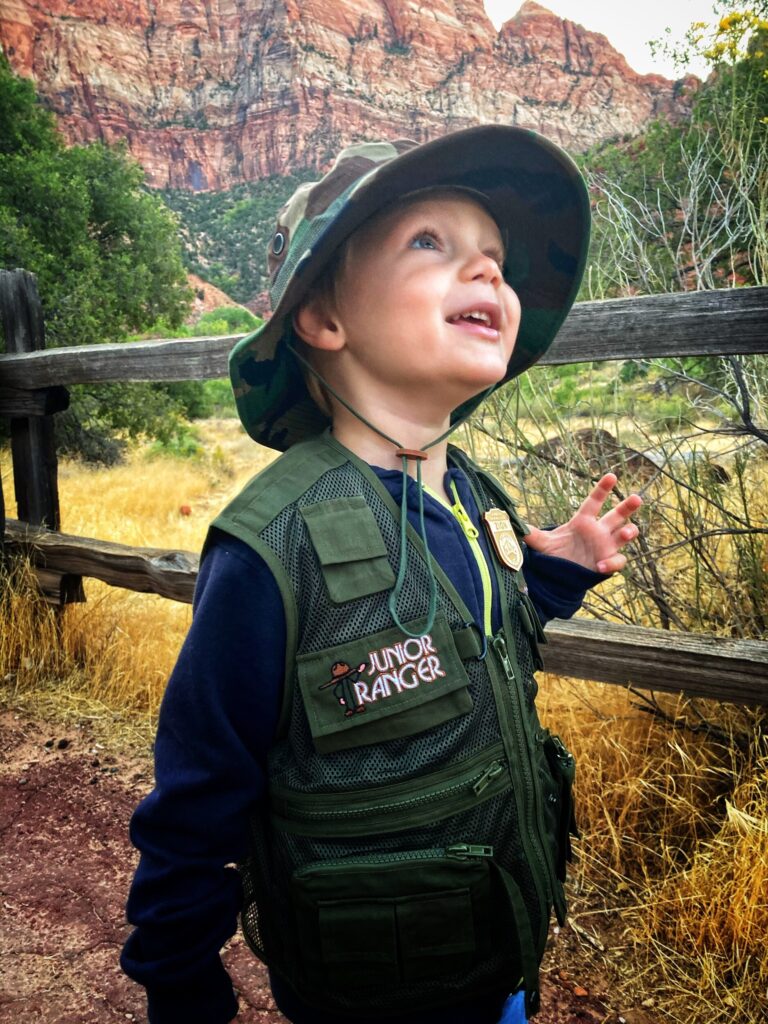
Those surprises aside, we did score a Junior Ranger vest for Owen here, which he absolutely loves. He insists on wearing it anytime we are hiking in a National Park. If you have a budding Junior Ranger that might be interested in this stylish accessory, you can get them at most of the park stores, or shipped to you from the National Parks Online Store.
TIP: If you plan to see and hike some of the more famous Zion attractions, like Angels Landing, be sure to buy your shuttle tickets as early as possible, or visit the park during a time when normal traffic is allowed up the canyon (off-season).
TIP: If you plan to see and hike some of the more famous Zion attractions, like Angels Landing, be sure to buy your shuttle tickets as early as possible, or visit the park during a time when normal traffic is allowed up the canyon (off-season).
Zion – Mt. Carmel Highway
We were able to drive the Zion – Mt. Carmel Highway, which is a different part of the park than the Zion Canyon, through the mile long tunnel, and all the way up to the Checkerboard Mesa. If you take this drive, be aware that the tunnel has size restrictions and you may have to pay for passage if you are in anything bigger than a pickup truck or camper-van. This beautiful drive showcases the unique geology and scenery of the area and offers many trailheads and scenic overlooks. The steep cliffs have multiple rock layers ranging from deep reds to bright whites, most of which is composed of the navajo sandstone for which the region is famous.
Pa’rus Trail
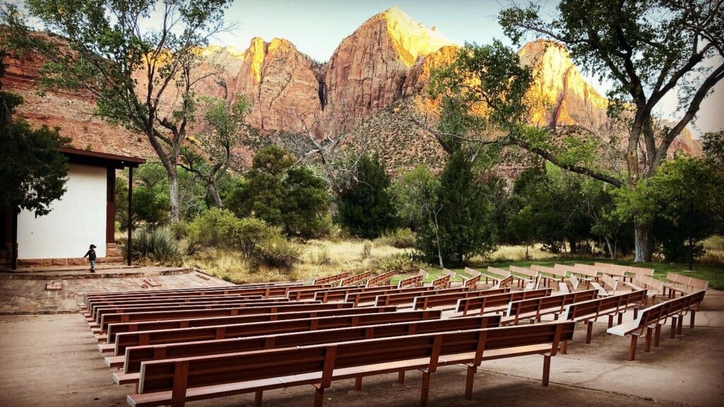
Even though our initial planed hiked was thwarted, we were still able to spend some time on the Pa’rus trail which leaves from the visitor center, heads past the campground and up towards the valley. This is a popular paved trail along the Virgin river with great views of the valley walls. It’s a common path for mountain bikers starting a day trek from the visitor center, so there was a fair amount of traffic, but it was still enjoyable. The highlight was taking a quick detour off the trail to the amphitheater at the nature center. Our Junior Ranger gave us a full on lecture about the area, until he was interrupted by a mule deer that popped out of some bushes right behind the stage. This was a great trail for kids, with plenty of spectacular scenery for the adults.
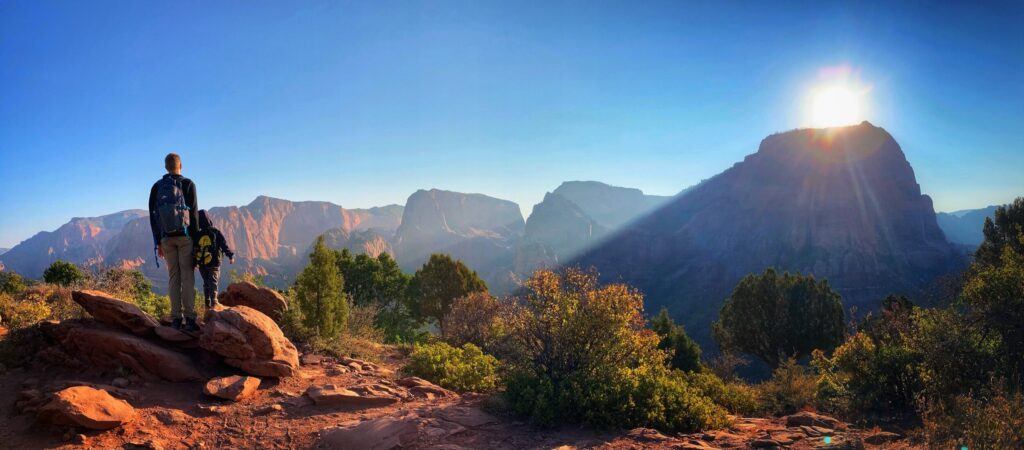
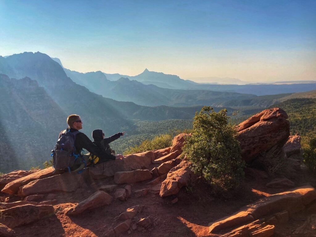
Kolob Canyons
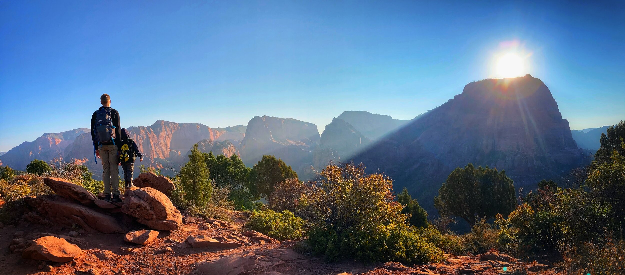
Based on a tip from some friends, we also took a day to explore the northern side of the park known as Kolob Canyons. What a great tip that turned out to be! There is a separate entrance to this this area, and no roads through the park connect the main Zion entrance to Kolob Canyons (though there are some lengthy hiking trails). Kolob is far less trafficked and we only encountered a few other hikers along the Timber Creek Overlook Trail. It offers similarly epic red-walled canyon views, without having to battle traffic or shuttles. The hiking app Alltrails rates the Timber Creek hike as “moderate” due to some rocky areas and the elevation change, but we had no trouble hiking this 1.1 mile out and back with Owen.
Tip: A morning hike in the Kolob Canyons area will keep you cooler in the warm months, but afternoon sunshine offers more light to enjoy the natural beauty of this area.
Tip: A morning hike in the Kolob Canyons area will keep you cooler in the warm months, but afternoon sunshine offers more light to enjoy the natural beauty of this area.
Even though we got a few surprises at this National Park, we still greatly enjoyed our time here. As with many others, this goes on the list of destinations that we would like to return to in the future to experience further. We’ll probably be surprised by something different next time, but that’s kind of all part of the travel and adventure experience!
Gallery
One of the more well known and popular National Parks, Zion is known for its red-walled canyons combined with lush green plant life. We got a few surprises at this park, and we also found some hidden gems.
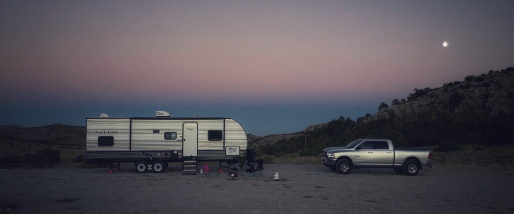
After we left Olympic National Park, our original travel plans had us going up to North Cascades National Park, and then heading down the West Coast through Oregon and California. Unfortunately, this year was an especially bad wildfire season in those areas, so we decided to make some changes. Instead, we made our way back to the East through Idaho and then down to Nevada to visit Great Basin National Park.
To paraphrase one of our National Park travel guides, “Great basin is pretty far from everything, and not on the way to anything.” We found this description to be accurate. That said, Great Basin is kind of a hidden gem. It’s remote location means that attendance is much lighter than other parks, and it offers some beautiful and truly unique scenery and experiences.
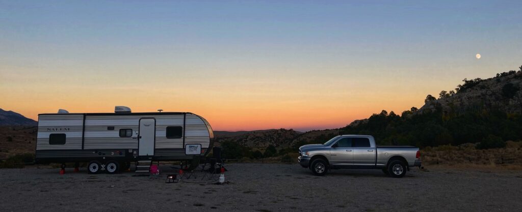
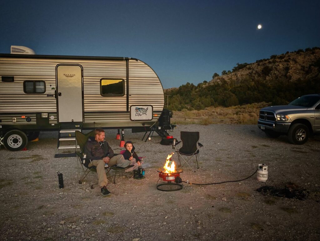
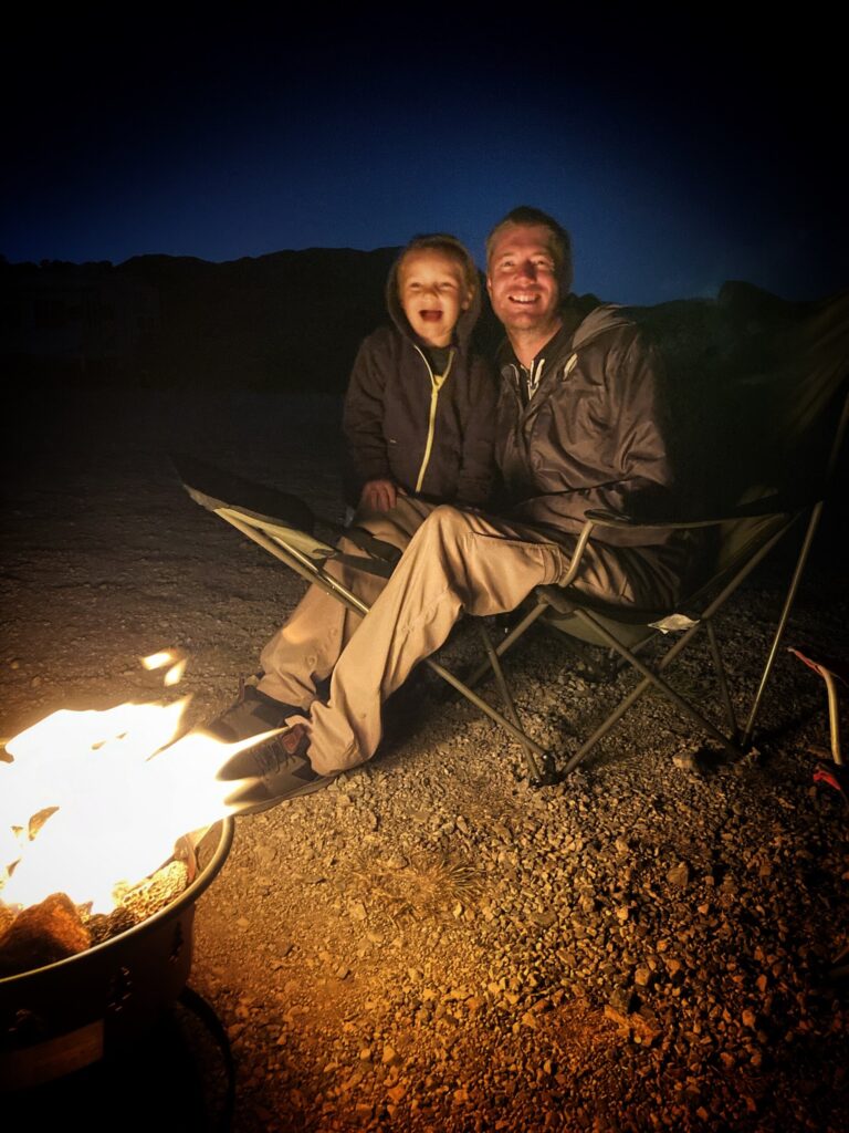
We were able to find an awesome (and free) BLM campground just a few miles down the road from the main entrance. If you are willing and able to dry camp (no hookups) for a day or two, definitely check out this spot for your visit to Great Basin.
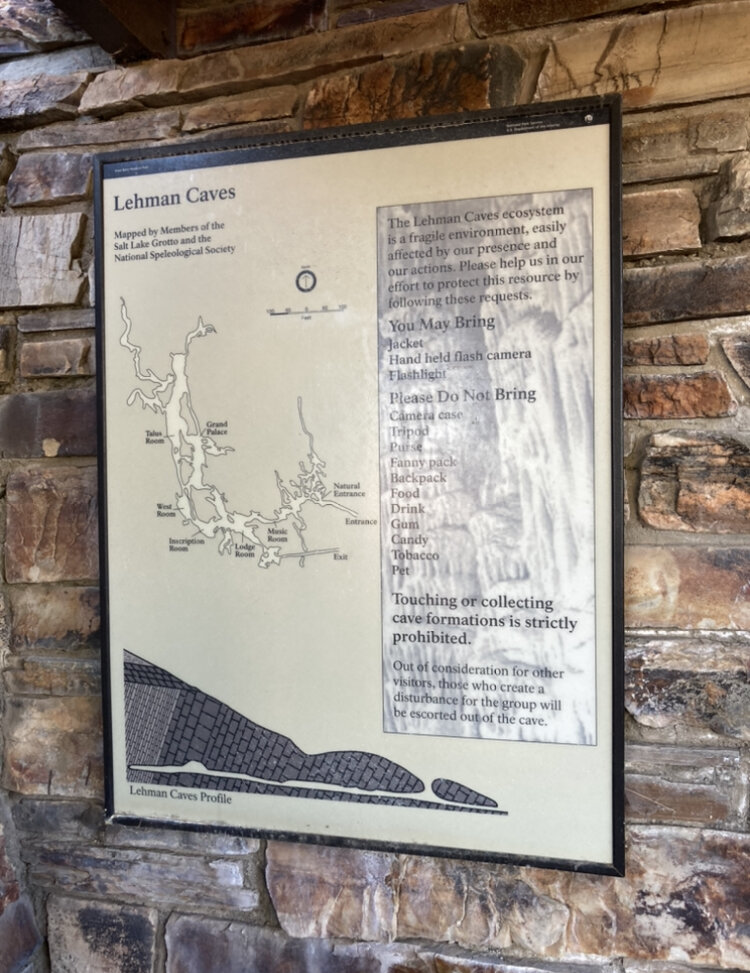
Lehman Caves Visitor Center
Not surprisingly, the cave system was closed due to Covid-19, but there is a nice, short nature trail that circles the visitor center that we completed. The trail offers signage describing some of the plant and animal life, as well as the mountain ranges and deserts in the area. In non-covid times, it would be fun to return here to explore the caves or grab lunch at the cafe in the visitor center.
One unique attribute about Great Basin is that it’s essentially a closed loop water system, meaning none of the precipitation that falls here flows to an ocean. It is all captured in local lakes, evaporates, or is absorbed through the ground into the water table. This contributes to a unique “mountain island” ecosystem where some of the plants and animals here exist only in this region.
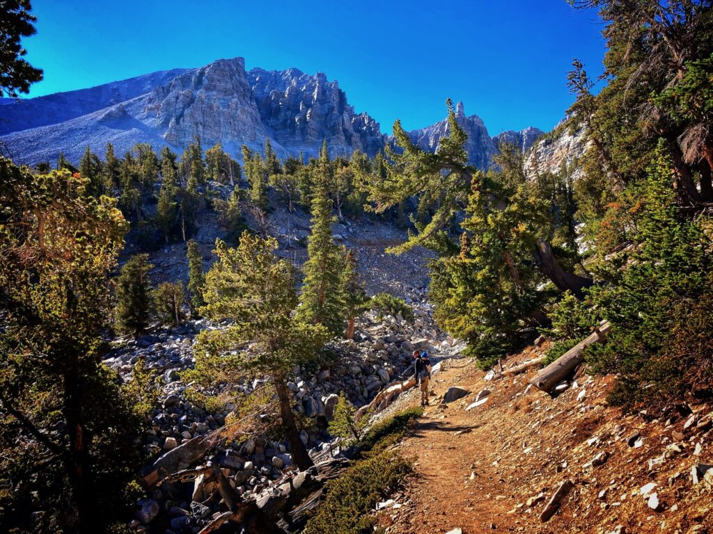
Wheeler Peak
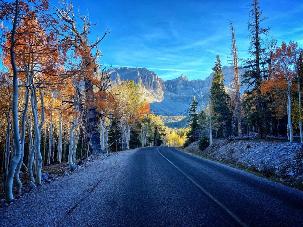
The highlight of our visit was the drive up to Wheeler Peak to the Sky Islands Forest Trail and Bristlecone Pine Glacier Trail. We made two trips up the mountain, completing the Sky Islands hike in the evening the first day, and the Bristlecone Pine trail in the morning on the following day. We were pleasantly surprised to catch the Aspen trees in the forest transitioning to bright oranges and yellows for Fall time. Additionally, this scenic drive offers views of the Nevada desert from a unique high elevation vantage point.
Sky Islands Forest Trail
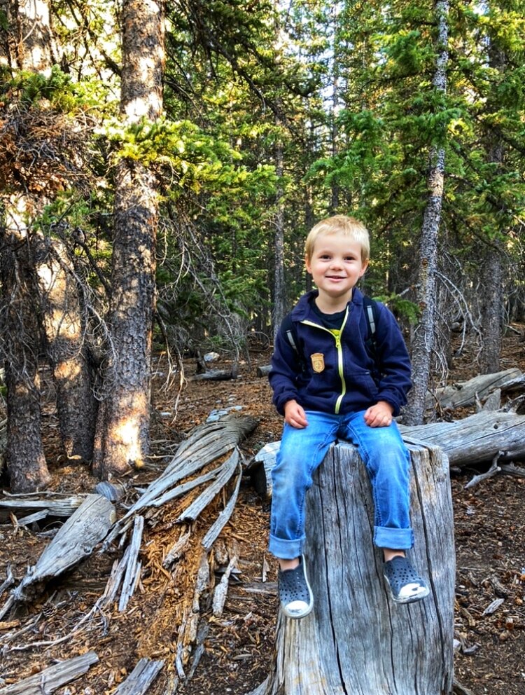
The Sky Islands Trail, is a short loop trail that is mostly boardwalk and flat gravel. It was a perfect trail for a mild evening stroll for our whole family. Owen had no problem completing it and enjoyed being our group’s hiking leader. This trail highlights the alpine ecosystem, complete with glacier fed streams.
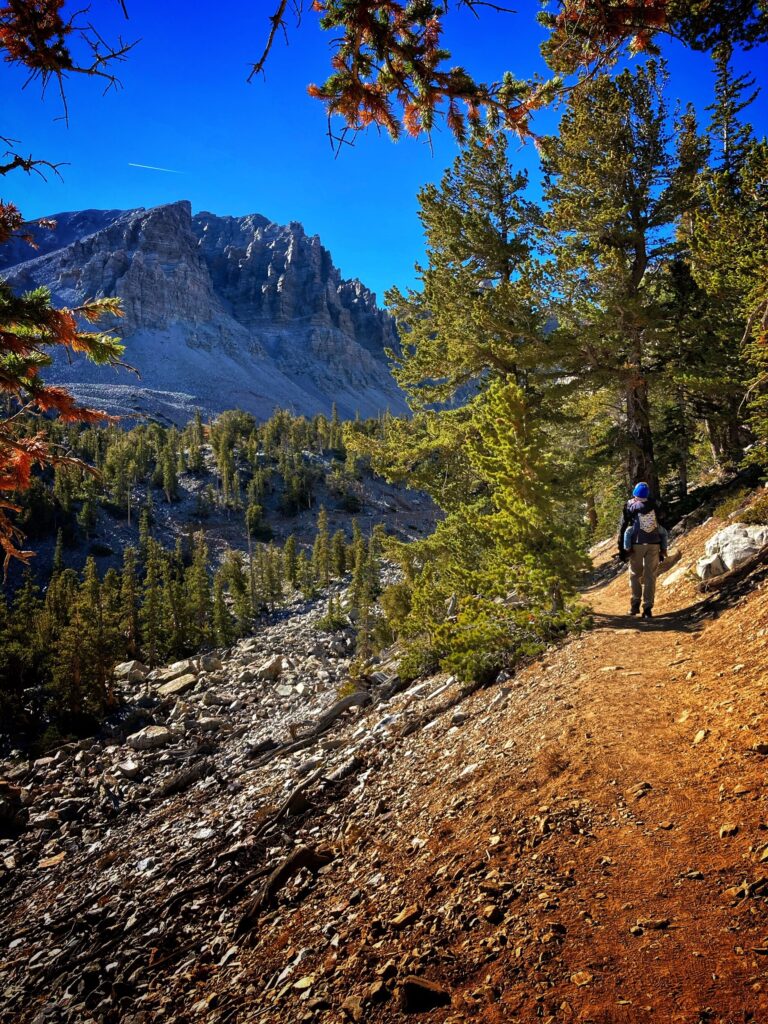
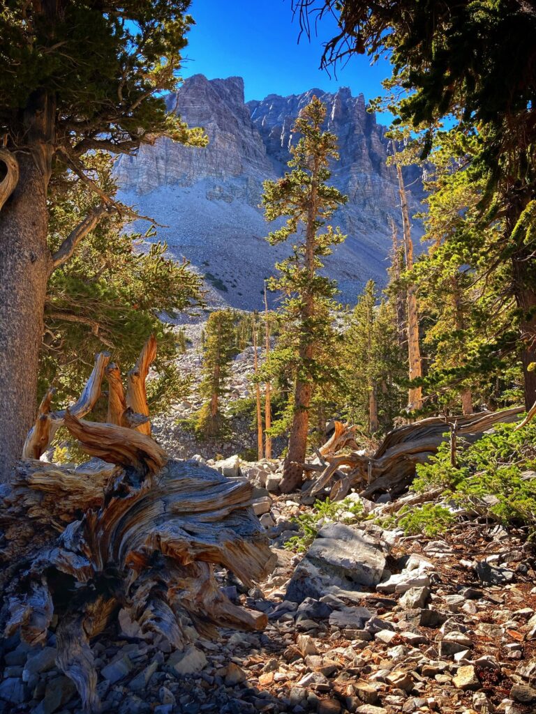
Bristlecone Pine Trail
We hiked the Bristlecone Pine Glacier trail the next morning. The trail goes through a Bristlecone Pine grove, and then continues on to the foot of a glacier. We opted to turn around at the Bristlecone Grove as that was about 3.5 miles round trip with a 600-700 foot elevation gain.
This was probably the most challenging hike we have completed with Owen to date, and while he did spend a little time in our kid carrier on my back, he surprised both Kristy and I by hiking about 70% of this on his own.
The trail includes some steep parts, and a few exposed sections that require attention with a toddler, but it was super enjoyable.
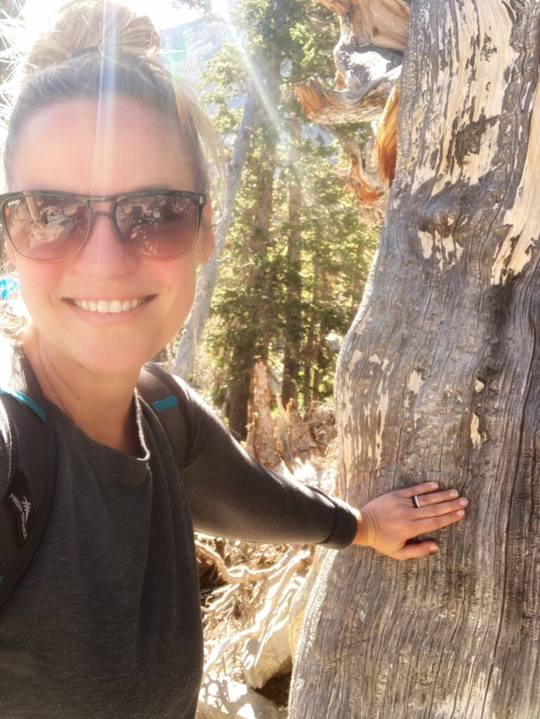
The destination of the Bristlecone Pine grove was rewarding as well. As it turns out, Bristlecone pines are one of, if not the oldest living things on Earth. Apparently, the oldest living thing title is contested by the creosote bush, and scientists have not yet come to consensus on who deserves this designation.
Some of the trees here, which you can walk right up to are nearly 4,000 years old. The oldest known Bristlecone tree has been dated to be over 5,000 years old. Standing in front of a 4,000 year old living thing, and thinking about everything that has happened in the span of its lifetime, is a humbling experience.
Perhaps we had low expectations going into Great Basin, but this park ranked as one of our favorites so far. Due to its location you will probably never be in the area by chance, but if you are looking for a destination where you can avoid the crowds and experience some pristine nature with incredible views, consider making the trek to this National Park. If you’re not convinced, here is a time-lapse of some of the more scenic views of the drive up to Wheeler Peak.
Great Basin Gallery
This National Park is one of the most remote places we have visited so far. The trek through the Nevada desert rewarded us with surprising Fall colors, and gnarly 4,000 year old trees. This isn’t a park you experience on your way to something else, but if you choose to plan a visit here, we’re certain you will enjoy it.
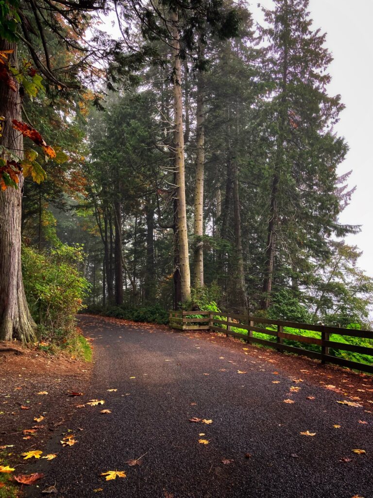
The city of Port Angeles, WA was our basecamp for visiting Olympic National Park. Unfortunately, when we arrived, wildfire season was kicking into high gear on the West coast. While this area was generally lower risk due to it’s humid climate, the smoke rolling in from elsewhere in the country was dense, and the air quality was extremely poor. We decided to limit our time outdoors due to the bad air quality, but we still managed to visit each of the three distinct ecosystems in Olympic: the coast, the rainforest and the alpine mountain region.
Additionally, we experimented a little bit with different camping styles on this leg of our trip. We stayed a few nights in a casino parking lot, and “moochdocked” for the first time. More on this in a bit.
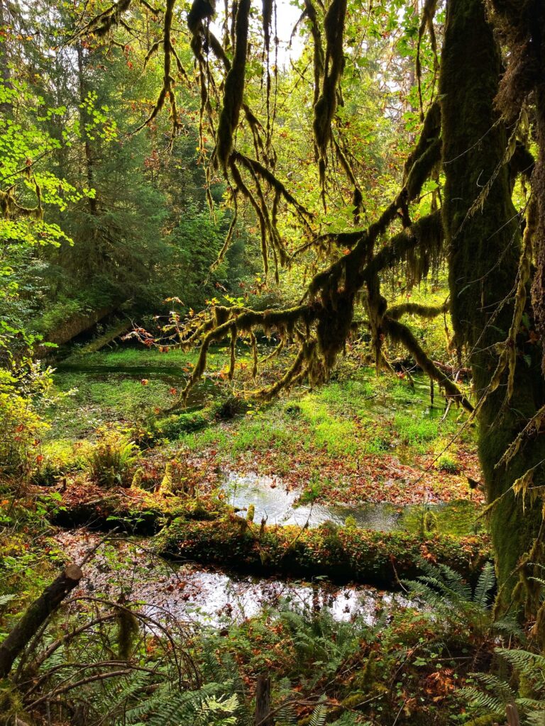
The Hoh Rainforest
So let’s just get this out of the way… both Kristy and I were surprised to learn there was a rainforest here. Really, that there wa a rainforest anywhere in North America. Granted it is a temperate rainforest and not a tropical one, but still.
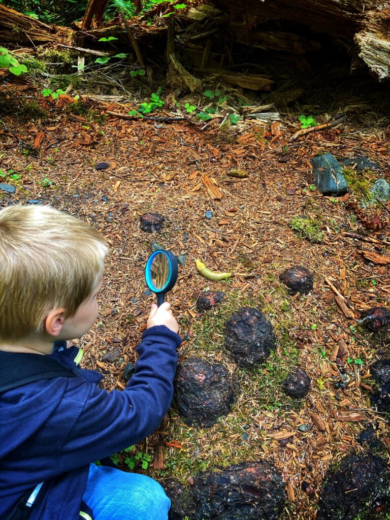
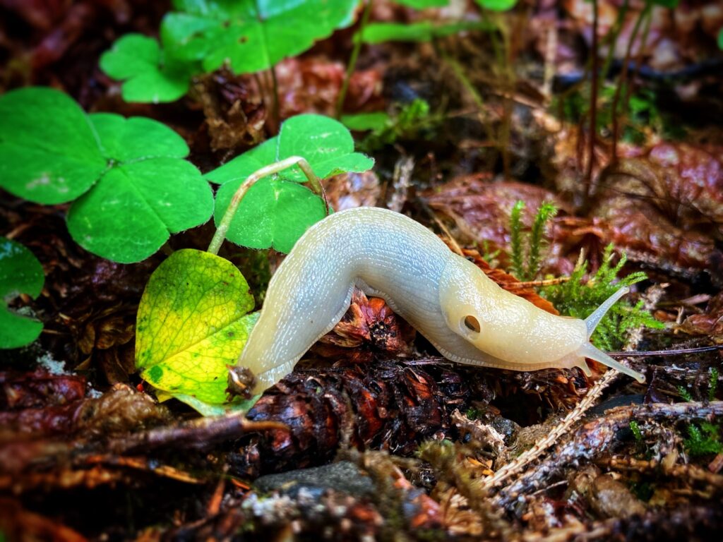
We chose the Hall of Moss trail in the Hoh rainforest, for a relatively quick hike that would give us a taste of this ecosystem. It proved to be a very enjoyable trail that wound through the forest, over streams, and offered up-close views of a variety of plants and animals. All the vegetation here is quite large due to the moisture in the area, giving the forest a prehistoric vibe, The trail was very toddler friendly, and Owen hiked the majority of it on his own.
We were hoping to catch a glimpse of a banana slug, which I had imagined in my mind to look pretty much just like a banana. Nature-spotter Owen was of course the first one of us to find one. As it turns out, they don’t look exactly like a banana, but they are still super big slugs, and really crazy looking.
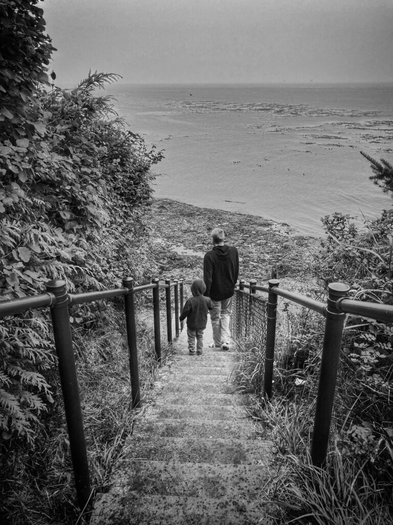
The Coast
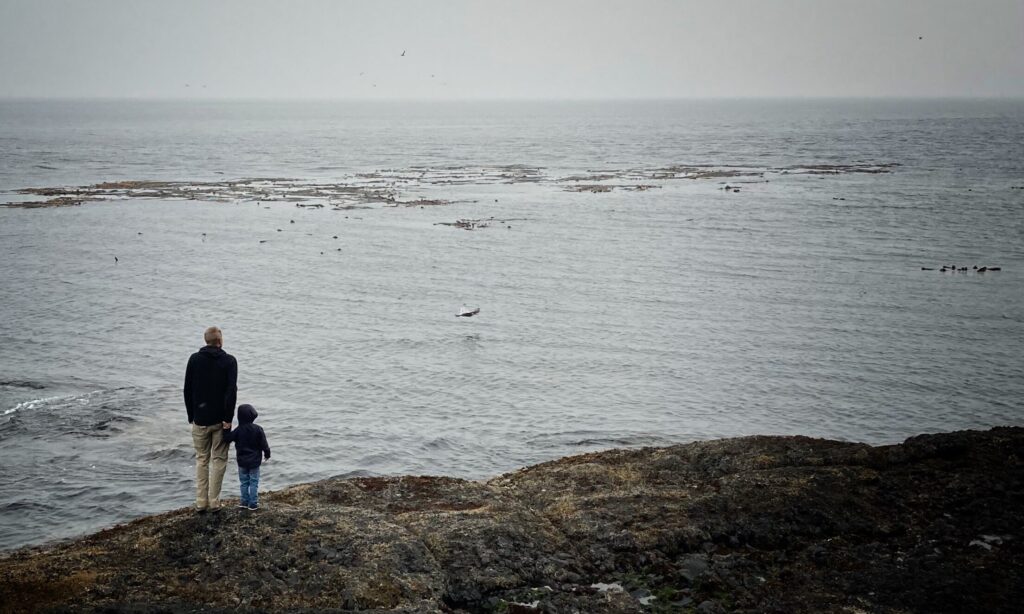
Olympic contains seventy miles of coast along the Pacific ocean, which can be explored in a variety of ways. We made a quick trip out to Rialto Beach and walked along the shore while the large Pacific waves rolled in. The sky was hazy with smoke from the wildfires in the area, but it was beautiful nonetheless. Swimming in the water here is discouraged due to the frequency of large uprooted trees from surrounding areas being washed ashore. I don’t think I would have wanted to swim anyway, as the beach is rocky, and the water chilly. We did however see a couple brave souls out surfing.
This was Owen’s first trip to the ocean, and he had a blast running along the shore and watching the waves come in. One particularly memorable moment was when a large wave caught us a little off guard and Owen and I ended up with sopping wet pants and hiking boots. I think Kristy had a good chuckle at us from her dry vantage point a little higher up the beach.
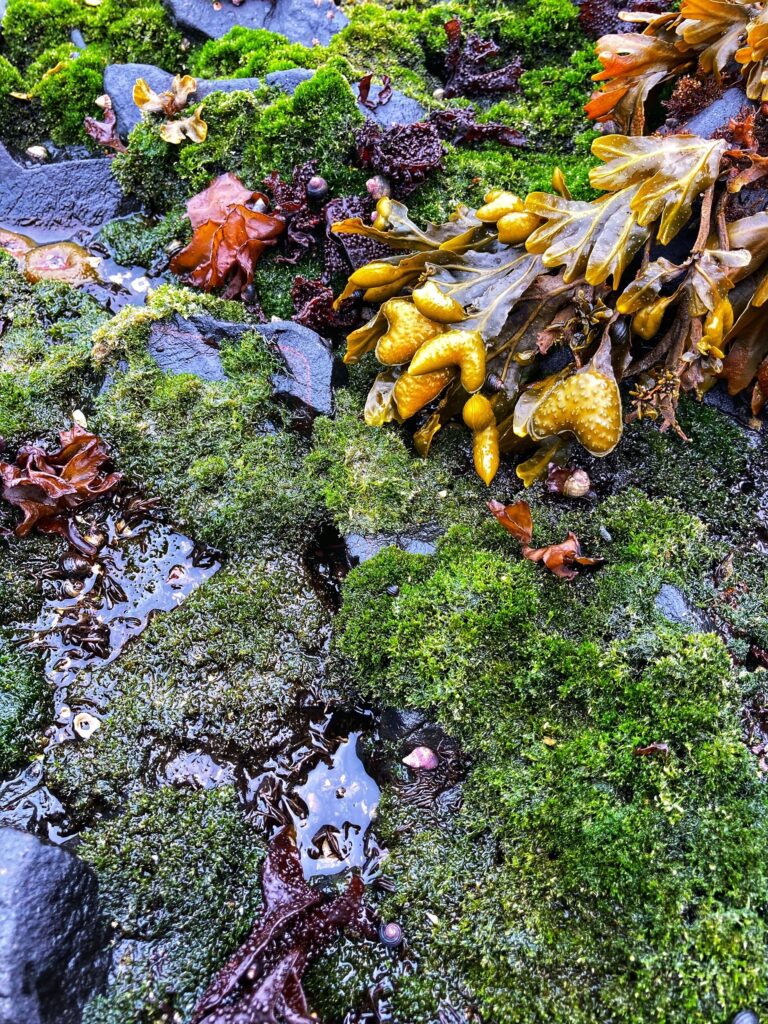
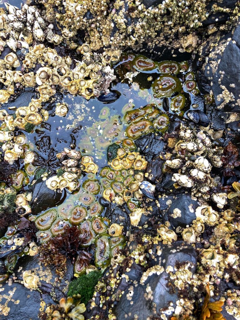
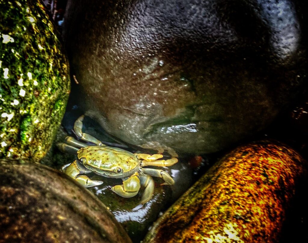
While not technically part of Olympic National Park, we also stopped at the Salt Creek Recreation Area, which is along the coast of the inland bay. This coastal area experiences a big swing from high tide to low tide, and offers a unique opportunity to explore the tide pools during low tide. We hopped around on the slick rocks and saw crabs, mussels, and a variety of plant life.
TIP: Salt Creek Recreation Area is in the vicinity of Olympic. It is free for day use, and is much less busy than some of the popular areas in the National Park. Check the tide charts so that you can time your visit at low tide and explore the tide pools.
TIP: Salt Creek Recreation Area is in the vicinity of Olympic. It is free for day use, and is much less busy than some of the popular areas in the National Park. Check the tide charts so that you can time your visit at low tide and explore the tide pools.
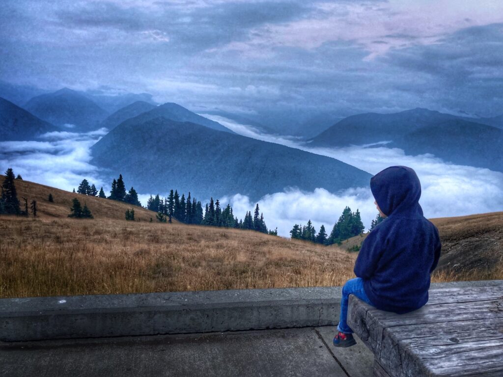
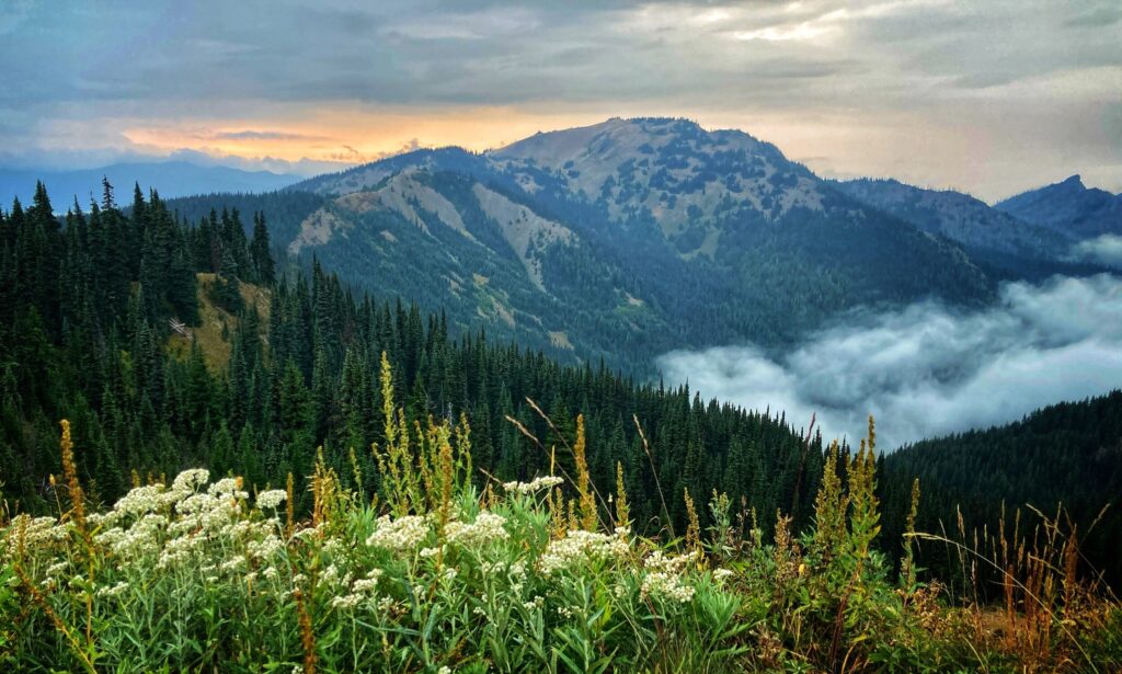
The Mountains
The alpine mountain ecosystem in Olympic might as well be its own park with how different it is from the other two areas. We took an evening drive up to the Hurricane Ridge visitor center to experience this part of Olympic. We found the area pretty much deserted, save for a newlywed couple and their wedding photographer taking a few pictures. It was downright cold coming from sea level up to 5,242 feet, and the damp air due to the proximity to the coast created low clouds that flowed through the valleys.
While we were there, we completed the short, but enjoyable Cirque Rim Nature Trail hike. I’m told that on a clear day you can see to the coast or even to the Canadian border here, but the fog and smoke on the day we visited limited the views. However, those same factors combined to make for a pretty spectacular sunset.
The drive down from Hurricane Ridge proved to be one of the most unanticipated, white-knuckle drives of our trip so far. The fog had rolled in quickly, and in the dark, our visibility was cut down to about 10-20 feet in front of the truck. That, combined with the steep mountain roads without guardrails, led to a very slow drive back down the mountain. We made it safely though, and we’re glad we were able to experience an evening at Hurricane Ridge.
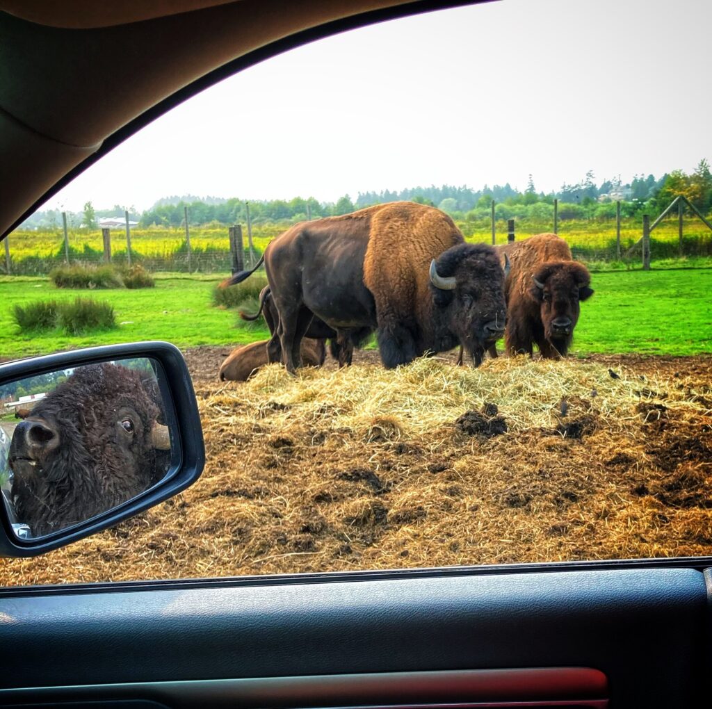
Olympic Game Farm
On the recommendation of one of our friends, we also visited the Olympic Game Farm. We were able to drive through the farm and get an up close look at tons of animals like bison, bears, llamas and elk. The animals here are generally re-homed or rehabilitated, or come from other licensed facilities. Owen thoroughly enjoyed seeing these creatures so close. If you are in the area, this is a fun attraction that is sure to be enjoyable for kids and adults alike.
Casinos and Moochdocking
During this leg of our journey we took the opportunity to try out a few new styles of camping. First, we tried a few nights in a casino parking lot. While this might sound like an odd choice for our family, it worked out quite well. We stayed at the 7 Cedars Hotel and Casino near Sequim. The stay was FREE, and they had about ten spots in the back of the parking lot with water and electric hookups. The catch was you have to sign up for their players club card in the casino, but there is no minimum spend. We did choose to buy one of our meals from the restaurant, and tried our luck at a few slots while we were there…we didn’t win. Aside from the spots not being particularly level, this worked out awesome for us.
We also executed our first “moochdocking” experience with a friend in the Seattle area. For those unfamiliar with the term moochdocking, it is when you stay in a friends driveway or on their property, and if you are lucky they may let you mooch their electricity and water. Special thanks to Angela from Tread Lightly Retire Early and her family for letting us crash with them for a few days.
Angela has an epic garden and Owen enjoyed helping out with the harvest. We all greatly enjoyed the bounty that they graciously let us keep. It was nice to spend a little time with friends and take advantage of some of the Seattle area restaurants and breweries.
Olympic is huge, and has a ton of interesting things to check out. We limited our time outside here due to the terrible air quality from the wildfires, and as a result we would love to return at some point in the future to experience more of the park.
Our original plan after Olympic was to head down the West coast through Oregon and California, but due to the severe fires, we called an audible and decided to head back inland through Idaho to Nevada and Utah. More on that in future posts!
Olympic National Park Gallery
Olympic has three distinct ecosystems that each warrant their own National Park. We were battling smoke and poor air quality from a particularly severe wildfire season, but we were still able to get in a short visit to each area of Olympic.