Author: Ben Hymans

  • Saguaro National Park – Arizona

    Saguaro National Park – Arizona

    Dates we visited: March 22nd – March 26th 2021
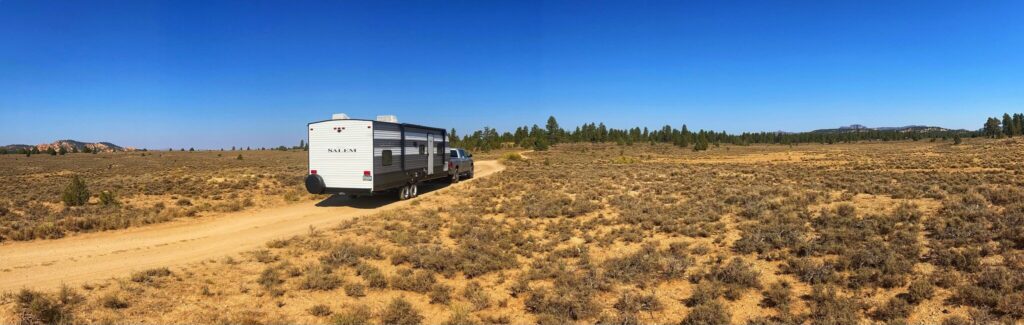
    Where we stayed: Tucson Lazydays KOA

    Saguaro National Park, near Tucson Arizona, was our first stop back out on the road after spending the winter in Phoenix. We made a quick trek up to the Grand Canyon in January, but other than that we were stationary since November 2020. We chose the Tucson Lazydays KOA to get us back in the swing of things. For one thing, it is pretty much right between the Saguaro East and West units, which are on opposite sides of the city from each other. For another, it is a pretty nice resort style KOA with lots of amenities to make our transition back into RV life an easy one.
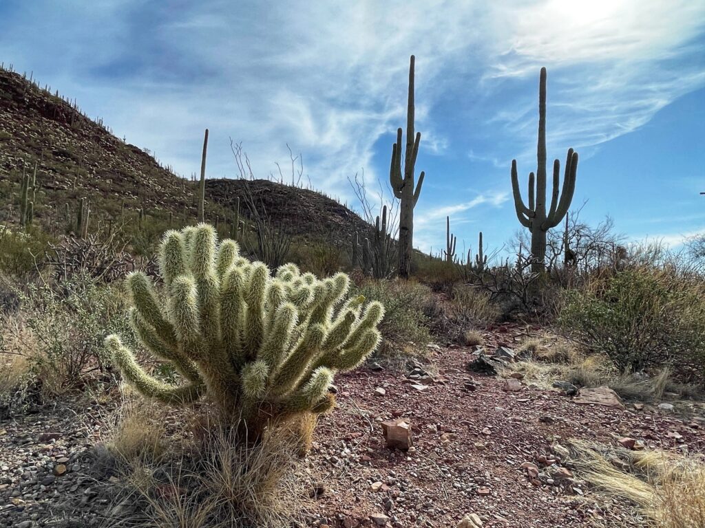
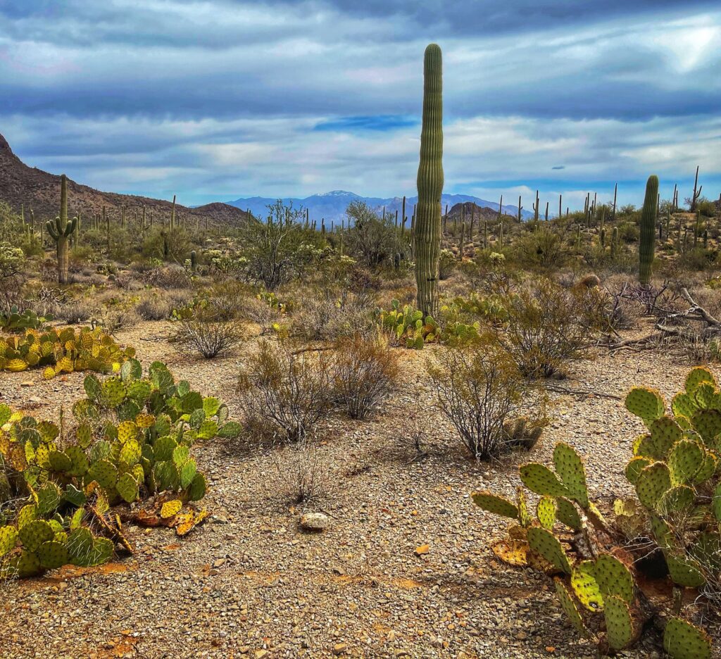
    Cacti

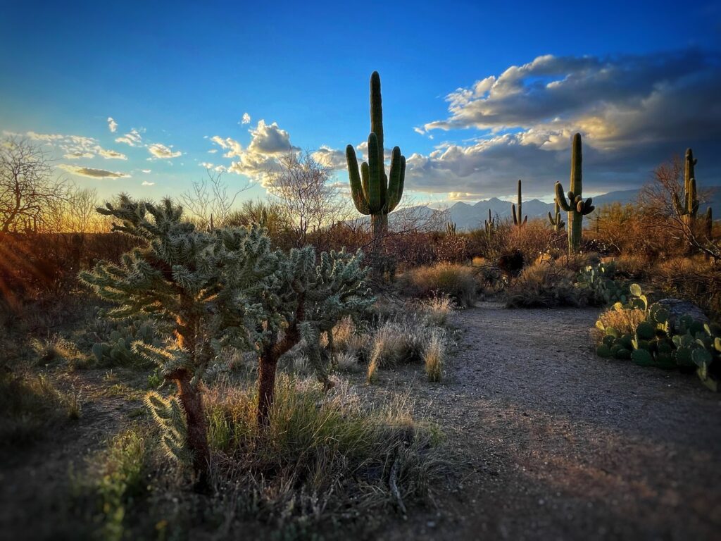
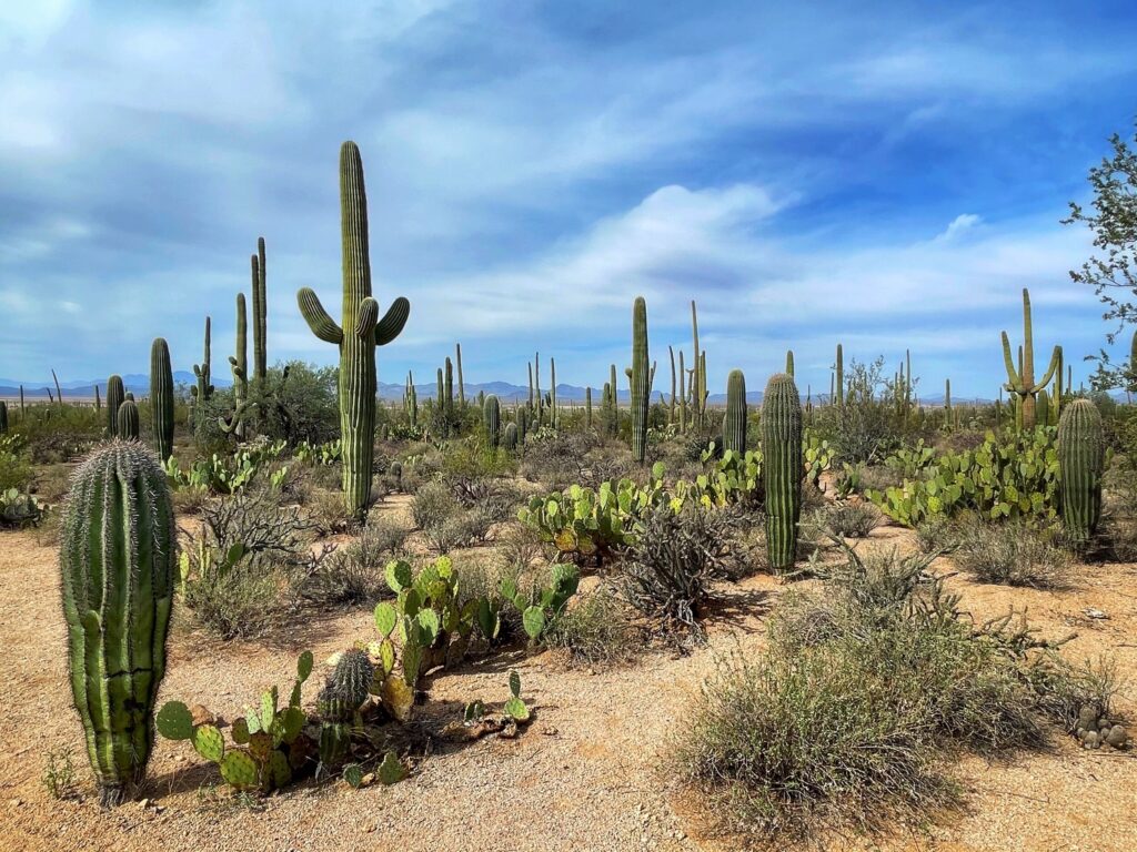
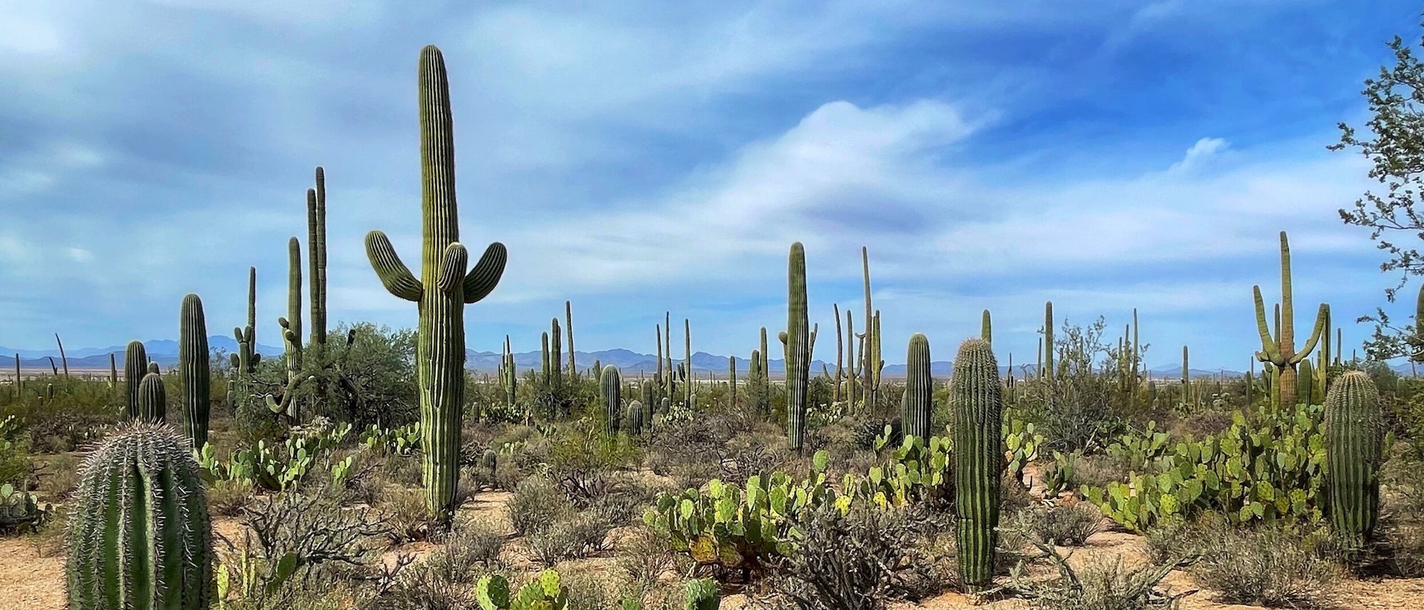
    As you might imagine, this national park is filled with cacti. Saguaro are the main attraction, but prickly pears and cholla abound as well. If you’ve never seen a Saguaro in real life it is quite an experience. The Saguaro is the quintessential image that comes to mind for most Americans when they hear the word cactus. What most people don’t realize about the Saguaro cactus though, is that they are huge and old. They can be as tall as 50 feet, weigh more than a ton and regularly live to be 150 years old. They don’t sprout their iconic “arms” until they are at least 60. It’s crazy to think that many of the Saguaro in this area were here before Arizona became a state (which was in 1912 in case you are wondering).

    East and West

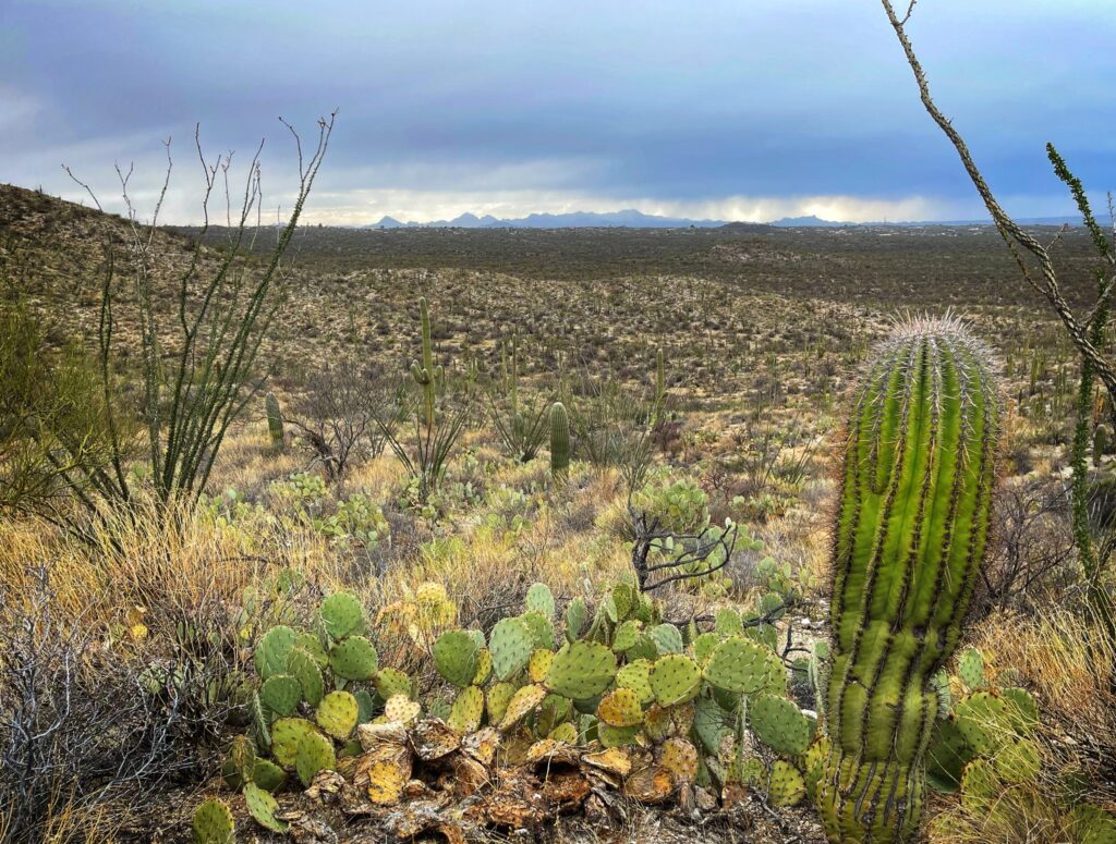
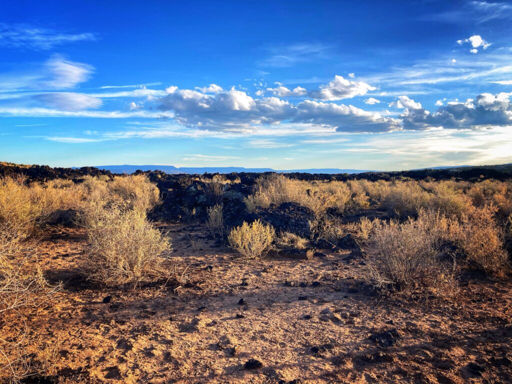
    We went into the park on each of three days while we were here. The first day we explored the East unit, taking the loop drive from Rincon Visitor Center and stopping for a short hike at along the Desert Ecology Trail. The weather was overcast and we were in the shadow of an impending rainstorm, but we enjoyed the trip in nonetheless.

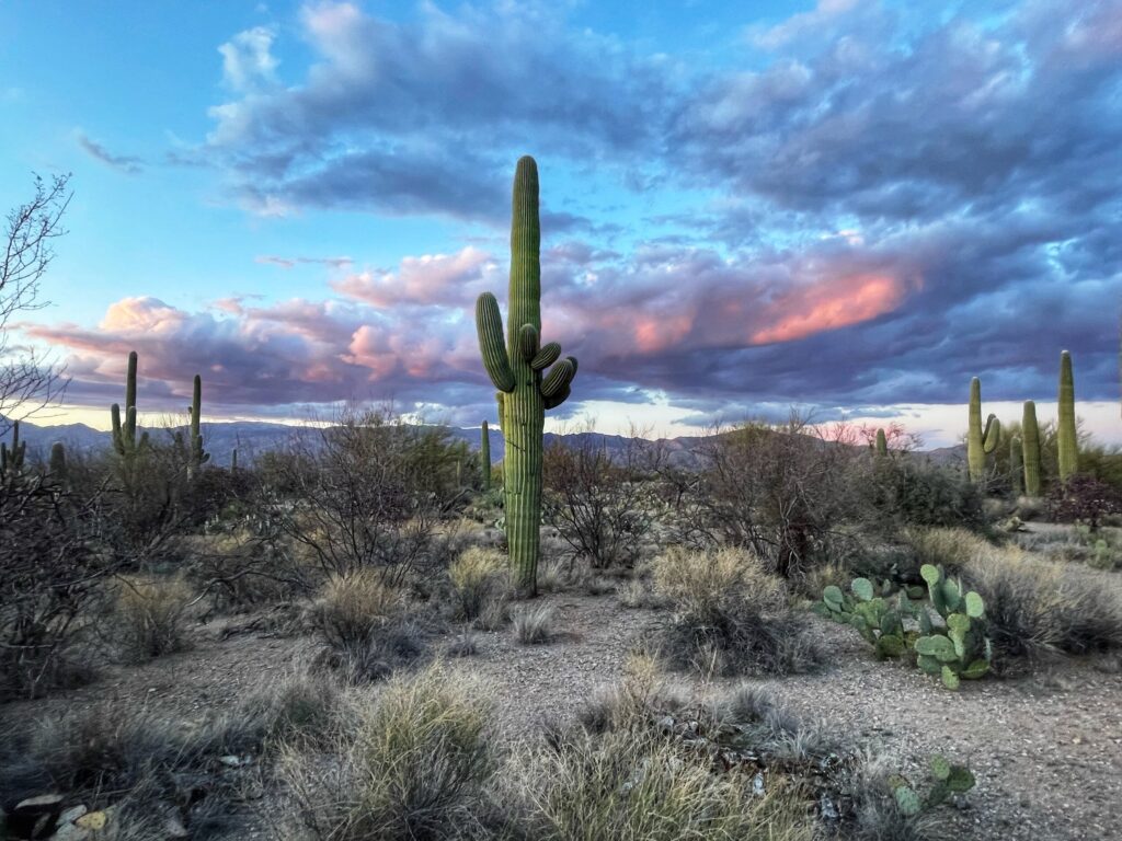
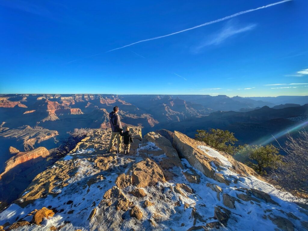
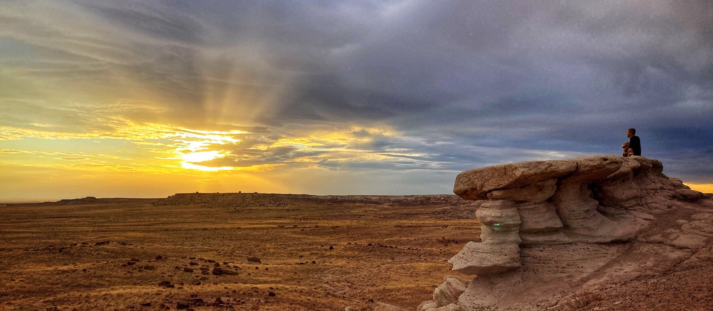
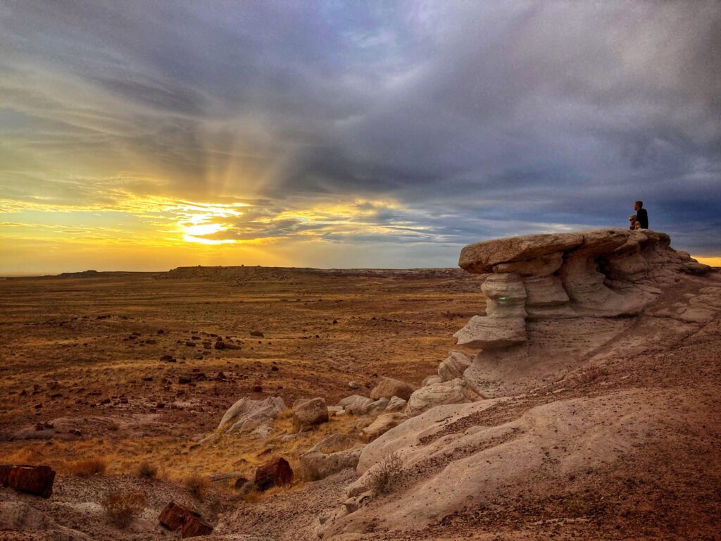
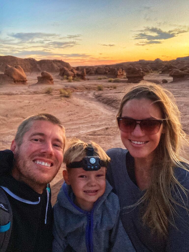
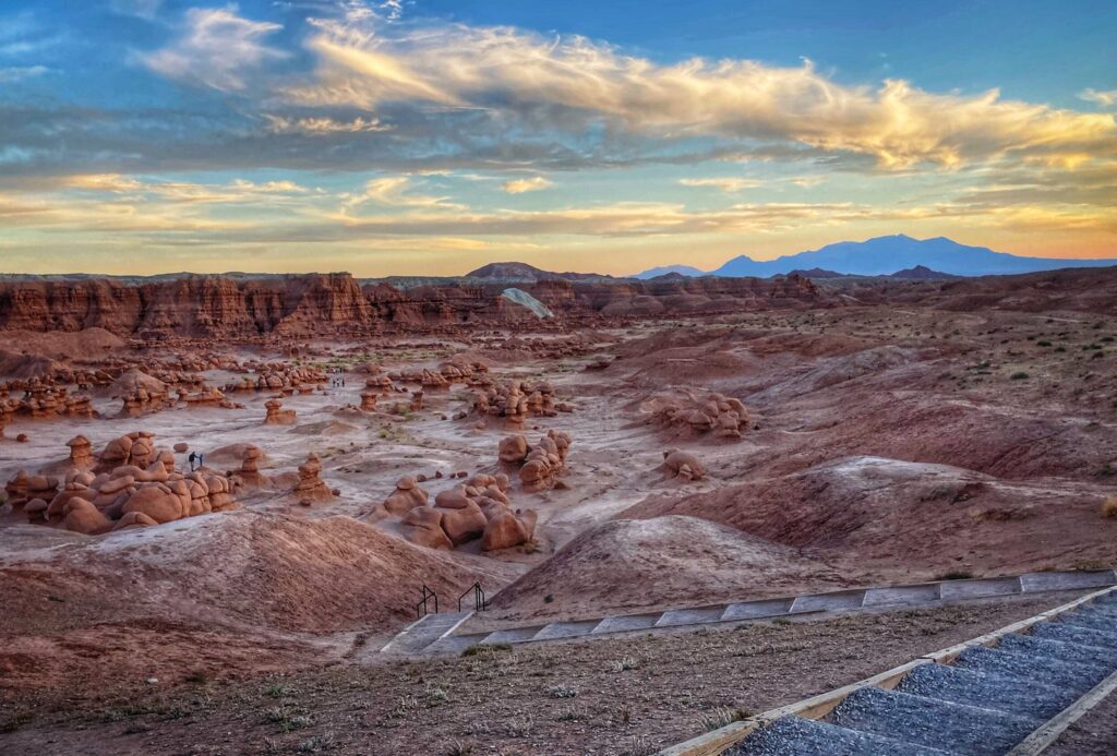
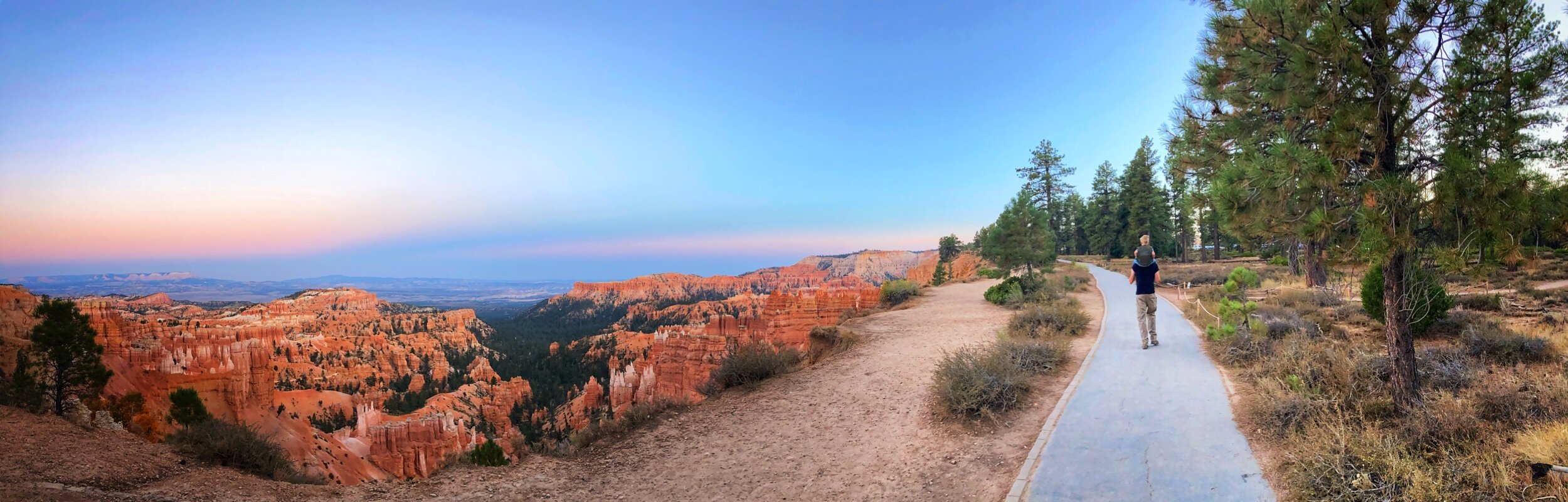
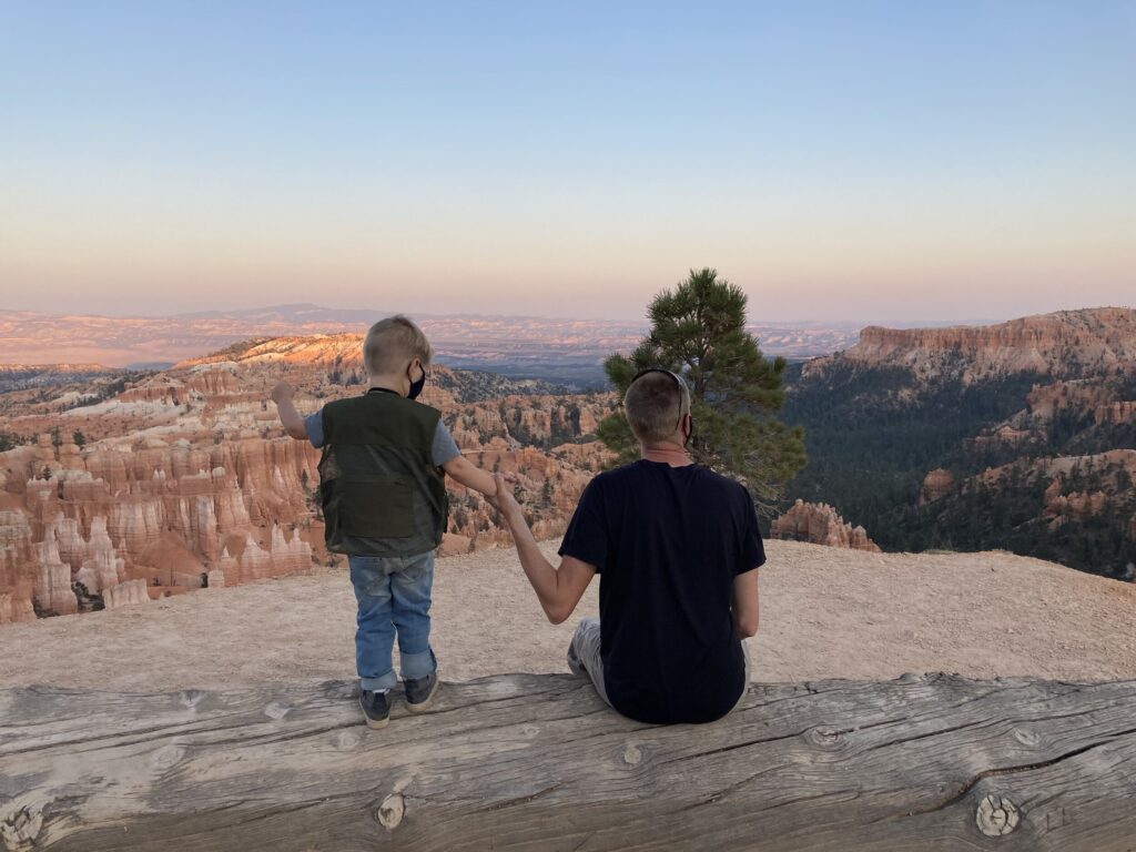
    We returned to the East unit for sunset at the Mica View Picnic Area. We enjoyed an expansive view of the park as the sun set over Tucson.

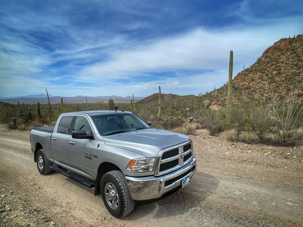
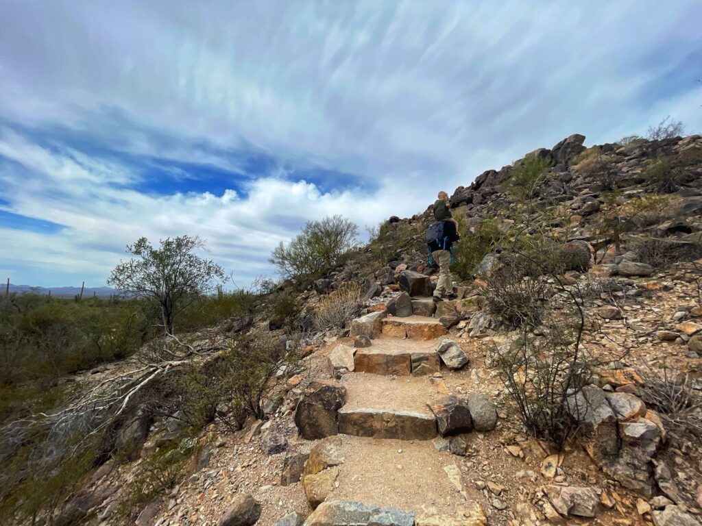
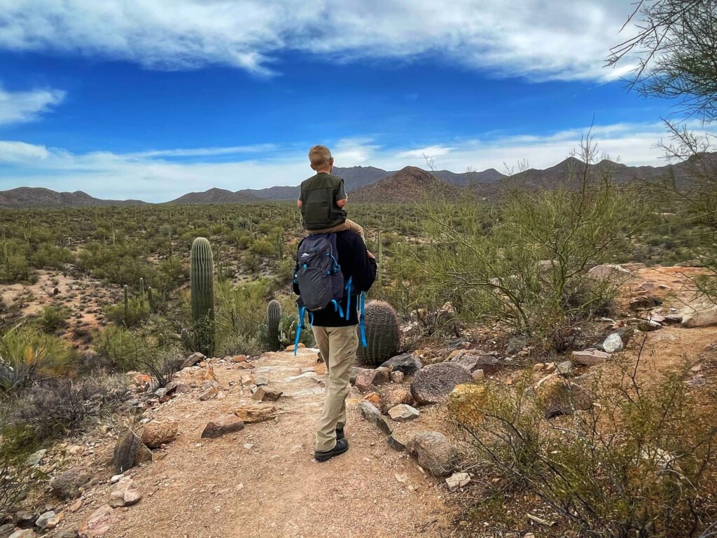
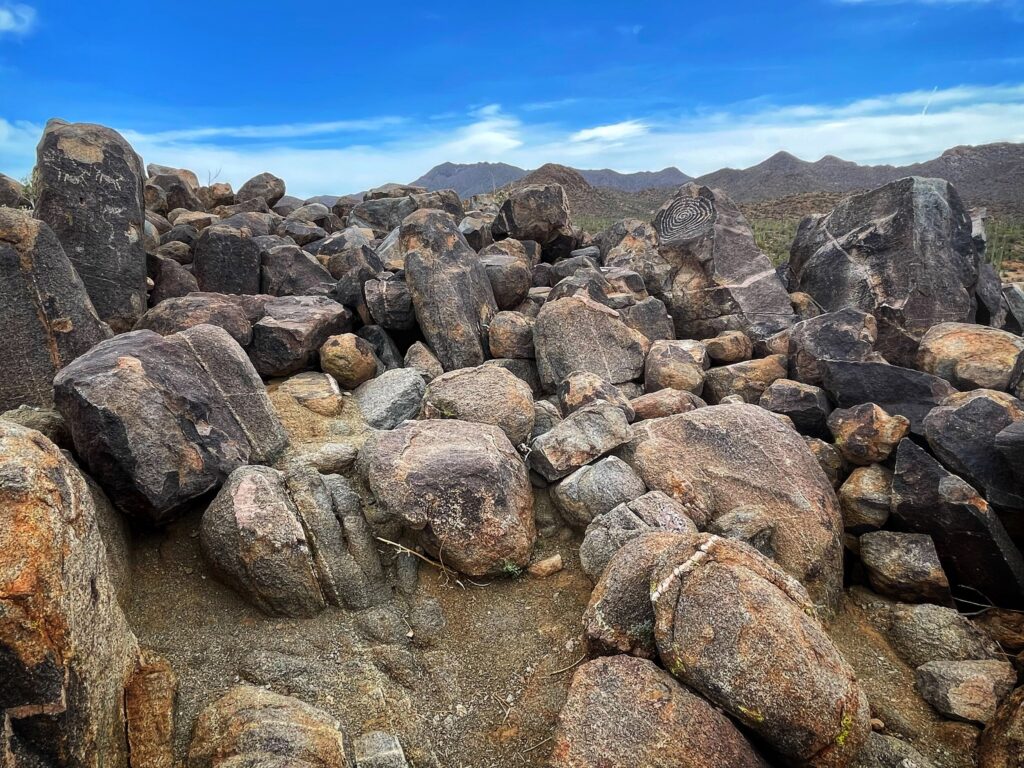
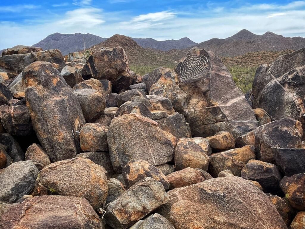
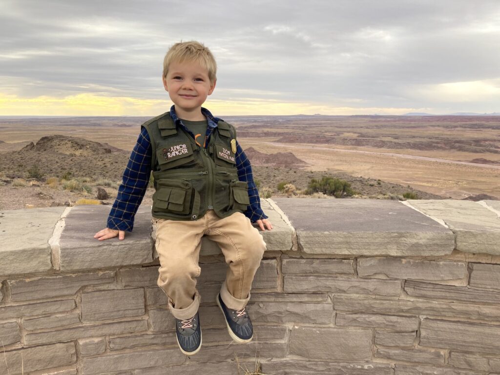
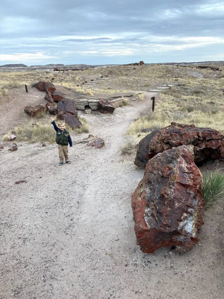
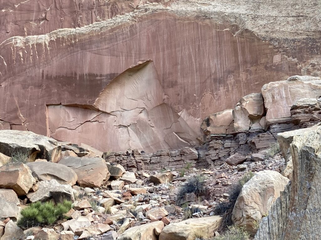
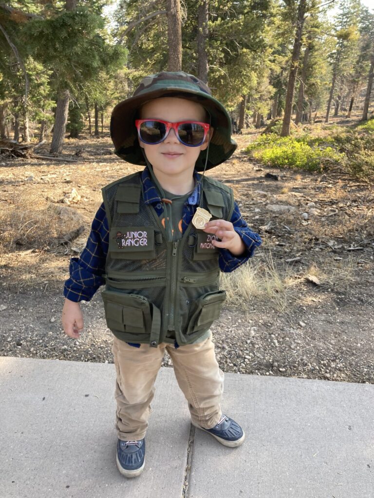
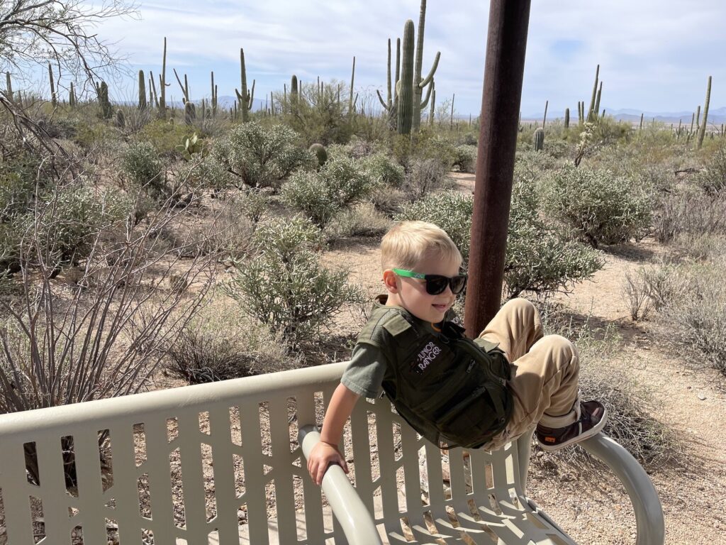
    On the final day we explored the West unit. First, we stopped at the Red Hills Visitor Center so that Owen could pick up a Junior Ranger booklet and score a Junior Ranger badge. Then, we headed out to complete the Desert Discovery Nature Trail, before taking the Hohokam dirt road to Golden Gate road, and on to the Signal Hill Picnic Area. While we were there, we did a short hike up Signal Hill to check out the petroglyphs, which were among the most plentiful and accessible of any we have come across. We finished up our visit by heading north up through the Picture Rocks area and then back to the campground.

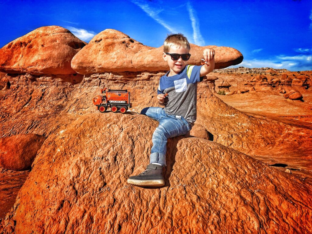
    While both sides of the park had their charms, Kristy and I both enjoyed the west side a bit more. The cacti seemed more dense, and the views more expansive. Owen, in his characteristically enthusiastic manner, said that both sides were “GREAT!”

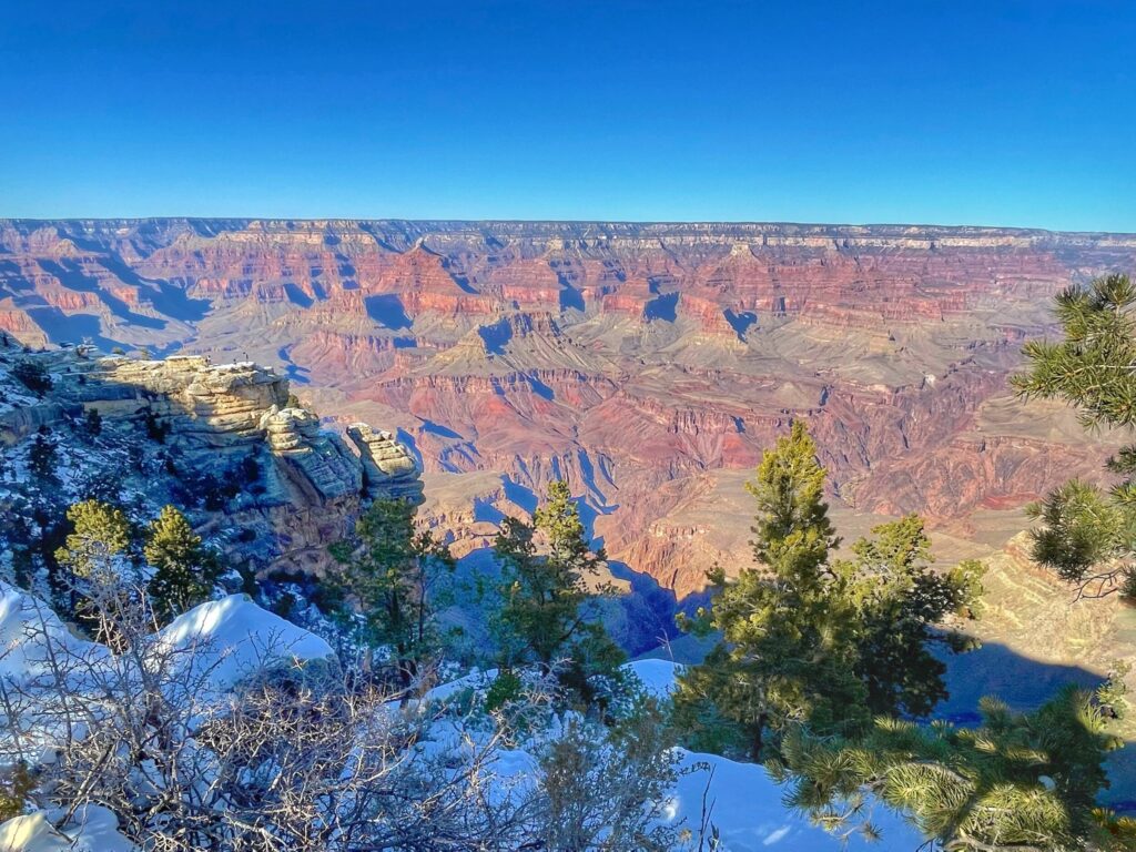
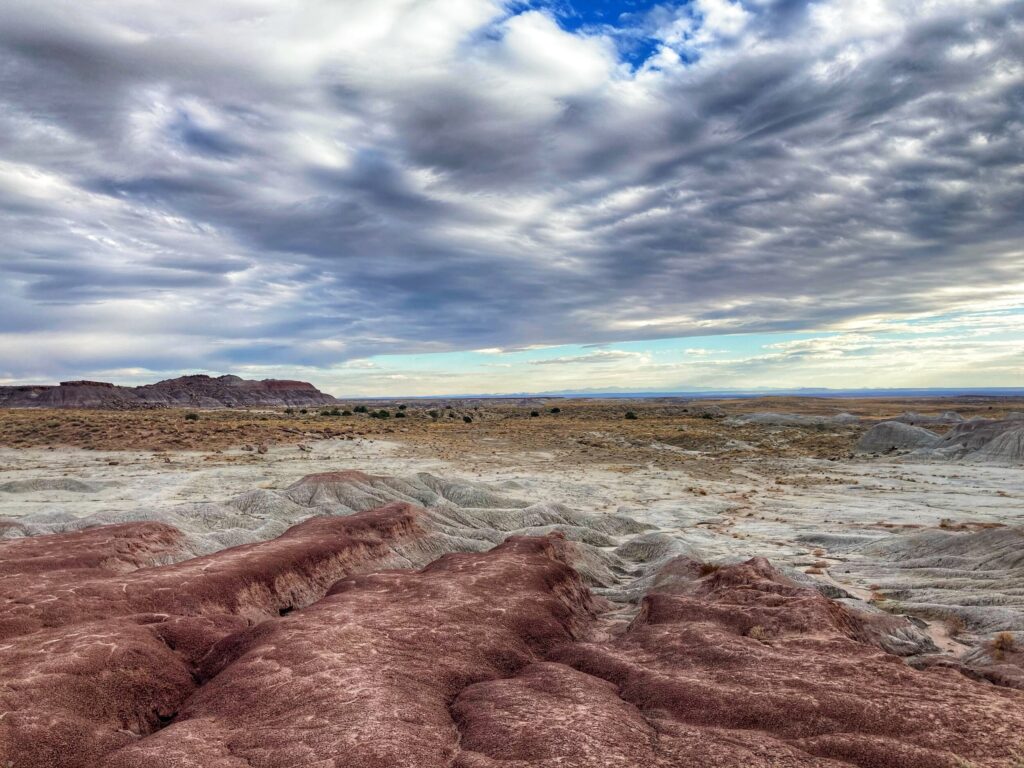
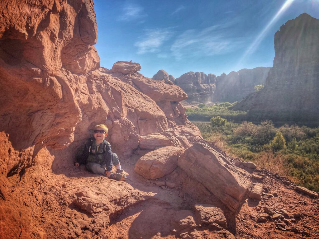
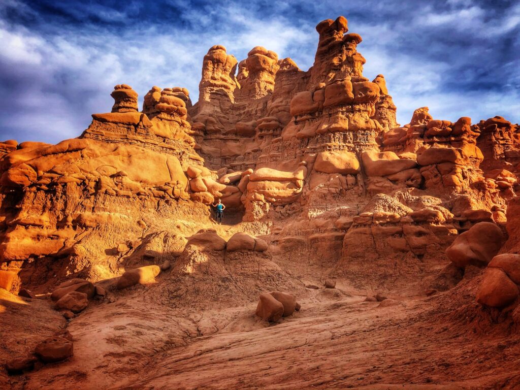
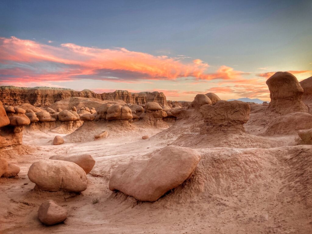
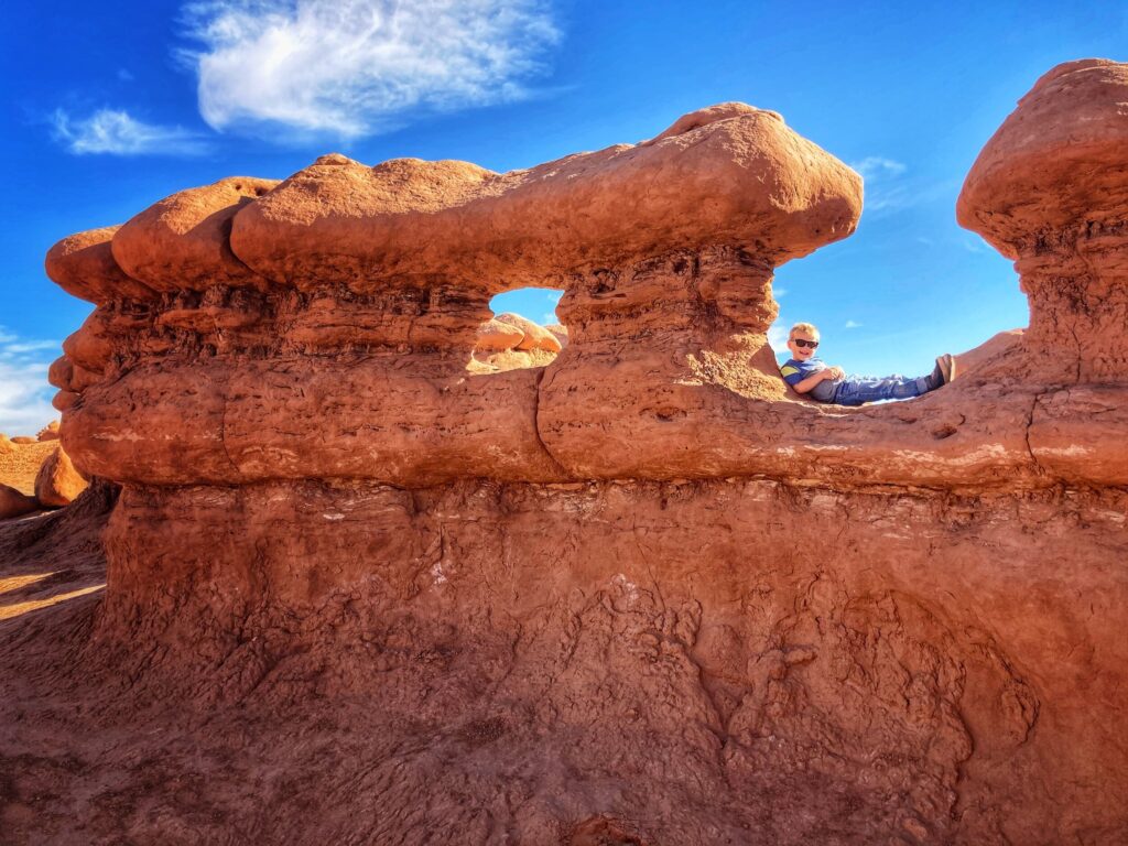
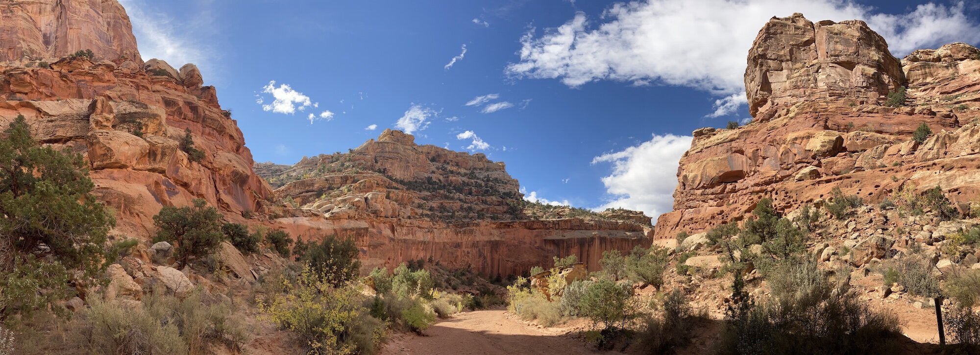
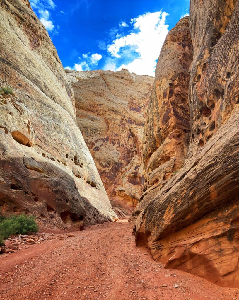
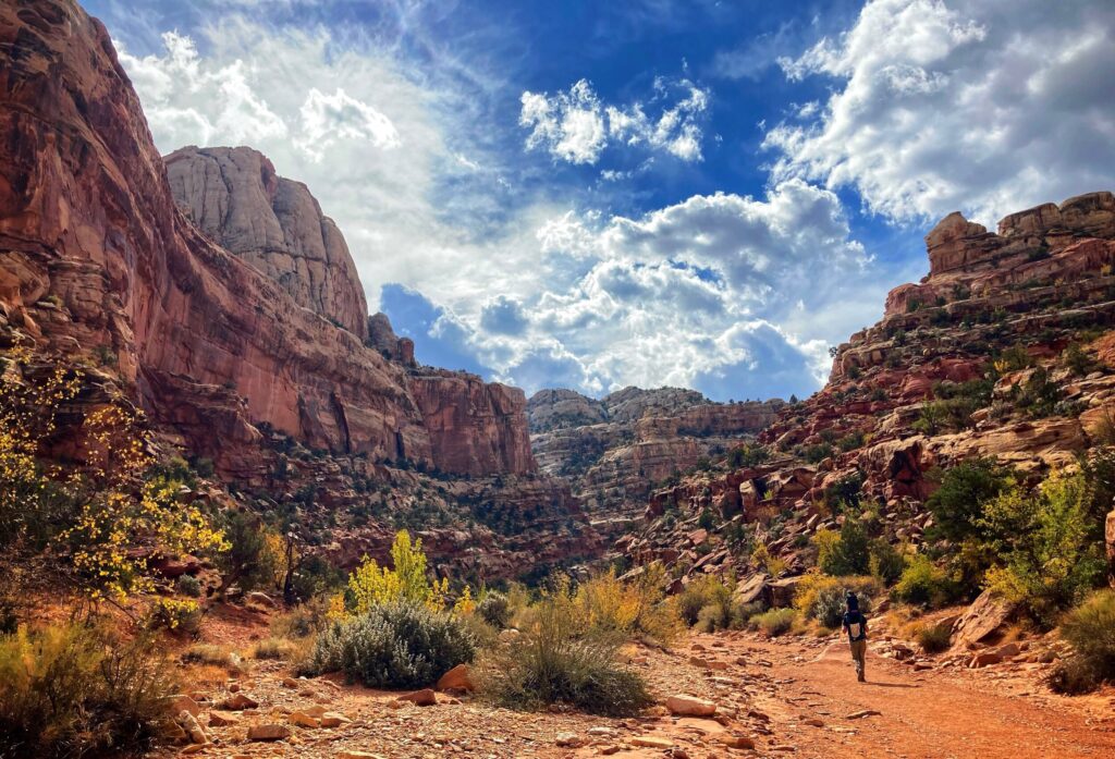
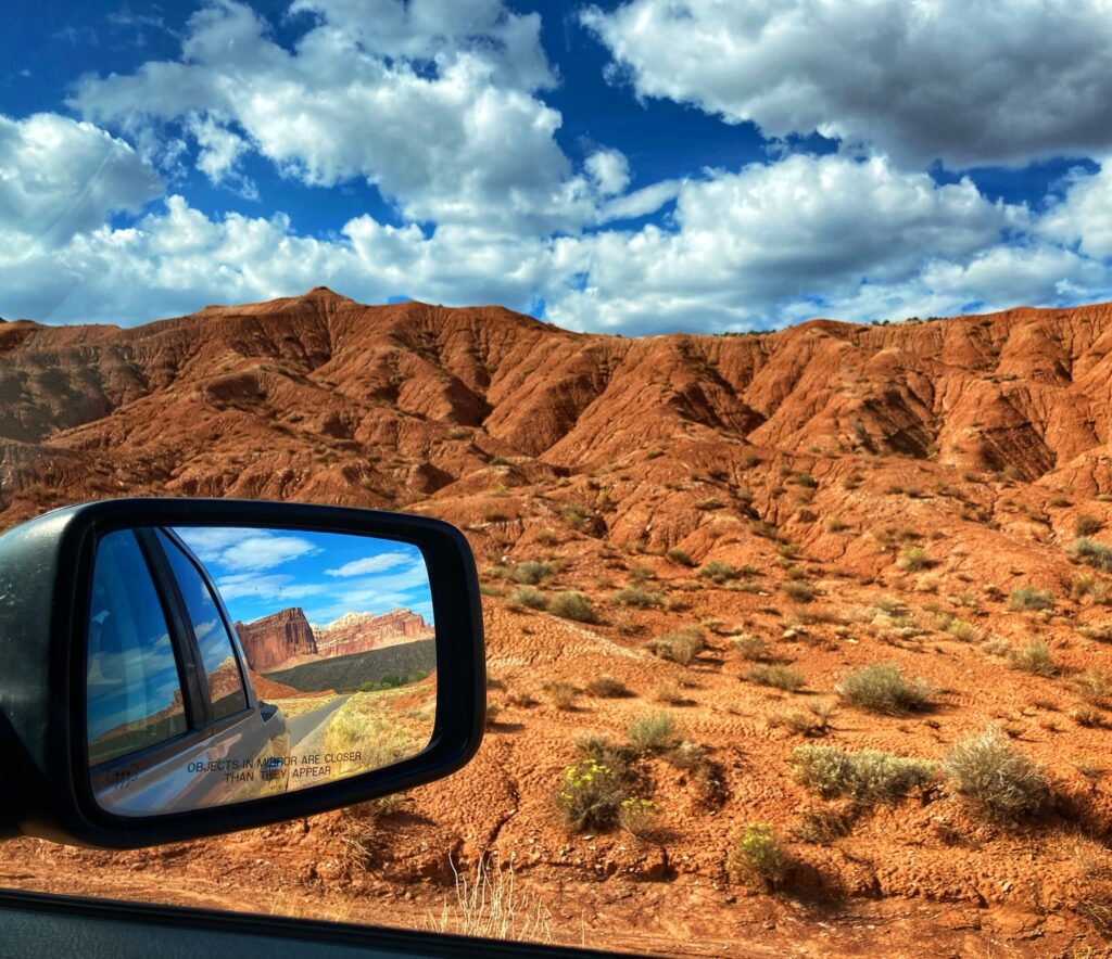
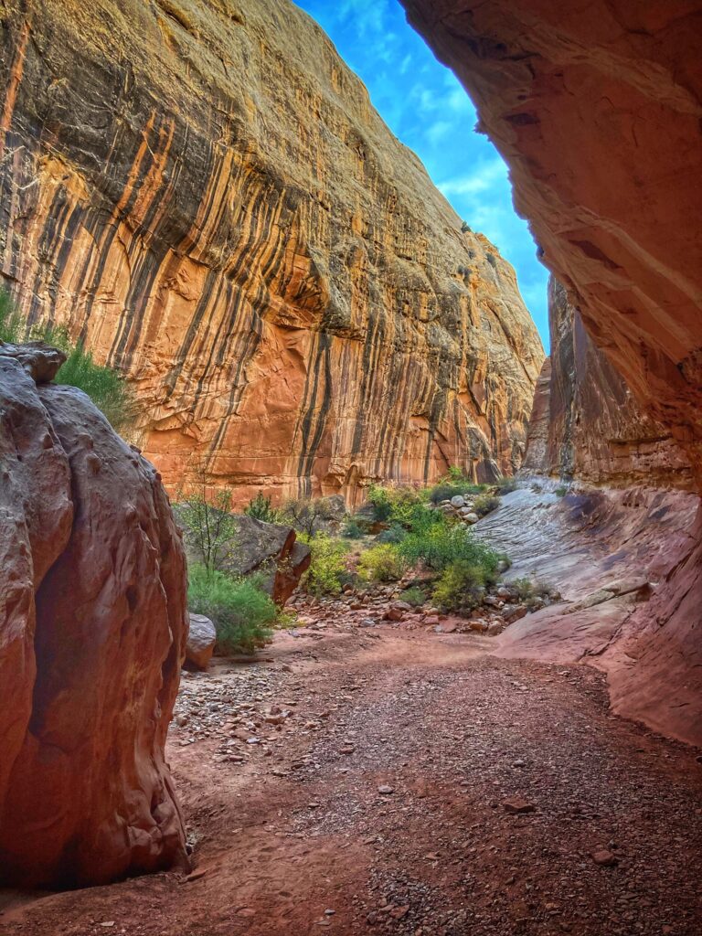
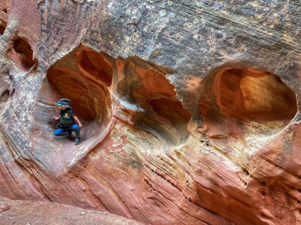
    The desert landscapes found at this National Park are truly unique. I probably wouldn’t use the word beautiful to describe this harsh environment, but it was fascinating. It’s hard to imagine anything surviving here, but there is a vibrant ecosystem of both plants and animals. It’s also difficult to put yourself in the shoes of the indigenous people and settlers that were walking through this unforgiving terrain, and then decided to stop and build their home here. It was fun to visit, but it would have been tough to live here without our modern convieniences!
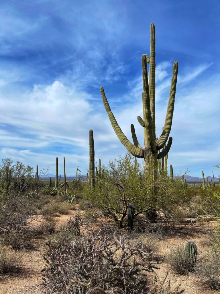

    Saguaro Gallery

    The giant Saguaro cacti are an iconic symbol of the American southwest, and this park is full of them! The desert has its own harsh kind of allure and we found it in abundance here.

  • Grand Canyon National Park – Arizona

    Grand Canyon National Park – Arizona

    Dates we visited: January 1st – 4th 2021
    Where we stayed: Black Bart’s RV Park

    Our travels had mostly been on hold since early November, as we spent the holidays with family in Arizona. However, we did find time to take the rig up to Flagstaff, Arizona for a week of cold weather camping (below freezing every night) to celebrate the new year. While we were in the area, we made two trips up to the South Rim of Grand Canyon National Park, which is about 90 minutes northwest of Flagstaff. Additionally, we explored two National Monuments in the area: Sunset Crater Volcano and Walnut Canyon, which are both worth your time if you are in the area.

    It’s Cold!

    The campground we stayed at was pretty quiet, and had limited services available due to Covid-19 and the cold weather. bathrooms and showers were closed, as was the on-site restaurant. While they had heated water pedestals to prevent freezing, the one for our spot was not working. Luckily our heated hose was long enough to hook up to the neighboring spot. If you have not camped in cold weather before, specifically below freezing temps, it’s awesome, but a whole different experience from summer camping. Even with the extra work that cold weather camping required, we had an awesome time ringing in 2021!

    The First Visit

    Our first trip up to the Grand Canyon was on Friday January 1st. Some friends that camped next to us over the weekend joined us on this trip. We were hoping that the park would not be too busy, but our hopes were quickly dashed as we were met with a pretty sizable crowd. We stopped at the Visitor Center area and bookstore to talk to a ranger and get the Junior Ranger booklet for Owen, and then walked to Mather Point, and strolled a short distance along the Rim Trail. While it was certainly a breathtaking view, the crowds were a bit overwhelming, and we decided to head out pretty quickly.

    The Second Visit

    We made a second attempt on the Grand Canyon a few days later in the early morning. We intended to see sunrise in the park, but arrived just after dawn, due to a minor mishap with local law enforcement (note to future visitors: watch out for the reduced speed zone on Hwy 64 going through “Grand Canyon Junction” near the Valle Airport). Upon our arrival, we found no crowds, beautiful vistas, and very chilly weather. While we didn’t do any hiking this day, we stopped at a few of the overlooks, including Hopi Point and Powell Point. Of the two, we enjoyed Powell Point the most. It’s just down the road from the village complex, so you get away from the crowds of people that only stop at the visitor center. Powell Point has great views of the canyon to the east and west, and there is a cool commemorative memorial to some of the early explorers of the canyon.

    Grand Canyon is one of the most popular National Parks in the country, and for good reason. The incredible force of the Colorado River, unrelenting over millions of years, has sculpted the landscape into something that has to be seen to be truly appreciated. Next time, we may try to get at the North Rim to experience the park from a different perspective.


    Grand Canyon Gallery

    We rang in the the 2021 new year in a style perfect for us, by visiting Grand Canyon National Park. Even though it was a little busy, we consider ourselves lucky to get a glimpse of the canyon with snow on the ground.

  • Petrified Forest National Park – Arizona

    Petrified Forest National Park – Arizona

    Dates we visited: Nov 5th – Nov 7th 2020
    Where we stayed: Holbrook / Petrified Forest KOA

    Petrified Forest National Park was our first of three Arizona National Parks, but our last one planned before hanging up the keys to spend the winter season in Phoenix. Located in the northeast corner of Arizona, we stopped here as we made our way down from Mesa Verde. Interstate 40 splits the park into a northern section and southern section. The northern section, looks out into the Painted Desert, while the southern section contains the petrified trees that date back 225 million years!

    Painted Desert

    The painted desert region in the north section of the park has little to do with the petrified forest, but it is incredibly scenic. We observed the endless shades of red rock from a short trail near the Painted Desert Inn, and again from Pintado Point, both of which are right along Painted Forest road. It is possible to hike down into the desert region, and while we didn’t tackle that hike on this trip, we saw some folks on the trek down and it looked like it would be a lot of fun.

    Giant Logs

    After driving the length of Painted Desert road from the north entrance, through a surprisingly varied landscape, and with a quick stop the Newspaper Rock Petroglyphs, we reached the Rainbow Forest Museum at the southern end of the park. This is also the launching point for the short but awesome Giant Logs Trail. There are petrified logs strewn along this trail that date back to the Triassic period. For some rough context, that is before the rise of most dinosaurs, and it’s when the land on earth was mainly arranged in a single supercontinent called Pangaea. In other words, super old. It was mind-blowing to walk this trail and think about what has happened around these fossilized tree trunks in the time since they were alive.

    We didn’t really know what to expect at Petrified Forest, and we were pleasantly surprised with the varied and scenic landscape, as well as the mind-boggling timescale of the super-old fossils. If you live in or travel to the southwest, you may have driven through this park along I-40 without even realizing it. Next time though, take the afternoon, or day, to stop and explore it!


    Petrified Forest Gallery

    225 Million years ago. That’s when the trees that would eventually become the Petrified Forest lived. As humans, it’s hard to wrap our brains around that kind of time scale. It was wild to walk amongst these fossilized tree trunks and think about all that has happened since they fell.

  • Mesa Verde National Park – Colorado

    Mesa Verde National Park – Colorado

    Dates we visited: Oct 29th – Oct 30th 2020
    Where we stayed: Sundance RV Park

    After braving a blizzard at Black Canyon of the Gunnison National Park, we headed down to the southwest corner of colorado to visit Mesa Verde National Park. Mesa Verde was the first park that we visited that was established primarily for archeological reasons. The area was set aside to preserve and study the Ancestral Pueblo heritage and relics in 1906. The Puebloans called this place home from roughly the year 600 till the year 1300. According to the Park Service, the area preserves over 5,000 archaeological sites and more than 600 cliff dwellings.

    Pit Houses to Cliff Dwellings

    One of the most fascinating things about this park is the ability to see how the Puebloan people progressed and changed over time. Early in their time here they built and resided in “Pit Houses” that were complex structures built into the ground. These were sometimes solitary and sometimes grouped together. Larger “Kivas” were also nearby and served as gathering places and for social functions.

    Then, over time, they moved out to the cliff dwellings. Archaeologists are still studying this migration, what prompted it, and what eventually prompted the Puebloan people to abandon the incredible cliff structures and move out of the area. Try as I might, I couldn’t wrap my head around thinking about the first person that was like “Hey, why don’t we build a house on those cliffs over there? What do you all think?”

    Sunrise

    We opted for a before sunrise entry to Mesa Verde, and were rewarded with some spectacular views and had the park essentially to ourselves. We made several stops along Mesa Top Ruins road to explore and hike. Some of our favorites were: Park Point Overlook, Far View House, Square Tower House.

    There are numerous other pull-offs where you can get a view of some of the most complex cliff dwellings and we stopped at many of them. Normally, it is possible to get a guided tour of these, but that was limited or unavailable due to Covid, so we had to settle for observing them from afar.

    We only spent one day at this park, but this is one of those places that you could easily spend a month exploring all the various archaeological sites, hiking trails, and scenic areas. All three of us left the park with a greater respect for the native inhabitants of the area, and a wonderment for the engineering prowess they possessed for their time.


    Gallery

    The first National Park that we visited that was primarily archaeological in nature, Mesa Verde left us inspired and awestruck at the engineering capabilities of the ancestral Puebloan people.

  • Black Canyon of the Gunnison National Park – Colorado

    Black Canyon of the Gunnison National Park – Colorado

    Dates we visited: October 21st-27th
    Where we stayed: Black Canyon / Montrose KOA

    Black Canyon of the Gunnison National Park is a lesser known park on the western side of Colorado. It was our next stop after completing the Utah Mighty 5 with a visit to Canyonlands. We didn’t really know what to expect going into this park, and it ended up ranking near the top of our favorites list! There were very few other visitors in the park, so we were able to take our time and explore the many overlooks available along Rim Drive. Two million years in the making, the Gunnison river carved out this canyon to be exceptionally deep, narrow and ominously scenic.

    Snow

    While staying in Montrose, Colorado we were hit by a massive snowstorm that tested our RV cold weather preparedness. Our pipes briefly froze up and I had to clear the snow off the slide roof with a broom. But, we survived and learned a lot about cold weather camping in the process. Additionally, the storm gave us the opportunity to see the Black Canyon through the lens of multiple seasons. It was quite striking with the fresh Colorado snow.

    Highlights

    The Rim Drive road is the main thoroughfare through the park. Starting at the South entrance station and ending at “High Point” it stops at the visitor center and offers many scenic overlooks. The various stops highlight different vantage points of the precipitous canyon. Some of our favorites were Tomichi Point, Chasm View and Painted Wall View.

    There is also a road on the north rim, but there is no bridge to it inside the park and it’s a 3-4 hour drive out and around to reach it…maybe next time.

    We spent several days at this park, but if you are just passing through, it’s possible to drive the south rim road and see the main attractions in an afternoon. Just make sure the road is open!

    Pine Creek Trail

    While we were in the area, we also took a drive east to hike a portion of the Pine Creek trail in the Curecanti National Recreation Area. This was a fun trail that runs right along the Gunnison river. There used to be a passenger rail line that ran alongside the river and there are a number of informational placards and remnants of the rail system along the trail.

    Even though I grew up in Colorado, and Kristy lived there for years, neither of us had spent much time west of the mountains. The blizzard was definitely a challenge, but it was fun to frolic around in the snow, and we really enjoyed our time in the area. Since the Rim Drive is closed in the winter months, we consider ourselves lucky to have been able to see Black Canyon covered in snow.


    Gallery

    One of the lesser known, and least visited National Parks, Black Canyon of the Gunnison turned out to be one of our favorites. A massive winter storm dumped over a foot of Colorado snow on us, testing our RV cold weather preparedness. We survived, and were rewarded with the experience of seeing the park blanketed in snow.

  • Canyonlands National Park – Utah

    Canyonlands National Park – Utah

    Dates we visited: October 12th – October 18th 2020
    Where we stayed: Green River KOA

    Our fifth and final stop in the Utah Mighty 5 was Canyonlands National Park. Like Arches, this park is near Moab, however it is far less well-known, and much less visited. As it turned out, this was also our favorite of the five Utah National Parks. As its name implies, there are many canyons to be explored here. While it may not be as grand in depth and length as the Grand Canyon, we found this area to be very interesting. As you can see in some of Kristy’s photos, there are canyons within canyon’s which are joined by other canyons. It’s basically canyons all the way down.

    Mesa Arch

    Surprisingly, one of our favorite features of Canyonlands was the Mesa Arch. This arch was a striking example of this unique rock formation, and it was a bit more accessible than some of it’s brethren over in Arches National Park. We took a short hike to this Arch at sunrise, and even though there were a few other folks in the area, everyone was friendly and took turns capturing photos from the prime locations.

    Grand View

    The main road at Canyonlands enters the park on the north side, and offers a scenic drive up Grand View Point Road to it’s ending at Grand View Point.

    The 1.8 mile out and back trail at Grand View Point is spectacular. The trail winds along the rim of the canyon, offering different vantage points of the multiple canyons. It was a little nerve-racking with Owen since there are no guardrails on the trail, but he did a great job sticking close to us and holding hands at the narrow sections.

    If you haven’t heard of Canyonlands National Park, consider yourself informed. There are a number of hiking trails around the park, along with what appeared to be a pretty intense 4-wheel trail down into the canyons. Next time you are in the Moab area of Utah, make sure to take a day or two to explore this park.


    Gallery

    Canyonlands National Park is like the movie Inception, but with canyons. There are canyons inside of canyons and the deeper you go, the more canyons there are. The hikes were breathtaking due to both their beauty and the terror of having a three year old with us that loves to make sudden moves. Nonetheless, we loved this lesser known park that is just southwest of Moab.

  • Arches National Park – Utah

    Arches National Park – Utah

    Dates we visited: October 12th – October 18th 2020
    Where we stayed: Green River KOA

    The fourth of Utah’s “Mighty 5” , we visited Arches National Park after Capitol Reef. Arches is a popular destination and one of the more well-known National Parks. It’s also the closest park to Moab, which is famed for its mountain biking and outdoors activities. We stayed in the city of Green River, which is a few miles to the northeast, but is much less busy, and offers more affordable accommodations if you are willing to drive a bit further to get to the attractions in the area.

    Highlights

    We made a few trips into Arches so that we could check out the various features along the main road that runs the length of the park.

    As you might expect, we stopped to check out several of the arches around the park. Two of our favorite locations were Delicate Arch and Double Arches. Delicate Arch is one of the most photographed arches in the world, and when you think of an arch rock formation, most likely this is the one that your brain conjures up.

    Double Arches is also a popular location, this one is a bit more kid friendly to approach. The two massive arches are situated in a way that allows you to hike up underneath them, and Owen really enjoyed checking them out from below.

    Obviously Arches is known for its, well, arches, but there is more to it than that. We also enjoyed the short hike around Balanced Rock. The massive and precariously sitting boulder will eventually topple off of it’s perch due to erosion. Most likely, that won’t happen for hundreds of years, but we’re still glad we got to see it before then!

    Potash Dinosaur Tracks

    The Potash dinosaur tracks and petroglyphs are not inside Arches national park, but proved to be an exciting destination for us nonetheless. A few miles south of Moab, there is a short but challenging trail that leads to fossilized dinosaur tracks. It’s possible to hike right up to the rock face and actually touch the tracks if you choose. This little trek was especially enjoyable for us because the destination is a little off the beaten path, and we were the only ones on the trail. If you are in the area, and into fossils and petroglyphs, it’s worth taking a few hours to pop over to this location.

    Arches is a popular destination for a reason, the arch rock formations found here defy logic when you see them up close. Due to its proximity to Moab, the park is often busy, and we experienced more lines and crowds than we are used to. Our take is that you should definitely check out Arches at least once in your life, but if you are looking for a more peaceful experience, perhaps check out some of the other less visited Utah parks.


    Gallery

    Arches National Park contains an unbelievable assortment of natural stone arches, but that’s not all we found there. We visited this park a few times over several days and found several hikes and features that the whole family enjoyed.

  • Goblin Valley State Park – Utah

    Goblin Valley State Park – Utah

    Dates we visited: October 10th 2020
    Where we stayed: Duke’s Slickrock Campground

    After visiting the first three of Utah’s “Mighty 5” National parks (Zion, Bryce Canyon & Capitol Reef) we took a slight detour so that we could check out Goblin Valley State Park. Goblin Valley was recommended to us by multiple people, so we figured we better see what it was all about. We want to extend our thanks to those that made that recommendation, because we loved this state park, and returned to it several times over the course of a few days!

    So many hoodoos

    We caught our first glimpse of the geologic phenomenon known as a hoodoo at Bryce Canyon. The hoodoos there were grand in scale, and interesting to experience from a multitude of overlooks…but Goblin Valley was an entirely different experience. Imagine a valley filled with hoodoo rock formations of every possible shape and size. Now imagine that there are no trails, and you just go out, explore, and climb around on those rocks…that’s basically Goblin Valley.

    Owen has spent a lot of time in national parks and he is well acquainted with the conservationist mantra “stay on the trail.” So when we arrived here and told him there was no trail and he could simply go explore the area, it took him a few minutes to actually wrap his mind around that. Once he figured it out though, he was thrilled! He took great pride in being the leader of our little party and picking our route through the valley. The area is very family friendly, and while it would be hard to get dangerously lost here, it is very easy to get seperated, so we still kept a close eye on him.

    We have been to a lot of places that felt like they belonged to either to a different time (Yellowstone), or a different planet (Craters of the Moon), and Goblin Valley definitely gets added to that list. Due to the red sandstone that is common in the area, there was a strong Mars vibe here. So much so that we decided to do a rough stop-motion video of Owen’s “mobile science lab” toy. Side-note: If you have ever tried to produce your own stop-motion video, you know how time consuming this can be. I ran up and down that rock somewhere between 75 and 100 times, moving the vehicle a fraction of an inch each time while Kristy painstakingly held the camera steady and clicked the photo button. I don’t know about you, but I think the results are down right cinematic 🙂

    Goblin Valley State Park at night

    Goblin Valley State Park at night

    Before leaving the area, we visited Goblin Valley three times, twice during the day, and once in the evening. In addition to being a fun place to explore in the daytime, the park is an “International Dark Sky Place”, meaning there is exceptionally little ambient light or light pollution in the area. We didn’t stay out too late, but we were still able to get some excellent views of the night sky and milky way.

    If you happen to be visiting any of the Utah “Mighty 5” parks, it’s worth planning a little extra time to stop by Goblin Valley, especially if you have kids along with you. It was one of Owen’s favorite destinations, and ranks up near the top for Kristy and I as well. Forgive me this one final pun, but whatever you do, don’t miss out on these hoodoos 😉


    Gallery

    This state park was recommended to us by several people, and we sure are glad we decided to check it out. With hoodoos as far as the eye could see, and the ability to simply explore the valley without the confines of a trail, this ranked among our favorite destinations so far.

  • Capitol Reef National Park – Utah

    Capitol Reef National Park – Utah

    Dates we visited: October 8th 2020 – October 10th 2020
    Where we stayed: Duke’s Slickrock Campground

    After visiting Bryce Canyon, the next destination on our agenda for Utah’s “Mighty 5” National Parks was Capitol Reef. It’s a relatively large National Park at 378 square miles and is the most remote of the five Utah parks. Rather than tow the RV through some of the remote and mountainous terrain between Bryce and Capitol Reef, we opted to take a longer, but more well established, route by going up north to I-70 and then east. As it turned out, the drive along I-70 east of Salina, UT was absolutely stunning. There were dramatic rock formations that, if you’ll permit me to geek out a bit, looked like Star Wars Imperial cruiser spaceships crashed on earth (albeit made of red rocks).

    Capitol Reef was given its name by combining two of it’s geologic features. First, the “Capitol Dome” was named due to its resemblance to the U.S. Capitol building in Washington DC. Secondly, the combined geologic features of the “waterpocket fold” and the Colorado plateau uplift formed a giant, very long cliff called an escarpment. Early explorers felt the escarpment resembled a reef, like one might find in the ocean. And so you put those together and you have Capitol Reef!

    Petroglyphs

    The drive into the park is super scenic, winding its way through the red rock canyons. After passing the namesake Capitol Dome formation, and shortly before reaching the visitor center, is a pull off to view some ancient petroglyphs. We stopped here to check them out and learn a bit about the history of the area. Seeing these thousand year old drawings carved into the sandstone is a reminder of those who came before us, and it refreshed our commitment to be good stewards of the land.

    Grand Wash

    After a quick stop and short hike to check out the Goosenecks Overlook, we made our way up the scenic drive to the Grand Wash Trail. We did this trail backwards from how Alltrails.com recommends. We turned off of Scenic Drive road on to the dirt Grand Wash road, and then parked at the Cassidy Arch Trailhead.

    This is a great, albeit somewhat long, trail for younger kids. The trail is mostly flat, and while there is some elevation change, it is relatively gradual. as the name implies the trail follows a “wash” which is where flood waters flow when it rains, making it imperative that you check the weather before embarking on this hike.

    The highlight of the hike is “The Narrows” which is a particularly narrow section of often referred to as a slot canyon. Owen had fun running his hands along the walls and describing the different textures of rocks we found along the way.

    On our trip out we came across a pair of fellow hikers, one of which had rolled her ankle and was in quite a lot of pain. While they repeatedly turned down our offers of assistance, we were still quite concerned for them, as it was a hot day, and they were still 3/4 of a mile to the trail head. We decided to let the rangers know about her situation on our way out, and while there is little they can do unless someone specifically requests assistance, hopefully they were able to at least confirm she made it out safely. It was a good reminder for us to where the right gear, bring plenty of water, and keep some basic first aid supplies with us at all times.

    An additional attraction at Capitol Reef is the Gifford Homestead, and the nearby orchards. This was a bit unexpected based on the terrain here, but supposedly the fruit, jams and jellies here are quite good. We didn’t have the opportunity to experience these treats on this go around, so that goes on the list for next time.

    Even though we only made one trip into Capitol Reef, we took great pleasure in the diverse landscape and the awe inspiring canyons and escarpments. We tried to put ourselves in the shoes of early explorers on horseback who would have happened upon this giant, miles long cliff while looking for passages further to the west. I imagine the first time that happened it would have been a bad day, with them saying to each other, “well, I guess we just have to go around”.


    Capitol Reef Gallery

    Capitol Reef was the third of Utah’s “Mighty Five” on our agenda. We were struck by the coloration of the rock walls and unusual geology this park had to offer. We even managed to squeeze in a great hike through a slot canyon!

  • Bryce Canyon National Park – Utah

    Bryce Canyon National Park – Utah

    Dates we visited: October 3rd-5th 2020
    Where we stayed: Dixie National Forest

    The feeling of walking through a forest and then suddenly emerging at the edge of a cliff overlooking a multicolored and dynamic canyon is hard to put into words. Bryce Canyon National Park, our second of five Utah parks, offered us family friendly trails and stunning vistas. We were lucky to be able to experience this park both in the evening as well as the early morning, each giving the park it’s own unique personality.

    Dixie National Forest Boondocking

    After our failed boondocking attempt near Zion we were a little nervous to try again, however this time it went much better. I was able to locate what appeared to be a suitable area of U.S. Forest Service Land using the Dyrt and Google Maps, but I wasn’t able to actually scout it out in person. Luckily, when we arrived, we found an available and relatively easily accessible campground within about twenty minutes.

    If you are looking for a good, free, boondocking experience while visiting Bryce Canyon, definitely check out the FR117 dispersed camping area off of highway 12.

    We had great stargazing conditions here, and enjoyed sitting out together to experience the evening. The one downside to this spot was that it was dusty. Perhaps it was the spot we picked, or maybe it’s just a fact of camping in this area, but we had planned to stay here for two nights, and ended up moving on after one due to the dust.

    Fairyland

    Our first stop in Bryce Canyon was Fairyland Point. This overlook is at a turn off right after the park sign, but before the formal entry gate. While there is a trailhead here, the trails are rather challenging with relatively steep drop-off exposure, so we just took in the sights from the overlook.

    Some of the defining features of Bryce Canyon are the rock formations called hoodoos. While this is obviously a fun word to say, these unique spire-like rocks are even more fun to see. Imagine tall, roughly cylindrical shaped, red rocks scattered across the landscape. Some of them larger on their tops than their bottoms.

    Sunrise to Sunset

    Just inside the park is an area called Bryce Canyon City. The visitor center is nearby, along with campgrounds and a multitude of trails. There are two popular observation points called Sunrise Point and Sunset Point that are about a half mile away from each other. There is a popular and easily accessible trail that runs between the two point along the rim of the “canyon” (turns out it’s not technically a canyon, because it wasn’t carved by a river). In theory the views are best from each point at the time of day for which they are named. However, we found that each offered stunning views of the expansive hoodoo filled canyon at any time of day.

    TIP: Try visiting Sunrise Point at sunset. Most of the crowds understandably flock to Sunset Point at sunset, but Sunrise Point offers a wonderful perspective with fewer people.

    TIP: Try visiting Sunrise Point at sunset. Most of the crowds understandably flock to Sunset Point at sunset, but Sunrise Point offers a wonderful perspective with fewer people.

    Scenic Drive

    The scenic drive in the park is Highway 63. The road runs from the park entrance all along the rim with a number of overlooks, trailheads and interesting features along the way. We made a brief stop to check out the Bryce Natural Bridge, which is a stunning rock arch formation, before continuing on up to the end of the road at Rainbow Point.

    After gawking at the vast expanse of unique geology at Rainbow Point, we completed the short Bristlecone Loop Trail. This trail was great for Owen, as well as Kristy and I. It meandered through the woods, with options to shorten or lengthen the hike, and had spurs to overlooks in all directions.

    Bryce Canyon stunned us with the surprisingly quick transition from forest to eroded cliffs. We found it hard to wrap our heads around the natural forces capable of creating such a dramatic landscape. Next time we visit here we would love to tackle one of the more challenging hikes down into the canyon area. The view from above was spectacular, but I would imagine the view from ground level to be a totally different and unique experience.


    Bryce Canyon Gallery

    From hoodoos and fins to natural bridges, Bryce Canyon National Park was a dramatic landscape. We walked along the rim of a canyon that’s not technically a canyon and tried to wrap our minds around the natural forces that could have created such wild terrain.